Grafenwiesen

Last updated
Grafenwiesen

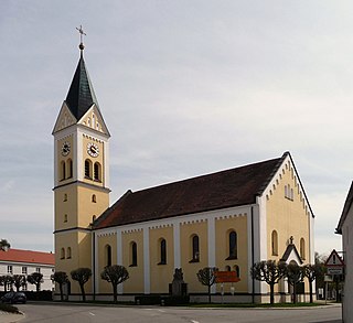
Pfarrkirche Grafenwiesen.JPG

Parish church
Wappen von Grafenwiesen.svg
Coat of arms
Germany adm location map.svg
Red pog.svg
Grafenwiesen
Location of Grafenwiesen within Cham district
Grafenwiesen in CHA.svg
Coordinates: 49°12′N12°52′E / 49.200°N 12.867°E / 49.200; 12.867 Coordinates: 49°12′N12°52′E / 49.200°N 12.867°E / 49.200; 12.867
Country Germany
State Bavaria
Admin. region Oberpfalz
District Cham
Government
   Mayor Josef Dachs
Area
  Total 10.23 km2 (3.95 sq mi)
Elevation 439 m (1,440 ft)
Population (2016-12-31) [1]
  Total 1,538
  Density 150/km2 (390/sq mi)
Time zone CET/CEST (UTC+1/+2)
Postal codes 93479
Dialling codes 0 99 41
Vehicle registration CHA
Website www.grafenwiesen.de

Grafenwiesen is a municipality in the district of Cham in Bavaria in Germany.

Municipalities of Germany the lowest official level of territorial division in Germany

Municipalities are the lowest level of official territorial division in Germany. This is most commonly the third level of territorial division, ranking after the Land (state) and Kreis (district). The Gemeinde which is one level lower in those states also includes Regierungsbezirke as an intermediate territorial division. The Gemeinde is one level higher if it is not part of a Samtgemeinde. Only 10 municipalities in Germany have fifth level administrative subdivisions and all of them are in Bavaria. The highest degree of autonomy may be found in the Gemeinden which are not part of a Kreis. These Gemeinden are referred to as Kreisfreie Städte or Stadtkreise, sometimes translated as having "city status". This can be the case even for small municipalities. However, many smaller municipalities have lost this city status in various administrative reforms in the last 40 years when they were incorporated into a Kreis. In some states they retained a higher measure of autonomy than the other municipalities of the Kreis. Municipalities titled Stadt are urban municipalities while those titled Gemeinde are classified as rural municipalities.

Cham (district) District in Bavaria, Germany

Cham is a Landkreis (district) in Bavaria, Germany. It is bounded by the districts of Regen, Straubing-Bogen, Regensburg and Schwandorf and by the Czech Plzeň Region.

Bavaria State in Germany

Bavaria, officially the Free State of Bavaria, is a landlocked federal state of Germany, occupying its southeastern corner. With an area of 70,550.19 square kilometres, Bavaria is the largest German state by land area comprising roughly a fifth of the total land area of Germany. With 13 million inhabitants, it is Germany's second-most-populous state after North Rhine-Westphalia. Bavaria's main cities are Munich and Nuremberg.

Related Research Articles

Treffelstein Place in Bavaria, Germany

Treffelstein is a municipality in the district of Cham in Bavaria in Germany.

Grattersdorf Place in Bavaria, Germany

Grattersdorf is a municipality in the district of Deggendorf, Bavaria, Germany.

Oberpöring Place in Bavaria, Germany

Oberpöring is a municipality in the district of Deggendorf in Bavaria in Germany.

Wallerfing Place in Bavaria, Germany

Wallerfing is a municipality in the district of Deggendorf in Bavaria in Germany.

Baierbach Place in Bavaria, Germany

Baierbach is a municipality in the district of Landshut in Bavaria in Germany.

Kröning Place in Bavaria, Germany

Kröning is a municipality in the district of Landshut in Bavaria in Germany.

Berg, Upper Palatinate Place in Bavaria, Germany

Berg is a municipality in the district of Neumarkt in Bavaria in Germany.

Deining Place in Bavaria, Germany

Deining is a municipality in the district of Neumarkt in Bavaria in Germany.

Pilsach Place in Bavaria, Germany

Pilsach is a municipality in the district of Neumarkt in Bavaria in Germany.

Leuchtenberg Place in Bavaria, Germany

Leuchtenberg is a municipality in the district of Neustadt an der Waldnaab in Bavaria, Germany, essentially a suburb of nearby Weiden in der Oberpfalz, and a larger historical region in the Holy Roman Empire governed by the Landgraves of Leuchtenberg.

Püchersreuth Place in Bavaria, Germany

Püchersreuth is a municipality in the district of Neustadt an der Waldnaab in Bavaria, Germany.

Schirmitz Place in Bavaria, Germany

Schirmitz is a municipality in the district of Neustadt an der Waldnaab in Bavaria, Germany.

Schlammersdorf Place in Bavaria, Germany

Schlammersdorf is a municipality in the district of Neustadt an der Waldnaab in Bavaria, Germany.

Geiersthal Place in Bavaria, Germany

Geiersthal is a municipality in the district of Regen in Bavaria in Germany.

Zachenberg Place in Bavaria, Germany

Zachenberg is a municipality in the district of Regen in Bavaria in Germany.

Rattenberg, Bavaria Place in Bavaria, Germany

Rattenberg is a municipality in the district of Straubing-Bogen in Bavaria, Germany.

Schwarzach, Lower Bavaria Place in Bavaria, Germany

Schwarzach is a municipality in the district of Straubing-Bogen in Bavaria, Germany. It is the seat of the municipal association Schwarzach. The town is an officially recognised Resort town.

Weng, Bavaria Place in Bavaria, Germany

Weng is a municipality in the district of Landshut in Bavaria in Germany.

Hofkirchen, Bavaria Place in Bavaria, Germany

Hofkirchen is a municipality in the district of Passau in Bavaria in Germany.

Windorf Place in Bavaria, Germany

Windorf is a municipality in the district of Passau in Bavaria in Germany.

References