Steg-Hohtenn

Last updated
Steg-Hohtenn
StegHohtenn-blazon.svg
Location of Steg-Hohtenn
Steg-Hohtenn
Switzerland adm location map.svg
Red pog.svg
Steg-Hohtenn
Reliefkarte Wallis blank.png
Red pog.svg
Steg-Hohtenn
Coordinates: 46°17′N7°47′E / 46.283°N 7.783°E / 46.283; 7.783
Country Switzerland
Canton Valais
District Raron
Government
   Mayor Philipp Schnyder
Area
[1]
  Total14.21 km2 (5.49 sq mi)
Elevation
660 m (2,170 ft)
Population
 (31 December 2018) [2]
  Total1,592
  Density110/km2 (290/sq mi)
Time zone UTC+01:00 (Central European Time)
  Summer (DST) UTC+02:00 (Central European Summer Time)
Postal code(s)
3940
SFOS number 6204
Surrounded by Eischoll, Ferden, Gampel, Kippel, Raron, Turtmann, Unterbäch, Wiler (Lötschen)
Website www.weibil.ch
SFSO statistics

Steg-Hohtenn is a municipality in the district of Raron in the canton of Valais in Switzerland. The municipality comprises the villages of Steg and Hohtenn.

Contents

History

Steg-Hohtenn was created on 1 January 2009 through the merger of the former municipalities of Steg and Hohtenn. [3]

Geography

Steg-Hohtenn has an area, as of 2011, of 14.2 square kilometers (5.5 sq mi). Of this area, 10.1% is used for agricultural purposes, while 38.1% is forested. Of the rest of the land, 9.6% is settled (buildings or roads) and 42.1% is unproductive land. [4]

The village of Steg is located at the southern entrance to the Lötschental or Lötschen valley. The western border of the village is the Lonza river, which is also the district border and the border with the neighboring village of Gampel.

Hohtenn village is located on terrace above the eastern entrance to the Lötschental and is about 150 meters (490 ft) above Steg.

Demographics

Steg-Hohtenn is located in the German speaking section of the canton and consists of the villages of Steg (with about 1,300 inhabitants) and Hohtenn (with about 250 inhabitants).

Steg-Hohtenn has a population (as of December 2020) of 1,620. [5] As of 2008, 7.5% of the population are resident foreign nationals. [6] Over the last 10 years (2000–2010 ) the population has changed at a rate of -3.9%. It has changed at a rate of -0.3% due to migration and at a rate of -0.1% due to births and deaths. [4]

Most of the population (as of 2000) speaks German (95.8%) as their first language, Serbo-Croatian is the second most common (1.3%) and Albanian is the third (0.9%). [4]

As of 2008, the population was 50.6% male and 49.4% female. The population was made up of 705 Swiss men (46.6% of the population) and 61 (4.0%) non-Swiss men. There were 696 Swiss women (46.0%) and 52 (3.4%) non-Swiss women. [7]

As of 2000, children and teenagers (0–19 years old) make up 22.3% of the population, while adults (20–64 years old) make up 63.7% and seniors (over 64 years old) make up 14.1%. [4]

As of 2009, the construction rate of new housing units was 1.3 new units per 1000 residents. [4] The vacancy rate for the municipality, in 2010, was 0.13%. [4]

Economy

As of  2010, Steg-Hohtenn had an unemployment rate of 1.3%. As of 2008, there were 48 people employed in the primary economic sector and about 22 businesses involved in this sector. 461 people were employed in the secondary sector and there were 19 businesses in this sector. 482 people were employed in the tertiary sector, with 56 businesses in this sector. [4] There were residents of the municipality who were employed in some capacity.

Of the working population, 15.3% used public transportation to get to work, and 51.2% used a private car. [4]

Transport

Two railway stations are located within the municipality of Steg-Hohtenn. Gampel-Steg station is on the Simplon line from Lausanne to Brig, and is situated alongside the River Rhone at the villages lowest point. Hohtenn station is on the Lötschberg line from Bern to Brig, and is situated above Hohtenn village, some 450 metres (1,480 ft) higher than Gampel-Steg station. [8]

Hohtenn station is served by trains to Bern, Thun and Brig. Gampel-Steg station is served by trains to Brig, Visp, Martigny and Monthey. A PostAuto bus service links Gampel-Steg station, Gampel village and Hohtenn village. [8] [9] [10] [11]

Notable residents

Related Research Articles

<span class="mw-page-title-main">Alpnach</span> Municipality in Obwalden, Switzerland

Alpnach is a village in the canton of Obwalden in Switzerland. It comprises the villages of Alpnach Dorf, Alpnachstad and Schoried.

<span class="mw-page-title-main">Hergiswil</span> Municipality in Nidwalden, Switzerland

Hergiswil is a municipality in the canton of Nidwalden in Switzerland.

<span class="mw-page-title-main">Stansstad</span> Municipality in Nidwalden, Switzerland

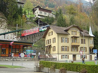
Stansstad is a municipality in the canton of Nidwalden in Switzerland.

<span class="mw-page-title-main">Kandersteg</span> Municipality in Bern, Switzerland

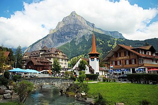
Kandersteg is a municipality in the Frutigen-Niedersimmental administrative district in the canton of Bern in Switzerland. It is located along the valley of the River Kander, west of the Jungfrau massif. It is noted for its spectacular mountain scenery and sylvan alpine landscapes. Tourism is a very significant part of its economic life today. It offers outdoor activities year-round, with hiking trails and mountain climbing as well as downhill and cross-country skiing. Kandersteg hosted the ski jumping and Nordic combined parts of the 2018 Nordic Junior World Ski Championships.

<span class="mw-page-title-main">Frutigen</span> Municipality in Bern, Switzerland

Frutigen is a municipality in the Bernese Oberland in the canton of Bern in Switzerland. It is the capital of the Frutigen-Niedersimmental administrative district.

<span class="mw-page-title-main">Kandergrund</span> Municipality in Bern, Switzerland

Kandergrund is a municipality in the Frutigen-Niedersimmental administrative district in the canton of Bern in Switzerland.

<span class="mw-page-title-main">Schöftland</span> Municipality in Aargau, Switzerland

Schöftland is a municipality in the district of Kulm in the canton of Aargau in Switzerland.

<span class="mw-page-title-main">Uitikon</span> Municipality in Zurich, Switzerland

Uitikon is a village and municipality in the district of Dietikon in the canton of Zürich in Switzerland. Besides the village of Uitikon itself, the municipality includes the villages of Waldegg and Ringlikon.

<span class="mw-page-title-main">Eggerberg</span> Municipality in Valais, Switzerland

Eggerberg is a village and municipality in the district of Brig in the canton of Valais in Switzerland. Besides the village of Eggerberg, the municipality includes the settlements of Berg, Eggen, Finnen, Mühlackern and Wirmschland.

Lalden is a municipality in the district of Visp in the canton of Valais in Switzerland.

<span class="mw-page-title-main">Ausserberg</span> Municipality in Valais, Switzerland

Ausserberg is a municipality in the district of Raron in the canton of Valais in Switzerland.

<span class="mw-page-title-main">Blatten (Lötschen)</span> Village and municipality in Valais, Switzerland

Blatten is a village and municipality in the Lötschental valley in the canton of Valais in Switzerland. It is part of the district of Westlich Raron, and much of the municipality lies within the Jungfrau-Aletsch protected area, a World Heritage Site. Besides the village of Blatten, the municipality includes the settlements of Eisten, Fafleralp, Ried and Weissenried.

<span class="mw-page-title-main">Ferden</span> Municipality in Valais, Switzerland

Ferden is a municipality in the district of Raron in the canton of Valais in Switzerland. Besides the village of Ferden itself, the municipality includes the hamlet of Goppenstein, and the alpine settlements of Faldum, Resti and Kummen.

Hohtenn is a village and former municipality in the district of Raron in the canton of Valais in Switzerland. Since 1 January 2009, it has been part of the municipality of Steg-Hohtenn.

<span class="mw-page-title-main">Kippel</span> Municipality in Valais, Switzerland

Kippel is a municipality in the district of Raron in the canton of Valais in Switzerland.

<span class="mw-page-title-main">Raron</span> Place in Valais, Switzerland

Raron is a municipality in the district of Raron in the canton of Valais in Switzerland.

<span class="mw-page-title-main">Wiler</span> Municipality in Valais, Switzerland

Wiler (Lötschen) is a municipality in the district of Raron in the canton of Valais in Switzerland.

<span class="mw-page-title-main">Obergoms</span> Municipality in Valais, Switzerland

Obergoms is the upper part of the Goms and a municipality in the district of Goms in the canton of Valais in Switzerland. It was formed on 1 January 2009 when the three municipalities Ulrichen, Obergesteln and Oberwald merged.

<span class="mw-page-title-main">Gampel-Bratsch</span> Municipality in Valais, Switzerland

Gampel-Bratsch is a municipality in the district of Leuk in the canton of Valais in Switzerland. It was formed on January 1, 2009. The voters of the municipalities of Gampel and Bratsch decided to merge on January 20, 2008.

<span class="mw-page-title-main">Goppenstein railway station</span>

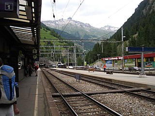
Goppenstein is a railway station in the Swiss canton of Valais and municipality of Ferden. The station is located on the Lötschberg line of the BLS AG, just outside the southern portal of the Lötschberg tunnel. It takes its name from the nearby hamlet of Goppenstein.

References

  1. "Arealstatistik Standard - Gemeinden nach 4 Hauptbereichen". Federal Statistical Office. Retrieved 13 January 2019.
  2. "Ständige Wohnbevölkerung nach Staatsangehörigkeitskategorie Geschlecht und Gemeinde; Provisorische Jahresergebnisse; 2018". Federal Statistical Office. 9 April 2019. Retrieved 11 April 2019.
  3. Amtliches Gemeindeverzeichnis der Schweiz published by the Swiss Federal Statistical Office (in German) accessed 14 January 2010
  4. 1 2 3 4 5 6 7 8 Swiss Federal Statistical Office accessed 13-October-2011
  5. "Ständige und nichtständige Wohnbevölkerung nach institutionellen Gliederungen, Geburtsort und Staatsangehörigkeit". bfs.admin.ch (in German). Swiss Federal Statistical Office - STAT-TAB. 31 December 2020. Retrieved 21 September 2021.
  6. Swiss Federal Statistical Office - Superweb database - Gemeinde Statistics 1981-2008 (in German) accessed 19 June 2010
  7. Ständige Wohnbevolkerung nach Geschlecht und Heimat am 31.12.2009.xls (in German and French) accessed 24 August 2011
  8. 1 2 map.geo.admin.ch (Map). Swiss Confederation. Retrieved 16 October 2013.
  9. "Spiez–Lötschberg–Brig" (PDF). Bundesamt für Verkehr. Retrieved 14 October 2013.
  10. "Lausanne–Sion–Brig (RER Vaud,lignes S1,S3)" (PDF). Bundesamt für Verkehr. Retrieved 14 October 2013.
  11. "Gampel-Steg–Hohtenn–Goppenstein–Blatten (Lötschen)–Fafleralp" (PDF). Bundesamt für Verkehr. Retrieved 14 October 2013.