
White Pine County is a largely rural, mountain county along the central eastern boundary of the U.S. state of Nevada. As of the 2010 census, the population was 10,030. Its county seat is Ely. The name "(Rocky Mountain) white pine" is an old name for the limber pine, a common tree in the county's mountains.
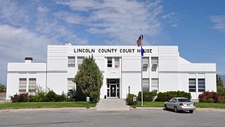
Lincoln County is a county located in the U.S. state of Nevada. As of the 2010 census, the population was 5,345. Its county seat is Pioche.
McGill is a census-designated place (CDP) in White Pine County, Nevada, United States. The population was 1,148 at the 2010 census.

The Humboldt–Toiyabe National Forest (HTNF) is the principal U.S. National Forest in the U.S. state of Nevada, and has a smaller portion in Eastern California. With an area of 6,289,821 acres (25,454.00 km2), it is the largest National Forest of the United States outside Alaska.

The Goshutes are a tribe of Western Shoshone Native Americans. There are two federally recognized Goshute tribes today:

The Desert National Wildlife Refuge is a protected wildlife refuge, administered by the U.S. Fish and Wildlife Service, located north of Las Vegas, Nevada, in northwestern Clark and southwestern Lincoln counties, with much of its land area lying within the southeastern section of the Nevada Test and Training Range. The Desert NWR, created on May 20, 1936, is the largest wildlife refuge in the lower 48 states of the United States, encompassing 1.615 million acres (6,540 km2) of the Mojave Desert in the southern part of Nevada. This Range is part of the larger Desert National Wildlife Refuge Complex, which includes the Ash Meadows National Wildlife Refuge, the Moapa Valley National Wildlife Refuge, and the Pahranagat National Wildlife Refuge.

NV Energy is a public utility which generates, transmits and distributes electric service in northern and southern Nevada, including the Las Vegas Valley, and provides natural gas service in the Reno–Sparks metropolitan area of northern Nevada. Based in Las Vegas, Nevada, it serves about 1.3 million customers and over 40 million tourists annually.
Las Vegas Wash is a 12-mile-long channel which feeds most of the Las Vegas Valley's excess water into Lake Mead. The wash is sometimes called an urban river, and it exists in its present capacity because of an urban population. The wash also works in a systemic conjunction with the pre-existing wetlands that formed the oasis of the Las Vegas Valley. The wash is fed by urban runoff, shallow ground water, reclaimed water, and stormwater.

The Schell Creek Range is a linear mountain range in central White Pine County, in east-central Nevada. Its length is approximately 132 miles (212 km) in a north-south direction. Most of the range is contained within the Humboldt-Toiyabe National Forest, with some of the range also included in the High Schells Wilderness.

Cave Lake State Park is a public recreation area occupying more than 4,000 acres (1,600 ha) in the Schell Creek Range, adjacent to Humboldt National Forest, in White Pine County, Nevada. The state park is located at an elevation of 7,300 feet (2,200 m) five miles (8.0 km) southeast of Ely and is accessed via U.S. Route 50 and Success Summit Road. It features a 32-acre (13 ha) reservoir for fishing and flat-wake boating.

The Cherry Creek Range is a line of mountains, Basin and Range faulted, in northern White Pine and southern Elko Counties, in northeastern Nevada in the western United States. The range runs generally north–south for approximately 50 miles (80 km). The highest point in the range is an unnamed peak, located just south of the border between the counties.

Coyote Springs, Nevada, is a master-planned community being developed in Lincoln County and Clark County, Nevada. The community was initially planned by developer and attorney-lobbyist Harvey Whittemore and Pardee Homes. Thomas Seeno and Albert Seeno, Jr. became the sole owners of Coyote Springs following Whittemore's resignation from the Wingfield Nevada Holding Group amidst legal troubles. No homes had been built as of June 2018.
The Egan Range is a line of mountains in White Pine County, in eastern Nevada in the western United States. From Egan Creek near the historic community of Cherry Creek, the range runs south for approximately 108 miles (173 km), extending south of Shingle Peak in the northern part of Lincoln County. To the east are the large Steptoe Valley and the even longer Schell Creek Range. To the west are the White River Valley and the scenic White Pine Range. To the north is the Cherry Creek Range, while to the south is remote Cave Valley and the southern tip of the Schell Creek Range. It is named after the Egan Family that live in Montville.

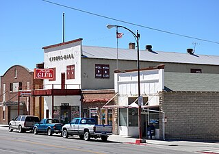
Cherry Creek is a historic mining town located in northern White Pine County, in northeastern Nevada in the western United States. It is a census county division (CCD), with a population at the 2010 census of 72.

Spring Valley Wind Farm is Nevada's first wind farm. The farm is owned and operated by Pattern Energy. The facility is located in Spring Valley, northwest of Great Basin National Park and approximately 30 miles (48 km) east of Ely, Nevada. The 151.8 megawatts (203,600 hp) plant utilizes 66 2.3 megawatts (3,100 hp) wind turbines and occupies 77 acres (31 ha) in the center of Spring Valley, which consists of 7,673 acres (3,105 ha).
State Route 486 was a state highway in White Pine County, Nevada. The roadway was turned over to local control in the 1990s.
The Ely Energy Center was a proposed coal-fired power plant that was to be built in Steptoe Valley, north of the city of Ely and located in White Pine County, Nevada. The plant was proposed by Nevada Power Company and Sierra Pacific Resources in January 2006. Construction was to begin on a 750-megawatt power unit in 2007, with completion by 2011. A second 750-megawatt unit was to be built within a few years after the first one, with a total cost of $3.8 billion. The companies also planned to ultimately add two 500-megawatt coal gasification plants to the project as soon as such technology became commercially viable. The total cost, upon full completion, would amount to $5 billion. The Ely Energy Center would have been the largest power plant in Nevada, and the state's largest energy project since the construction of Hoover Dam.
The White Pine Energy Station was a proposed coal-fired power plant that was to be built in White Pine County, Nevada. The plant was to be built in the county's Steptoe Valley, and would be located 34 miles north of the city of Ely. White Pine Energy Associates, LLC, a subsidiary of LS Power, announced the project in February 2004, with plans to begin construction in 2006, with the possibility of having it operational in 2010. The 1,590-megawatt project would consist of three units, each producing 530 megawatts.

