Stewart Sound Group

Last updated

Stewart Sound Group
India Andaman and Nicobar Islands location map.svg
Red pog.svg
Stewart Sound Group
Location of Stewart Sound Group
Geography
Location Bay of Bengal
Coordinates 12°58′N92°56′E / 12.97°N 92.93°E / 12.97; 92.93 Coordinates: 12°58′N92°56′E / 12.97°N 92.93°E / 12.97; 92.93
Archipelago Andaman Islands
Adjacent bodies of water Indian Ocean
Total islands20
Major islands
  • Aves
  • Stewart
  • Sound
Area24.88 km2 (9.61 sq mi) [1]
Highest elevation147 m (482 ft) [2]
Administration
Flag of India.svg  India
District North and Middle Andaman
Island group Andaman Islands
Island sub-groupStewart Sound Group
Taluk multiple
Largest settlementAves Island
Demographics
Population4 (2011)
Pop. density0.16 /km2 (0.41 /sq mi)
Ethnic groups Hindu, Andamanese
Additional information
Time zone
PIN 744202 [3]
Telephone code031927 [4]
ISO code IN-AN-00 [5]
Official website www.and.nic.in
Literacy84.4%
Avg. summer temperature30.2 °C (86.4 °F)
Avg. winter temperature23.0 °C (73.4 °F)
Sex ratio 1.2/
Census Code35.639.0004
Official Languages Hindi, English

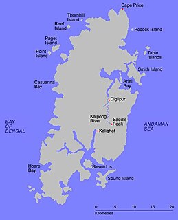
Stewart Sound Islands are a group of islands of the Andaman Islands. It belongs to the North and Middle Andaman administrative district, part of the Indian union territory of Andaman and Nicobar Islands. [6]

Andaman Islands archipelago in the Bay of Bengal

The Andaman Islands form an archipelago in the Bay of Bengal between India, to the west, and Myanmar, to the north and east. Most are part of the Andaman and Nicobar Islands which are a Union Territory of India, while a small number in the north of the archipelago, including the Coco Islands, belong to Myanmar.

North and Middle Andaman district district of India in Andaman and Nicobar Islands

North and Middle Andaman district is one of the 3 districts of the Indian Union Territory of Andaman and Nicobar Islands located in the Bay of Bengal. Mayabunder town is the district headquarters. The area covered by this district is 3251.85 km2.

India Country in South Asia

India is a country in South Asia. It is the seventh-largest country by area, the second-most populous country, and the most populous democracy in the world. Bounded by the Indian Ocean on the south, the Arabian Sea on the southwest, and the Bay of Bengal on the southeast, it shares land borders with Pakistan to the west; China, Nepal, and Bhutan to the north; and Bangladesh and Myanmar to the east. In the Indian Ocean, India is in the vicinity of Sri Lanka and the Maldives; its Andaman and Nicobar Islands share a maritime border with Thailand and Indonesia.

Contents

Geography

Important islands: Aves, Stewart, Sound (the largest and highest island, at 147 metres), [2] Curlew, Blister, Gurjan, Dotrel, Oliver, Orchid, Egg, Gander, Oyster, Square, Swamp, Karlo, Goose.

Aves Island (Andaman and Nicobar Islands)

Aves Island is an island of the Andaman Islands. It belongs to the North and Middle Andaman administrative district, part of the Indian union territory of Andaman and Nicobar Islands. The island lies 140 km (87 mi) north from Port Blair.

Stewart Island (Andaman and Nicobar Islands)

Stewart Island is an island of the Andaman Islands. It belongs to the North and Middle Andaman administrative district, part of the Indian union territory of Andaman and Nicobar Islands. the island is lying 150 km (93 mi) north from Port Blair. Its population only consists of two people.

Sound Island

Sound Island is an island of the Andaman Islands. It belongs to the North and Middle Andaman administrative district, part of the Indian union territory of Andaman and Nicobar Islands. The island lies 144 km (89 mi) north from Port Blair.

Demographics

There are 2 villages, on Stewart and Aves.

Related Research Articles

South Andaman Island island

South Andaman Island is the southernmost island of the Great Andaman and is home to the majority of the population of the Andaman Islands. It belongs to the South Andaman administrative district, part of the Indian union territory of Andaman and Nicobar Islands. It is the location of Port Blair, capital of the Andaman and Nicobar Islands.

North Andaman Island island in India

North Andaman Island is the northern island of Great Andaman of the Andaman Islands. It belongs to the North and Middle Andaman administrative district, part of the Indian union territory of Andaman and Nicobar Islands. the island is lying 137 km (85 mi) north from Port Blair.

Middle Andaman Island island

Middle Andaman Island is an island of the Andaman Islands. It belongs to the North and Middle Andaman administrative district, part of the Indian union territory of Andaman and Nicobar Islands.

Interview Island island

Interview Island is an island of the Andaman Islands. It belongs to the North and Middle Andaman administrative district, part of the Indian union territory of Andaman and Nicobar Islands. the island is lying 125 km (78 mi) north from Port Blair.

Landfall Island island in India

Landfall Island is the northernmost island of the Indian union territory of Andaman and Nicobar Islands. It belongs to the territory's North and Middle Andaman administrative district. The island lies 220 km (137 mi) north of Port Blair, and is situated 300 km (186 mi) km from Burma. It is home to the Kari tribe.

East Island (Andaman and Nicobar Islands) one of the Andaman Islands, off India

East Island is an island of the Andaman Islands. It belongs to the North and Middle Andaman administrative district, part of the Indian union territory of Andaman and Nicobar Islands. the island is lying 220 km (137 mi) north from Port Blair.

Paget Island (Andaman and Nicobar Islands)

Paget Island is an island of the Andaman Islands. It belongs to the North and Middle Andaman administrative district, part of the Indian union territory of Andaman and Nicobar Islands. the island is lying 195 km (121 mi) north from Port Blair.

Smith Island (Andaman and Nicobar Islands)

Smith Island is an island of the Andaman Islands. It belongs to the North and Middle Andaman administrative district, part of the Indian union territory of Andaman and Nicobar Islands. The island lies 298 km (185 mi) north of Port Blair.

Aerial Bay Islands

The Aerial Bay Islands are a group of islands in Aerial Bay in the Andaman Islands. This group belongs to the North and Middle Andaman administrative district, part of the Indian union territory of Andaman and Nicobar Islands. Smith Island is the largest and only inhabited one.

Curlew Island (Andaman and Nicobar Islands)

Curlew Island is an island of the Andaman Islands. It belongs to the North and Middle Andaman administrative district, part of the Indian union territory of Andaman and Nicobar Islands. the island is lying 150 km (93 mi) north from Port Blair.

Interview Group

The Interview Islands is a group of islands located in Austin Harbour and Interview sound. These islands belong to the Andaman Islands. They belong to the North and Middle Andaman administrative district, part of the Indian union territory of Andaman and Nicobar Islands.

Spike Island (Andaman and Nicobar Islands) island in India

Spike Island is an island of the Andaman Islands. It belongs to the North and Middle Andaman administrative district, part of the Indian union territory of Andaman and Nicobar Islands. The island lies 63 km (39 mi) north from Port Blair.

North Passage Island

North Passage Island is an island of the Andaman Islands. It belongs to the North and Middle Andaman administrative district, part of the Indian union territory of Andaman and Nicobar Islands. The island lies 80 km (50 mi) north from Port Blair.

Kyd Island island in India

Kyd Island is an island of the Andaman Islands. It belongs to the South Andaman administrative district, part of the Indian union territory of Andaman and Nicobar Islands. the island lies 30 km (19 mi) north from Port Blair.

Napier Bay Islands

Napier Bay Islands is a group of islands of the Andaman Islands. It belongs to the South Andaman administrative district, part of the Indian union territory of Andaman and Nicobar Islands. The islands are 30 km (19 mi) north of Port Blair.

Passage Island (Andaman and Nicobar Islands)

Passage Island or Duncan Island is an uninhabited island of the Andaman Islands. It belongs to the South Andaman administrative district, part of the Indian union territory of Andaman and Nicobar Islands. The island is 53 km (33 mi) south from Port Blair.

The Brothers (Andaman and Nicobar Islands)

North and South Brother Islands are uninhabited islands in the Indian Ocean, part of the Andaman Archipelago. They belong to the South Andaman administrative district, part of the Indian union territory of Andaman and Nicobar Islands. the island is lying 75 km (47 mi) south from Port Blair.

References

  1. "Islandwise Area and Population - 2011 Census" (PDF). Government of Andaman.
  2. 1 2 Sailing Directions (Enroute), Pub. 173: India and the Bay of Bengal (PDF). Sailing Directions . United States National Geospatial-Intelligence Agency. 2017. p. 273.
  3. "A&N Islands - Pincodes". 22 September 2016. Archived from the original on 23 March 2014. Retrieved 22 September 2016.
  4. "STD Codes of Andaman and Nicobar". allcodesindia.in. Retrieved 23 September 2016.
  5. Registration Plate Numbers added to ISO Code
  6. "Village Code Directory: Andaman & Nicobar Islands" (PDF). Census of India. Retrieved 16 January 2011.