
Zermatt is a municipality in the district of Visp in the German-speaking section of the canton of Valais in Switzerland. It has a year-round population of about 5,800 and is classified as a town by the Swiss Federal Statistical Office (FSO).

The Sangre de Cristo Mountains are the southernmost subrange of the Rocky Mountains. They are located in southern Colorado and northern New Mexico in the United States. The mountains run from Poncha Pass in South-Central Colorado, trending southeast and south, ending at Glorieta Pass, southeast of Santa Fe, New Mexico. The mountains contain a number of fourteen thousand foot peaks in the Colorado portion, as well as all the peaks in New Mexico which are over twelve thousand feet.

Monte Rosa is a mountain massif in the eastern part of the Pennine Alps. It is between Italy's and Switzerland's (Valais). Monte Rosa is the second highest mountain in the Alps and western Europe, after Mont Blanc.

North Mountain is a peak in the Catskill Mountains of New York, on the border between the towns of Catskill and Hunter, in Greene County. It is part of the Catskill Escarpment. Cairo Round Top is located northeast and Artists Rock is located southeast of North Mountain.

The Blackhead Mountains range is located near the northern end of the Catskill Mountains, in Greene County, New York, United States, where it divides the towns of Windham and Jewett. The three named peaks in the range — Thomas Cole Mountain, Black Dome, and Blackhead Mountain — are the fourth-, third-, and fifth-highest peaks in the Catskills, respectively. The gap between Thomas Cole and Black Dome is, at 3,700 feet, the highest in the Catskills.

The South Jasper Ranges are mountain ranges of the Rocky Mountains in Alberta and British Columbia, Canada.

The Gornergrat is a rocky ridge of the Pennine Alps, overlooking the Gorner Glacier south-east of Zermatt in Switzerland. It can be reached from Zermatt by the Gornergrat rack railway (GGB), the highest open-air railway in Europe. Between the Gornergrat railway station and the summit is the Kulm Hotel. In the late 1960s two astronomical observatories were installed in the two towers of the Kulmhotel Gornergrat. The project “Stellarium Gornergrat” is hosted in the Gornergrat South Observatory.

Chapel Brook of Franklin County, Massachusetts is a tributary of the South River and the name of a 173-acre (70 ha) open space preserve located along the brook. The brook, est. 3.79 mi (6 km) long, is located in southeast Ashfield and southwest Conway. It drains into Poland Brook, thence into the South River, the Deerfield River, the Connecticut River, and Long Island Sound. The Chapel Brook reservation, managed by the non-profit conservation organization The Trustees of Reservations, is located in Ashfield and contains Chapel Falls, a series of three waterfalls on Chapel Brook, measuring 10 feet, 15 feet and 20 feet high; and Pony Mountain est. 1,400 feet, a 100-foot (30 m) open granite cliff face and popular recreational rock climbing site.

Hinterstockensee is a lake above Erlenbach im Simmental in the Canton of Berne, Switzerland. The lake is located at an elevation of 1595 m, below Stockhorn and near Oberstockensee.
White Rock, 2,550 feet (780 m), is the high point on a 7 mi (11 km) ridgeline in the Taconic Mountains. The ridge is located in the tri-state corner of New York, Massachusetts, and Vermont in the towns of Petersburgh, Williamstown, and Pownal. The ridge has several distinct knobs; those with names are, from south to north: White Rocks, 2,365 feet (721 m); Smith Hill, 2,330 feet (710 m); White Rock, the high point 2,550 feet (780 m); and Bald Mountain 2,485 feet (757 m). The Snow Hole, located along the ridgeline between Bald Mountain and the White Rock, is a crevasse in which snow can be found well into the summer.

The Findel Glacier is a valley glacier in the Monte Rosa massif east of Zermatt in the Pennine Alps. It has a length of 8 km (5.0 mi) and covers an area of 19 km2 (7.3 sq mi).

The Stockhorn is a mountain of the Swiss Pennine Alps, located to the southeast of the town of Zermatt. It lies on the range between the Findel and Gorner glaciers, east of the Gornergrat.

The Stockhorn is a mountain of the Bernese Alps, overlooking the region of Lake Thun in the Bernese Oberland. It is located north of the town of Erlenbach im Simmental.
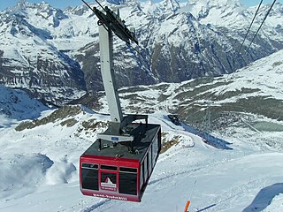
The Hohtälli is a mountain of the Swiss Pennine Alps, located southeast of Zermatt in the canton of Valais. It lies on the range that separates the Findel Glacier from the Gorner Glacier, between the Gornergrat and the Stockhorn. Its summit has an elevation of 3,275 metres (10,745 ft) and includes a cable car station. The Hohtälli is part of a ski area and features several ski runs leading down the mountain.
The Hohmad is a mountain of the Bernese Alps, located south of Blumenstein in the canton of Bern. It lies on the range north of the Simmental, approximately halfway between the Gantrisch and the Stockhorn.

Stockhorn Arena is a football stadium in Thun, Switzerland. It has a capacity of 10,000 spectators and opened in 2011. It is the home of FC Thun of the Swiss Super League.
The Stockhorn is a mountain located south of Thun in the Bernese Oberland. It is also the name of several other mountains:
The Stockhorn is a mountain of the Lepontine Alps, overlooking Binn in the canton of Valais. It lies north of the Scherbadung massif.

Hausberg is German for a prominent mountain or hill in the immediate vicinity of a village, town or city, usually located on its municipal territory, but outside the built up area. It means something like the "local mountain" or "local hill" closely associated with a settlement by its population. The Hausberg forms a backdrop to its home settlement and also offers a prominent viewing point looking over the settlement. As a result, many Hausberge have cable cars or gondola lifts to transport visitors to the top. "Hausberg" is also the proper name of numerous local mountains and hills in German-speaking countries.

