Traralgon is a city located in the east of the Latrobe Valley in the Gippsland region of Victoria, Australia and the most populous city in the City of Latrobe and the region. The urban population of Traralgon at the 2021 census was 26,907. It is the largest and fastest growing city in the greater Latrobe Valley area, which has a population of 77,168 at the 2021 Census and is administered by the City of Latrobe.

Sale is a city situated in the Gippsland region of Victoria, Australia and the council capital of the Shire of Wellington. It had an estimated population of 15,305 in 2022 according to the Australian Bureau of Statistics. The total population including the immediate area around the town is approximately 19,000 according to shire website.

Warragul is a town in Victoria, Australia, 102 kilometres south-east of Melbourne. Warragul lies between the Strzelecki Ranges to the south and the Mount Baw Baw Plateau of the Great Dividing Range to the north. As of the 2021 census, the town had a population of 19,856 people. Warragul forms part of a larger urban area that includes nearby Drouin that had an estimated total population of 42,827 as of the 2021 census.

Healesville is a town in Victoria, Australia, 64 km north-east from Melbourne's central business district, located within the Shire of Yarra Ranges local government area. Healesville recorded a population of 7,589 in the 2021 census.

Pakenham is a suburb of Melbourne in Victoria, Australia, 53 km (33 mi) south-east of Melbourne's Central Business District and the most populous in the Shire of Cardinia. Pakenham recorded a population of 54,118 at the 2021 census.

Cranbourne is a suburb in Melbourne, Victoria, Australia, 43 km south-east of Melbourne's Central Business District, located within the City of Casey local government area. Cranbourne recorded a population of 21,281 at the 2021 census.

Pearcedale is a town in Victoria, Australia, 49 km south-east of Melbourne's Central Business District, located within the City of Casey and the Shire of Mornington Peninsula local government areas. Pearcedale recorded a population of 3,867 at the 2021 census.

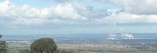
Trafalgar is a town in the West Gippsland region of Victoria, Australia. The town lies on the Princes Highway and main Gippsland railway line about 10 kilometres (6 mi) west of Moe. The town backs onto the foothills of the Strzelecki Ranges to the south. The township sits at approximately 70 metres above sea level. At the 2016 census, Trafalgar had a population of 3,912. The town is named in honour of the Battle of Trafalgar, 1805, which established the Royal Navy's supremacy at sea; allowing consolidation of Britain's Australian colonies at the time.

Warracknabeal is a town in the Australian state of Victoria, located in the Victorian wheatbelt. Situated on the banks of the Yarriambiack Creek, 330 km northwest of Melbourne, it is the business and services centre of the northern Wimmera and southern Mallee districts, and hosts local government offices of the Shire of Yarriambiack. At the 2021 census, the Warracknabeal township had a population of 2,359.

Korumburra is a town in the Australian state of Victoria. It is located on the South Gippsland Highway, 120 kilometres (75 mi) south-east of Melbourne, in the South Gippsland Shire local government area. At the 2016 census Korumburra had an urban population of 3,639.

Drouin is a town in the West Gippsland region, 90 kilometres (56 mi) east of Melbourne, in the Australian state of Victoria. Its local government area is the Shire of Baw Baw, and is home to the shire council's headquarters despite being the second-largest town in the shire, behind neighbouring Warragul. The town's name is believed to be derived from an Aboriginal word meaning "north wind". New housing developments have accelerated the town's residential growth in recent years. As at the 2016 census, Drouin had a population of 11,887 people.

Moe is a town in the Latrobe Valley in the Gippsland region of Victoria, Australia. It is approximately 130 kilometres east of the central business district of Melbourne, 45 kilometres due south of the peak of Mount Baw Baw in the Great Dividing Range and features views of the Baw Baw Ranges to the north and Strzelecki Ranges to the south.

Foster is a dairying and grazing town 174 kilometres (108 mi) south-east of Melbourne on the South Gippsland Highway in Victoria, Australia. At the 2016 census Foster had a population of 1,164. It is about 20 kilometres (12 mi) north of the Gippsland coastline which includes Shallow Inlet, Corner Inlet, Waratah Bay, Yanakie and Wilsons Promontory.

Lang Lang is a town in Victoria, Australia, 73 km south-east of Melbourne's Central Business District, located within the Shires of Bass Coast, Cardinia and South Gippsland local government areas. Lang Lang recorded a population of 2,556 at the 2021 census.

Buchan is a town in the east Gippsland region of Victoria, Australia. The town is situated adjacent to the Buchan River, in the Shire of East Gippsland, upstream from the river's junction with the Snowy River. At the 2011 census, Buchan and the surrounding area had a population of 385. The town is most well known for the limestone Buchan Caves.

Omeo is a town in Victoria, Australia on the Great Alpine Road, east of Mount Hotham, in the Shire of East Gippsland. At the 2016 census, Omeo had a population of 406. The name is derived from an Aboriginal word for 'mountains' or 'hills'. Omeo is affectionately known as the City of the Alps with many historic buildings remaining in the town. The town is still the commercial hub for the Omeo Region and is a service centre for outlying communities such as Benambra, Cobungra, Cassilis, Swifts Creek, and Ensay.

Rosedale is a pastoral and agricultural town 184 kilometres east of Melbourne via the Princes Highway. It is situated on the southern side of the LaTrobe River. Once a staging post on the Port Albert to Sale and Port Albert to Walhalla coach runs, it was the administrative centre of the Shire of Rosedale which extended to the east and included the Ninety Mile Beach. It is now part of the Wellington Shire centred in Sale. At the 2006 census, Rosedale had a population of 1,077. The town is in the area of Gippsland explored separately by the Scotsman, Angus McMillan, and the Polish aristocrat, Count Paul von Strzelecki, in 1840. A memorial to McMillan is located in Rosedale, and one to Strzelecki near Traralgon to the west. Strzelecki named the region Gippsland after Governor Gipps.

Bruthen is a small town located alongside the Tambo River between Bairnsdale and Ensay on the Great Alpine Road in East Gippsland, Victoria, Australia. At the 2016 census, Bruthen had a population of 814. Bruthen is 26 km (16 mi) east of Bairnsdale and 311 km (193 mi) east of the state capital Melbourne.

Fish Creek is a small dairy farming community in Gippsland, Victoria, Australia. It sits in between the Boon wurrung and Gunai/Kurnai Indigenous regions. At the 2016 census, Fish Creek and the surrounding area had a population of 827. It was named for the many river blackfish in the creek that runs alongside the town.
Meeniyan is a small country town on the South Gippsland Highway between Leongatha and Foster in Australia. As of 2016 it has a population of 771.

