Stony Fork Junction, Kentucky

Last updated
Stony Fork Junction
Unincorporated community
USA Kentucky location map.svg
Red pog.svg
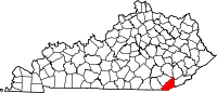
Stony Fork Junction
Location within the state of Kentucky
Usa edcp location map.svg
Red pog.svg
Stony Fork Junction
Stony Fork Junction (the US)
Coordinates: 36°36′6″N83°45′8″W / 36.60167°N 83.75222°W / 36.60167; -83.75222 Coordinates: 36°36′6″N83°45′8″W / 36.60167°N 83.75222°W / 36.60167; -83.75222
Country United States
State Kentucky
County Bell
Elevation 1,181 ft (360 m)
Time zone Eastern (EST) (UTC-5)
  Summer (DST) EDT (UTC-4)
GNIS feature ID 504509 [1]

Stony Fork Junction is an unincorporated community located in Bell County, Kentucky, United States.

Unincorporated area Region of land not governed by own local government

In law, an unincorporated area is a region of land that is not governed by a local municipal corporation; similarly an unincorporated community is a settlement that is not governed by its own local municipal corporation, but rather is administered as part of larger administrative divisions, such as a township, parish, borough, county, city, canton, state, province or country. Occasionally, municipalities dissolve or disincorporate, which may happen if they become fiscally insolvent, and services become the responsibility of a higher administration. Widespread unincorporated communities and areas are a distinguishing feature of the United States and Canada. In most other countries of the world, there are either no unincorporated areas at all, or these are very rare; typically remote, outlying, sparsely populated or uninhabited areas.

Bell County, Kentucky county in Kentucky, United States

Bell County is a county located in the southeast part of the U.S. state of Kentucky. As of the 2010 census, the population was 28,691. Its county seat is Pineville. The county was formed in 1867, during the Reconstruction era from parts of Knox and Harlan counties and augmented from Knox County in 1872. The county is named for Joshua Fry Bell, a US Representative. It was originally called "Josh Bell", but on January 31, 1873, the Kentucky legislature shortened the name to "Bell",

Kentucky State of the United States of America

Kentucky, officially the Commonwealth of Kentucky, is a state located in the east south-central region of the United States. Although styled as the "State of Kentucky" in the law creating it, (because in Kentucky's first constitution, the name state was used) Kentucky is one of four U.S. states constituted as a commonwealth. Originally a part of Virginia, in 1792 Kentucky became the 15th state to join the Union. Kentucky is the 37th most extensive and the 26th most populous of the 50 United States.

Related Research Articles

Lebanon Junction, Kentucky City in Kentucky, United States

Lebanon Junction is a home rule-class city in Bullitt County, Kentucky, in the United States. The population was 1,813 as of the 2010 census.

Allen, Kentucky City in Kentucky, United States

Allen is a home rule-class city in Floyd County, Kentucky, in the United States. The population was 193 at the 2010 census, up from 150 at the 2000 census.

Harlan, Kentucky City in Kentucky, United States

Harlan is a home rule-class city in and the county seat of Harlan County, Kentucky, United States. The population was 1,745 at the 2010 census, down from 2,081 at the 2000 census.

Cumberland River river in the United States of America

The Cumberland River is a major waterway of the Southern United States. The 688-mile-long (1,107 km) river drains almost 18,000 square miles (47,000 km2) of southern Kentucky and north-central Tennessee. The river flows generally west from a source in the Appalachian Mountains to its confluence with the Ohio River near Paducah, Kentucky, and the mouth of the Tennessee River. Major tributaries include the Obey, Caney Fork, Stones, and Red rivers.

Kentucky River river in the United States of America

The Kentucky River is a tributary of the Ohio River, 260 miles (418 km) long, in the U.S. Commonwealth of Kentucky. The river and its tributaries drain much of the central region of the state, with its upper course passing through the coal-mining regions of the Cumberland Mountains, and its lower course passing through the Bluegrass region in the north central part of the state. Its watershed encompasses about 7,000 square miles (18,000 km2). It supplies drinking water to about one-sixth of the population of the Commonwealth of Kentucky.

Kentucky Route 1 is a 48.486-mile-long (78.031 km) state highway in the U.S. state of Kentucky. It originates at a junction with KY 3, one mile (1.6 km) east of Cadmus in Lawrence County. The route continues through Grayson in Carter County to terminate at US 23 in Greenup in Greenup County. Part of the highway is co-signed with the Jenny Wiley Trail. Segments of KY 1 are built upon the old Eastern Kentucky Railroad. KY 1 follows parts of the Little Sandy River and parts of a smaller fork of the Little Sandy called the Little Fork upstream of Grayson.

Stony River Reservoir was constructed on the Stony River in 1888 by Westvaco to supply the source of water for the company's main pulp mill. William Luke's summer residence was located on the lake. The dam suffered from structural weakness and was periodically drained for repairs. The center portion of the dam has since been demolished and the reservoir drained. The majority of the dam still stands on either side of the, now, free flowing river.

Big South Fork National River and Recreation Area

The Big South Fork National River and Recreation Area preserves the Big South Fork of the Cumberland River and its tributaries in northeastern Tennessee and southeastern Kentucky. In addition, the former mining community of Blue Heron is preserved and interpreted via signage.

Paint Creek may refer to:

The Rolling Fork is a 108-mile-long (174 km) river in central Kentucky. The river flows through Marion and Hardin counties, as well as being the border between LaRue and Nelson counties. The Rolling Fork drains much of the land in these counties, and is a key part of life in this area of the Knob Region. The Rolling Fork is a part of the Salt River Basin, and the larger Ohio River Basin.

Stony Fork or Stoney Fork may refer to:

Morris, Pennsylvania Unincorporated community in Pennsylvania, United States

Morris is an unincorporated community in Morris Township, Tioga County, in the U.S. state of Pennsylvania. It lies at the junction of Pennsylvania Route 414 and Pennsylvania Route 287 between Williamsport and Wellsboro. Babb Creek, a tributary of Pine Creek, flows through Morris.

Kentucky Route 306 (KY 306) is a 2.1-mile-long (3.4 km) state highway in the U.S. state of Kentucky. The highway travels south-to-north, mostly in Wheelwright, within Floyd County.

Kentucky Route 317 (KY 317) is a 8.9-mile-long (14.3 km) state highway in the U.S. state of Kentucky. The highway connects mostly rural areas of Letcher County with Fleming-Neon.

Kentucky Route 441 (KY 441) is a 4.897-mile-long (7.881 km) state highway in the U.S. state of Kentucky. The highway travels through mostly urban areas of Bell County. Virtually the entire highway is within the city limits of Middlesboro.

Kentucky Route 463 (KY 463) is a 9.828-mile-long (15.817 km) state highway in the U.S. state of Kentucky. The highway connects mostly rural areas of Letcher and Perry counties with Gordon and Delphia.

References