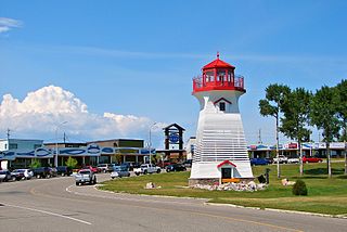
Basseterre is the capital and largest city of Saint Kitts and Nevis with an estimated population of 14,000 in 2018. Geographically, the Basseterre port is located at 17°18′N62°44′W, on the south-western coast of Saint Kitts Island, and it is one of the chief commercial depots of the Leeward Islands. The city lies within Saint George Basseterre Parish.

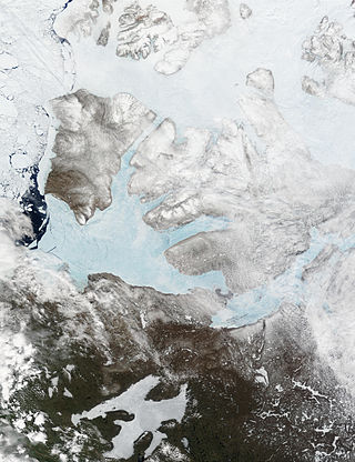
Victoria Island is a large island in the Arctic Archipelago that straddles the boundary between Nunavut and the Northwest Territories of Canada. It is the eighth-largest island in the world, and at 217,291 km2 (83,897 sq mi)1 in area, it is Canada's second-largest island. It is nearly double the size of Newfoundland (111,390 km2 [43,010 sq mi]), and is slightly larger than the island of Great Britain (209,331 km2 [80,823 sq mi]) but smaller than Honshu (225,800 km2 [87,200 sq mi]). The western third of the island lies in the Inuvik Region of the Northwest Territories; the remainder is part of Nunavut's Kitikmeot Region. The population of 2,168 is divided between two settlements, the larger of which is Cambridge Bay (Nunavut) and the other Ulukhaktok.

Banks Island is one of the larger members of the Arctic Archipelago. Situated in the Inuvik Region, and part of the Inuvialuit Settlement Region, of the Northwest Territories, it is separated from Victoria Island to its east by the Prince of Wales Strait and from the mainland by Amundsen Gulf to its south. The Beaufort Sea lies to its west, and to its northeast M'Clure Strait separates the island from Prince Patrick Island and Melville Island.

The following is an alphabetical list of topics related to Canada.

The Avalon Peninsula is a large peninsula that makes up the southeast portion of the island of Newfoundland in Canada. It is 9,220.61 square kilometres (3,560.10 sq mi) in size.

Amundsen Gulf is a gulf located mainly in the Inuvik Region, Northwest Territories, Canada with a small section in the Kitikmeot Region of Nunavut. It lies between Banks Island and Victoria Island and the mainland. It is approximately 250 mi (400 km) in length and about 93 mi (150 km) across where it meets the Beaufort Sea.

Stefansson Island is an uninhabited island in the Arctic Archipelago in the Kitikmeot Region of Nunavut, Canada. It has a total area of 4,463 km2 (1,723 sq mi), making it the 128th largest island in the world, and Canada's 27th largest island. The island is located in Viscount Melville Sound, with M'Clintock Channel to the east. It lies just off Victoria Island's Storkerson Peninsula, separated by the Goldsmith Channel. Stefansson Island's highest mount is 256 m (840 ft). A weather station, at 73°45′56″N105°17′44″W, is located on the northern part of the island as part of an automated weather station array operated by Environment and Climate Change Canada in the Arctic. The first European sighting of the island was in 1917 by Storker T. Storkerson who was travelling with Canadian explorer Vilhjalmur Stefansson (1879-1962), for whom the island was named.

Terrace Bay is a township in Thunder Bay District in northern Ontario, Canada, located on the north shore of Lake Superior east of Thunder Bay along Highway 17. The name originates from a series of lake terraces formed as the water level in Lake Superior lowered following the latest ice age.

Aulavik National Park ; from the Inuvialuktun for "place where people travel") is a national park located on Banks Island in the Northwest Territories of Canada. It is known for its access to the Thomsen River, one of the most northerly navigable rivers in North America. The park is a fly-in park, and protects approximately 12,274 square kilometres (4,739 sq mi) of Arctic Lowlands at the northern end of the island. The most practical way to visit the park is to charter a plane, and currently the park has four landing sites. Aulavik is considered a polar desert and often experiences high winds. Precipitation for the park is approximately 300 mm (12 in) per year. In the southern regions of the park a sparsely vegetated upland plateau reaches a height of 450 m (1,480 ft) above sea level.

Sachs Harbour is a hamlet located in the Inuvik Region of the Northwest Territories, Canada. Situated on the southwestern coast of Banks Island in the Inuvialuit Settlement Region, the population according to the 2021 census count was 104 people. Sachs Harbour is the only permanent settlement on Banks Island.

Alert Bay is a village on Cormorant Island, near the town of Port McNeill on northeast Vancouver Island, in the Regional District of Mount Waddington, British Columbia, Canada.

Discovery Island Marine Provincial Park is a provincial park located about two nautical miles east of Oak Bay on the coast of British Columbia, Canada. It is about one mile (1.6 km) long and one-half mile (0.80 km) wide and looks out into the Strait of Juan de Fuca.

Lockeport is a town and port in Shelburne County, Nova Scotia, Canada. It is a traditional Nova Scotian fishing town, situated on a peninsula in Allendale Bay. It is connected to the mainland by the Crescent Beach causeway. The area that surrounds the bay is known as the "Ragged Islands."
The 'Namgis First Nation is a First Nations band government on northern Vancouver Island in British Columbia, Canada, and on adjoining islands in the southern Queen Charlotte Strait region.

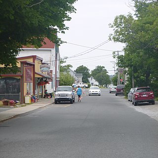
Humber Arm South is a town in the Canadian province of Newfoundland and Labrador. The town consists of the communities of Halfway Point, Benoit's Cove, John's Beach, and Frenchman's Cove. The town had a population of 1,537 in the Canada 2021 Census. The Town's Post Office is located in Benoit's Cove. Humber Arm South is located in the Bay of Islands and is in the Humber-Bay of Islands electoral district. The town's residents are of Mi'kmaw, Innu, and European descent.
Goldsmith Channel is a waterway in the Canadian territory of Nunavut connecting Parry Channel and M'Clintock Channel. Broadest in the northwest, the island-filled channel narrows as it progresses to the southeast where it separates northeastern Victoria Island's Storkerson Peninsula from western Stefansson Island by a few hundred meters of shallow water. This is an uninhabited, extremely remote area. Elvira Island is located at the head of the channel.

HMS Investigator was a merchant ship purchased in 1848 to search for Sir John Franklin's ill-fated Northwest Passage expedition. She made two voyages to the Arctic and had to be abandoned in 1853, after becoming trapped in the pack ice.
Cascumpec Bay is within Prince Edward Island in Canada and is adjacent to the Gulf of Saint Lawrence.
Baring Bay is an Arctic waterway in the Qikiqtaaluk Region, Nunavut, Canada. It lies off the southwestern coast of Devon Island in the eastern high Arctic. Like Macormick Bay to the south, it is an arm of Wellington Channel.


