
The Marsh Arabs, also referred to as Ahwaris, the Maʻdān or Shroog —the latter two often considered derogatory in the present day—are Arab inhabitants of the Mesopotamian marshlands in the modern-day south Iraq, as well as in the Hawizeh Marshes straddling the Iraq-Iran border.

Sir Wilfred Patrick Thesiger, also known as Mubarak bin Landan was a British military officer, explorer, and writer. Thesiger's travel books include Arabian Sands (1959), on his foot and camel crossing of the Empty Quarter of the Arabian Peninsula, and The Marsh Arabs (1964), on his time living with the Marsh Arabs of Iraq.

Frederic Thesiger, 1st Baron Chelmsford, PC, FRS was a British jurist and Conservative politician. He was twice Lord High Chancellor of Great Britain.

Viscount Chelmsford, of Chelmsford in the County of Essex, is a title in the Peerage of the United Kingdom. It was created in 1921 for Frederic Thesiger, 3rd Baron Chelmsford, the former Viceroy of India. The title of Baron Chelmsford, of Chelmsford in the County of Essex, was created in the Peerage of the United Kingdom in 1858 for the first Viscount's grandfather, the lawyer and Conservative Sir Frederic Thesiger, who twice served as Lord Chancellor of Great Britain. Then following was the 2nd Baron, who gained the rank of general and was awarded. As of 2010 the titles are held by the first Viscount's great-grandson, the fourth Viscount, who succeeded his father in 1999.
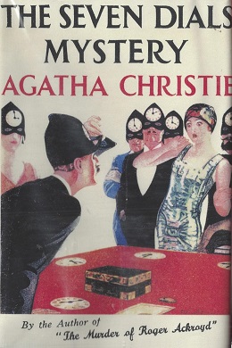
The Seven Dials Mystery is a work of detective fiction by Agatha Christie, first published in the UK by William Collins & Sons on 24 January 1929 and in the US by Dodd, Mead and Company later in the same year.

Frederic John Napier Thesiger, 1st Viscount Chelmsford,, styled the Lord Chelmsford until 1921, was a British statesman. He served as Governor of Queensland from 1905 to 1909, Governor of New South Wales from 1909 to 1913, and Viceroy of India from 1916 to 1921, where he was responsible for the creation of the Montagu–Chelmsford Reforms. After serving a short time as First Lord of the Admiralty in the government of Ramsay MacDonald, he was appointed the Agent-General for New South Wales by the government of Jack Lang before his retirement.

General Frederic Augustus Thesiger, 2nd Baron Chelmsford, was a British Army officer who rose to prominence during the Anglo-Zulu War, when an expeditionary force under his command suffered a decisive defeat at the hands of a Zulu force at the Battle of Isandlwana in 1879. Despite this defeat, he was able to score several victories against the Zulus, culminating in the British victory at the Battle of Ulundi, which ended the war and partly restored his reputation in Britain.

Ernest Frederic Graham Thesiger, CBE was an English stage and film actor. He is noted for his performance as Doctor Septimus Pretorius in James Whale's film Bride of Frankenstein (1935).

Sachs Harbour is a hamlet located in the Inuvik Region of the Northwest Territories, Canada. Situated on the southwestern coast of Banks Island in the Inuvialuit Settlement Region, the population according to the 2021 census count was 104 people. Sachs Harbour is the only permanent settlement on Banks Island.
Alfred Henry Thesiger, styled The Hon. Alfred Thesiger from 1858 to 1877 and The Rt Hon. Lord Justice Thesiger from 1877, was a British lawyer and judge.
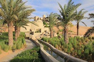
The Liwa Oasis is a large oasis area in the Western Region of the Emirate of Abu Dhabi, the United Arab Emirates.
Major General George Handcock Thesiger, was a senior officer in the British Army during the First World War who was killed in action during the Battle of Loos by German shellfire. His career had encompassed military service in Egypt, South Africa, Ireland, British India and France and had been rewarded with membership in two chivalric orders.
Thesiger is a surname, and may refer to:
Adrian Hayes is a British record-breaking polar explorer and adventurer, best known for reaching the three extreme points of the Earth—the Three Poles Challenge—which involved walking all the way to the North Pole, South Pole and summiting Mount Everest, all in the shortest period of time.
Admiral Sir Bertram Sackville Thesiger was a Royal Navy officer who went on to be Commander-in-Chief, East Indies Station.

Major General Sir John Eardley Wilmot Inglis was a British Army officer, best known for his role in protecting the British compound for 87 days in the siege of Lucknow.
William Bruce Ellis Ranken was a British artist and Edwardian aesthete.
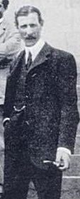
Wilfred Gilbert Thesiger DSO was a British officer and diplomat, who was British Minister in Ethiopia from 1909 to 1919.
Convoy HX 47 was a North Atlantic convoy of the HX series which ran during the battle of the Atlantic in World War II. It was the 47th of the numbered series of merchant convoys run by the Allies from Halifax to Liverpool. The convoy was attacked by German U-boats and lost three of its 58 ships.
Frederick Thesiger was an English naval officer who went to sea with the East India Company and was later commissioned into the Royal Navy and the navy of the Russian Empire.
