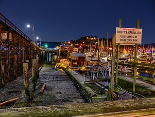
Gibsons is a coastal community of 4,605 in southwestern British Columbia, Canada on the Strait of Georgia.

Powell River is a city on the northern Sunshine Coast of southwestern British Columbia, Canada. Most of its population lives near the eastern shores of Malaspina Strait, which is part of the larger Georgia Strait between Vancouver Island and the Mainland. With two intervening long, steep-sided fjords inhibiting the construction of a contiguous road connection with Vancouver to the south, geographical surroundings explain Powell River's remoteness as a community, despite relative proximity to Vancouver and other populous areas of the BC Coast. The city is the location of the head office of the qathet Regional District.
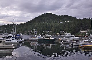
The Sunshine Coast is a geographic subregion of the British Columbia Coast that generally comprises the regional districts of qathet and Sunshine Coast.
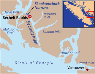
Skookumchuck Narrows is a strait forming the entrance of Sechelt Inlet on British Columbia's Sunshine Coast in Canada. Before broadening into Sechelt Inlet, all of its tidal flow together with that of Salmon Inlet and Narrows Inlet must pass through Sechelt Rapids. At peak flows, standing waves, whitecaps, and whirlpools form at the rapids even in calm weather. The narrows are also the site of Skookumchuck Narrows Provincial Park.

The Sunshine Coast Regional District is a regional district in British Columbia, Canada. It is located on the southern mainland coast, across Georgia Strait from Vancouver Island. It borders on the qathet Regional District to the north, the Squamish-Lillooet Regional District to the east, and, across Howe Sound, the Metro Vancouver District to the south. The regional district offices are located in the District Municipality of Sechelt.
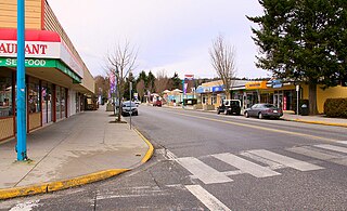
The District Municipality of Sechelt is located on the lower Sunshine Coast of British Columbia. Approximately 50 km northwest of Vancouver, it is accessible from mainland British Columbia by a 40-minute ferry trip between Horseshoe Bay and Langdale, and a 25-minute drive from Langdale along Highway 101, also known as the Sunshine Coast Highway. The name Sechelt is derived from the Sechelt language word, shishalh, the name of the First Nations people who first settled the area thousands of years ago.
Halfmoon Bay is a small community of about 2,800 people, many of whom are only summer residents. It is a large scalloped bay protected from the open sea by South Thormanby Island and Vancouver Island. It encompasses a small village of permanent homes, summer cottages and five regional parks on the Sunshine Coast of British Columbia. It belongs to Electoral Area B in the Sunshine Coast Regional District.

The Sechelt or Shíshálh people, are an indigenous people of the Pacific Northwest Coast. At the time of the first European contact the Sechelt had a population of close to 26,000. Sechelt women were famous for their beautiful cedar woven baskets, which were made using materials such as cedar tree roots, cannery grass and birch bark.

Jervis Inlet is one of the principal inlets of the British Columbia Coast, about 95 km (59 mi) northwest of Vancouver, and the third of such inlets north of the 49th parallel, the first of which is Burrard Inlet, Vancouver's harbour.

Sechelt Inlet formerly Seechelt Inlet is one of the principal inlets of the British Columbia Coast. The inlet is significant in that it almost makes an island of what is instead the Sechelt Peninsula, whose isthmus is at the town of Sechelt at the head of the inlet. The isthmus is less than 1.2 km (0.75 mi) in distance. Sechelt Inlet's mouth is at Jervis Inlet, inland from the Malaspina Strait.

Sechelt Inlets Marine Provincial Park is a provincial park in British Columbia, Canada, at various locations on Sechelt Inlet, Salmon Inlet and Narrows Inlet, near Sechelt. Established initially as a recreation area in 1980, it was converted to a park in 1999, containing approximately 140 hectares.

Skookumchuck Narrows Provincial Park is a provincial park in the Sunshine Coast of British Columbia, Canada. It was established on August 25, 1957 to protect the Sechelt Rapids located in the Skookumchuck Narrows between Sechelt Inlet and Jervis Inlet.
School District 46 Sunshine Coast is a school district in British Columbia, Canada. It covers an area in the Sunshine Coast region northwest of Greater Vancouver, including the communities of Gibsons, and Sechelt.

Pender Harbour is a harbour on British Columbia's Sunshine Coast, on the east side of Malaspina Strait. The harbour is an intricate amalgam of bays and coves that encroach inland for five kilometres and provide over sixty kilometres of shoreline. Once a steamer stop, a fishing village, and an important logging and medical waypoint, it is now an unincorporated community within the Sunshine Coast Regional District (SCRD).
The Sechelt language, Sháshíshálh or Shashishalhem, is a Coast Salish language spoken by the Shishalh (Sechelt) people of the Pacific Northwest Coast. It is spoken in the area now called southwestern British Columbia, Canada, centred on their reserve communities in the Sechelt Peninsula area of the Sunshine Coast.
The Sechelt Peninsula is located on the Sunshine Coast of British Columbia, just northwest of Vancouver. It is bounded to the west by Malaspina Strait, to the north by Agamemnon Channel and Jervis Inlet, to the east by Sechelt Inlet, and to the south by the Strait of Georgia (separating it from Vancouver Island. Its approximately 350 km2 is a mixture of drier and wetter temperate rain forest. The Caren Range extends north–south along the shore of Sechelt Inlet. The peninsula is a popular outdoor recreation destination, containing many lakes and opportunities for shoreline and woodland hiking, including to the renowned Skookumchuk Narrows. There are several parks, the largest of which is Spipiyus Provincial Park in the interior of the peninsula.
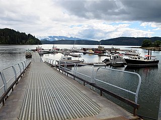
Quatsino Sound is a complex of coastal inlets, bays and islands on northwestern Vancouver Island in the Canadian province of British Columbia. It is the northernmost of the five sounds that pierce the west coast of Vancouver Island, the others being Kyuquot Sound, Nootka Sound, Clayoquot Sound, and Barkley Sound.
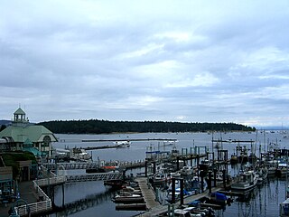
Nanaimo Harbour, also known as the Port of Nanaimo, is a natural harbour on the east coast of Vancouver Island, British Columbia, Canada. The City of Nanaimo runs along the west side of the harbour. Three islands, Newcastle, Protection, and Gabriola, along with Duke Point, form the eastern edge. The Port of Nanaimo includes the Inner Harbour, Nanaimo River estuary, Departure Bay, the waters on the east side of Newcastle and Protection Islands, and Northumberland Channel. The port is under the management of the Nanaimo Port Authority.

The Brittain River is a river of the Sunshine Coast of the Canadian province of British Columbia. It originates in the Pacific Ranges of the Coast Mountains, and flows about 23 km (14 mi) southeast to the Pacific Ocean at the Princess Royal Reach of Jervis Inlet.

Narrows Inlet formerly Narrows Arm is a fjord branching east from Sechelt Inlet in British Columbia, Canada. Its companion, Salmon Inlet, another side-inlet of Sechelt Inlet, lies roughly 10 km (6.2 mi) south.


