Atoka County is a county located in the U.S. state of Oklahoma. As of the 2010 census, the population was 14,007. Its county seat is Atoka. The county was formed before statehood from Choctaw Lands, and its name honors a Choctaw Chief named Atoka.

Stringtown is a town in Atoka County, Oklahoma, United States. The population was 410 at the 2010 census, an increase of 3.5 percent from the figure of 396 recorded in 2000. It is the second largest town in Atoka County.
Stringtown can refer to the following:
Liverpool is an unincorporated community in Jackson and Roane counties, West Virginia, United States. Liverpool is located along the Right Fork Sandy Creek at the junction of Jackson County Route 13 and Roane County Route 1, 5.7 miles (9.2 km) west of Reedy Liverpool had a post office, which closed on May 30, 1989. The community was named after Liverpool, in England.
Emmett is an unincorporated community in Logan County, West Virginia, United States. Emmett is located on Elk Creek, County Route 11/1, and the CSX Railroad, 4.8 miles (7.7 km) southeast of Man. Emmett had a post office, which closed on March 7, 1998.

Shively is an unincorporated community located on the Smokehouse Fork of Big Harts Creek in Logan County, West Virginia, United States. Shively is accessed by County Route 3. It is situated 7.2 miles from Harts and 9.3 miles from Chapmanville.
Beckwith is an unincorporated community in Fayette County, West Virginia, United States. Beckwith is located on West Virginia Route 16 and Laurel Creek, 4.1 miles (6.6 km) northwest of Fayetteville. Beckwith had a post office, which closed on October 3, 1998. The community has the name of P. D. Beckwith.
Long Branch is an unincorporated community in Fayette County, West Virginia, United States. Long Branch is located near the West Virginia Turnpike, 1.1 miles (1.8 km) northwest of Pax. Long Branch had a post office, which closed on October 3, 1998.
Mead is an unincorporated community in Raleigh County, West Virginia, United States. Mead is located on County Route 33 and Stonecoal Creek, 2.7 miles (4.3 km) east-northeast of Rhodell. Mead had a post office, which closed on June 10, 1989. It was also known as Vanwood.
Bens Run is an unincorporated community in Tyler County, West Virginia, United States. Bens Run is located on the Ohio River at the junction of West Virginia Route 2 and County Route 5, 4.3 miles (6.9 km) southwest of Friendly. Bens Run had a post office, which closed on November 2, 2002.
Centerville is an unincorporated community in Tyler County, West Virginia, United States. Centerville is located along West Virginia Route 18, 5.4 miles (8.7 km) southeast of Middlebourne. Centerville has a post office with ZIP code 26320; the post office uses the name Alma.
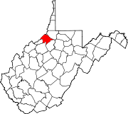
Stringtown is an unincorporated community in Roane County, West Virginia, United States. Stringtown is located on County Route 52, 9.25 miles (14.89 km) south of Spencer.
Wilbur is an unincorporated community in Tyler County, West Virginia, United States. Wilbur is located along County Route 58, 9 miles (14 km) south-southeast of Middlebourne. Wilbur had a post office, which closed on February 1, 1988.
Braden is an unincorporated community in Tyler County, West Virginia, United States. Braden is located on Indian Creek and County Route 13, 9.3 miles (15.0 km) east-southeast of Middlebourne.
Everettville is an unincorporated community in Monongalia County, West Virginia, United States. Everettville is located along County Route 45 and Little Indian Creek, 7.3 miles (11.7 km) southwest of Morgantown. Everettville had a post office, which closed on November 2, 2002.
Big Moses is an unincorporated community in Tyler County, West Virginia, United States, along Indian Creek. Its post office is closed.
Meadowdale is an unincorporated community in Jackson County, West Virginia, United States. Meadowdale is located on County Route 13 and the Right Fork Sandy Creek, 8.1 miles (13.0 km) northeast of Ripley. Meadowdale once had a post office, which is now closed.
Ripley Landing is an unincorporated community in Jackson County, West Virginia, United States. Ripley Landing is located along West Virginia Route 2 near the confluence of the Ohio River and Mill Creek, 6.1 miles (9.8 km) southwest of Ravenswood. Ripley Landing once had a post office, which is now closed.
Booher is an unincorporated community in Tyler County, West Virginia, United States, along Indian Creek. Its post office is closed.

Indian Creek is a tributary of Middle Island Creek, 14.8 miles (23.8 km) long, in northern West Virginia in the United States. Via Middle Island Creek and the Ohio River, it is part of the watershed of the Mississippi River, draining an area of 32.3 square miles (84 km2) in a rural region on the unglaciated portion of the Allegheny Plateau.