
Bhojpur is one of the two urban municipalities of Bhojpur District of Province No. 1 of Nepal.

Baglung District, a part of Gandaki Province, is one of the seventy-seven districts of Nepal. The district, with Baglung as its district headquarters, covers an area of 1,784 km2 (689 sq mi) and has a population (2011) of 268,613.
Sarlahi, a part of Madhesh Province, is one of the seventy-seven districts of Nepal. According to new laws, a combination of more than two or four villages makes a municipality, which covers an area of 1,259 km2 (486 sq mi) and had a population of 635,701 in 2001 and 769,729 in 2011.

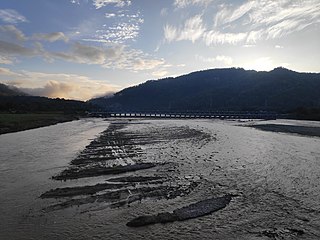
Udayapur District (Nepali: उदयपुर जिल्ला, is one of the 14 districts of Koshi Province in eastern Nepal. The district, with Triyuga as its district headquarters, covers an area of 2,063 km2 and in 2001 had a population of 287,689, in 2011 of 317,532, in 2021 of 342,773

Budhabare, more specifically Hadiya Budhabare, is a village and former Village Development Committee that is now part of Buddhashanti Rural Municipality in Jhapa district of Province No. 1 in south-eastern Nepal. The latest official data, 2011 Nepal Census, puts the total population of the VDC at 22,936. Owing to this average population size, the VDC has been divided into nine wards.
Rigaun or Ree gaun is a village development committee in Dhading District in the Bagmati Zone of central Nepal. At the time of the 1991 Nepal census it had a population of 5218 and had 875 houses in it. Ree Gaun is located in the Northern part of Dhading. It consists of wards no 1 & 2 of Gangajamuna Rural Municipality, State 3, Dhading Nepal. There are 90% people of the Tamang ethnic group, and some are Gurung, Kami (BK), Damai. The main occupation of this area is agriculture.

Takukot is a Ward of Barpak sulikot Rural Municipality in Gorkha District in the Gandaki Province of northern-central Nepal. At the time of the 1991 Nepal census it had a population of 4,234 and had 801 houses in the town.
Jitpur is a town and Village Development Committee in Ilam District in the Province No. 1 of eastern Nepal. At the time of the 1991 Nepal census it had a population of 5,454 persons residing in 989 individual households.
Phakphok is a town and Village Development Committee (VDC) in Ilam District in the Province No. 1 of eastern Nepal. At the time of the 1991 Nepal census it had a population of 4,233 persons living in 734 individual households.
Lamatar is a village and former Village Development Committee that is now part of Mahalaxmi Municipality in Province No. 3 of central Nepal.
Khamlung is a village development committee in the Himalayas of Taplejung District in the Province No. 1 of north-eastern Nepal. At the time of the 2011 Nepal census it had a population of 1517 people living in 319 individual households. There were 730 males and 787 females at the time of census.
Solma is a village development committee in the Himalayas of Terhathum District in the Kosi Zone of eastern Nepal. At the time of the 1991 Nepal census it had a population of 4093 people living in 717 individual households. Solma is a Village Development Committee (VDC) lies on western part of Tehrathum District. The main ethnicity distribution of this VDC is Limbu (1190), Bramans (873), Kchhetri (663), Magar (381), Gurungs(287), Newar (166), Tamang (43) Kami (119)and Dam/Darji (100), Bhujel/Gharti (47). This VDC have one high school named Ratna Higher Secondary School, one Health Post, Post Office, Agriculture and Veterinary Center.
Kohabara is a village development committee in Jhapa District in the Province No. 1 of south-eastern Nepal. RamChandre Khola,a stream, separates it from Khajurgachhi VDC.

Tahoon is a village very development committee in Palpa District in the Lumbini Zone of southern Nepal. At the time of the 1991 Nepal census it had a population of 3776.
Birendranagar is a village development committee (VDC) in Chitwan District in the Narayani Zone of southern Nepal. At the time of the 2011 Nepal census it had a population of 14,934 people living in 3,374 individual households.

Belbari, officially known as Belbari municipality, is one of the major suburb of Morang district, Province No. 1. It lies in the eastern Terai region of Nepal. Previously a Village Development Committee (VDC), it was upgraded to the municipality status in 2014. In order to meet the requirements to become a municipality, Belbari VDC merged Kaseni VDC with itself, making it larger in total area. Moreover, in 2017 AD VDC like Dangihat and Bahuni merged with it to become present Belbari Municipality. Now it have 11 wards offices. It had a population of 81,837 people living in 18,945 households making it the third most populous city in Morang district.
Bhaudaha is a village development committee in Morang District in the Kosi Zone of south-eastern Nepal. At the time of the 1991 Nepal census it had a population of 4743 people living in 876 individual households.
Sijuwa is a part of Ratuwamai municipality in Morang District in the Kosi Zone of south-eastern Nepal. To the north, it is bordered by Itahara; to the south, Jhurkiya; to the east, Jhapa and to the west, Govindapur.
Pragatinagar is a town in Devachuli Municipality in Nawalparasi District in the Lumbini Zone of southern Nepal. The municipality was established on 18 May 2014 by merging existing Devachuli, Dibyapuri, Pragatinagar VDCs. At the time of the 2001 Nepal census it had a population of 11,771 people living in the VDC. There are 2690 households as of June 2010 in the VDC with 100 per cent school enrollment, and birth registration. It also has the lowest level of malnutrition and one of the highest level of adult literacy (86%) in Nepal.
Serachaur सेराचौर is a village which is located in Kaski District, Gandaki Province, Nepal. The word Sera refers to a plain land which is used to farm and supply food to a palace and Chaur means a grassy land. First settlers of this village were Adhikari Family. It is a part of the Annapurna Gaunpalika ward number- 2, Kaski, Nepal. Pastly the village was part of Dhikurpokhari V.D.C but later the Ministry of Federal Affairs and Local Development (Nepal) dissolved the existing village development committees and announced the establishment of this new local body. Visitors can take the Baglung Highway, Kaskikot road and other existing trails to reach here. Concrete pavement is recent installation to the road.

