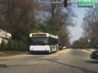
Sudbrook Park | |
Nearest city | Pikesville, Maryland |
---|---|
Coordinates | 39°21′58″N76°43′49″W / 39.36611°N 76.73028°W |
Area | 200 acres (81 ha) |
Built | 1890 |
Architect | Olmsted, Frederick Law |
Architectural style | Colonial Revival, Queen Anne, Shingle Style |
NRHP reference No. | 73000904 [1] |
Added to NRHP | June 19, 1973 |
Sudbrook Park is a historic neighborhood near Pikesville, Maryland located just northwest of the Baltimore City limits in Baltimore County.
The community dates to 1889 when it was designed by American landscape architect Frederick Law Olmsted, Sr. (1822–1903) and developed by the Sudbrook Company. Known most for designing well-known urban projects like Central Park in New York City, Olmsted conceived this "suburban village" with curved roads and open green spaces, traits that set the community apart from its contemporaries. Two homes in the district were designed by architect George Archer in the Colonial Revival style. [2] [3]
Sudbrook Park was registered on the National Register of Historic Places in 1973, and from 1993 to 1999 portions of Sudbrook Park became listed as Baltimore County Historic Districts.
Today, the community continues to uphold Olmsted's vision through community association regulations. It is a tight-knit community and holds several annual events and neighborhood activities.
One of Sudbrook Park's unique features is the one-lane bridge that crosses over Western Maryland Railway. Constructed in 1889, the bridge stood for more than a century with a wooden platform. In 2005, the bridge closed for reconstruction. It reopened about a year later with an asphalt pavement, retaining its one-lane status in order to preserve the community's historic charm.
Elkridge is an unincorporated community and census-designated place (CDP) in Howard County, Maryland, United States. The population was 15,593 at the 2010 census. Founded early in the 18th century, Elkridge is adjacent to two other counties, Anne Arundel and Baltimore.
The Baltimore–Washington Parkway is a limited-access highway in the U.S. state of Maryland, running southwest from Baltimore to Washington, D.C. The road begins at an interchange with U.S. Route 50 (US 50) near Cheverly in Prince George's County at the Washington, D.C. border, and continues northeast as a parkway maintained by the National Park Service (NPS) to MD 175 near Fort Meade, serving many federal institutions. This portion of the parkway is dedicated to Gladys Noon Spellman, a representative of Maryland's 5th congressional district, and has the unsigned Maryland Route 295 (MD 295) designation. Commercial vehicles, including trucks, are prohibited within this stretch. This section is administered by the NPS's Greenbelt Park unit. After leaving park service boundaries the highway is maintained by the state and signed with the MD 295 designation. This section of the parkway passes near Baltimore–Washington International Thurgood Marshall Airport.
Locust Point is a peninsular neighborhood in Baltimore, Maryland. Located in South Baltimore, the neighborhood is entirely surrounded by the Locust Point Industrial Area; the traditional boundaries are Lawrence street to the west and the Patapsco River to the north, south, and east. It once served as a center of Baltimore's Polish-American, Irish-American and Italian-American communities; in more recent years Locust Point has seen gradual gentrification with the rehabilitation of Tide Point and Silo Point. The neighborhood is also noted as being the home of Fort McHenry and the western end of its namesake tunnel that carries eight lanes of Interstate 95 under the river.
Druid Hill Park is a 745-acre (3.01 km2) urban park in northwest Baltimore, Maryland. Its boundaries are marked by Druid Park Drive (north), Swann Drive and Reisterstown Road, and the Jones Falls Expressway / Interstate 83 (east).
Roland Park is a community located in Baltimore, Maryland. It was developed between 1890 and 1920 as an upper-class streetcar suburb. The early phases of the neighborhood were designed by Edward Bouton and Frederick Law Olmsted Jr.
Mount Washington is an area of northwest Baltimore, Maryland. It is a designated city historic district and divided into two sections: South Road/Sulgrave to the southeast and Dixon's Hill to the north. The Mount Washington Historic District was listed on the National Register of Historic Places in 1990 with a boundary increase in 2001, with five contributing buildings and four contributing structures.
The Coldstream-Homestead-Montebello community, often abbreviated to C-H-M, is a neighbourhood in northeastern Baltimore, Maryland. A portion of the neighborhood has been listed on the National Register of Historic Places as the Coldstream Homestead Montebello Historic District, recognized for the development of a more suburban style of rowhouses.
Northwood is a neighborhood in the northeastern section of Baltimore, Maryland in the United States. Northwood is served by the New Northwood and the Original Northwood community associations. The area is also home to the Northwood Shopping Center and the Northwood Baseball League. Morgan State University is located in this area.
Gaithersburg station is a commuter rail station located on the Metropolitan Subdivision in downtown Gaithersburg, Maryland. It is served by the MARC Brunswick Line service; it was also served by Amtrak from 1971 to 1986. The former Baltimore and Ohio Railroad station building and freight shed, designed by Ephraim Francis Baldwin and built in 1884, are listed on the National Register of Historic Places as Gaithersburg B & O Railroad Station and Freight Shed. They are used as the Gaithersburg Community Museum.
Guilford is a prominent and historic neighborhood located in the northern part of Baltimore, Maryland. It is bounded on the south by University Parkway, on the west by North Charles Street, Warrenton and Linkwood Roads, on the north by Cold Spring Lane and on the east by York Road. The neighborhood is adjacent to the neighborhoods of Tuscany-Canterbury, Loyola-Notre Dame, Kernewood, Wilson Park, Pen Lucy, Waverly Oakenshawe, Charles Village, and the universities of Johns Hopkins and Loyola University Maryland. The neighborhood was added to the National Register of Historic Places in 2001.
Seton Hill Historic District is a historic district in Baltimore, Maryland. It was listed on the National Register of Historic Places in 1975.
Harford National Bank is a historic bank building located at Bel Air, Harford County, Maryland. It is a one-story, with day-light basement built in a modified Richardson Romanesque style of glazed red brick and rusticated brownstone. It was designed by architect George Archer in 1889.
Lovely Lane United Methodist Church, formerly known as First Methodist Episcopal Church and earlier founded as Lovely Lane Chapel, is a historic United Methodist church located at Baltimore, Maryland, United States.
Walters Bath No. 2 is a historic bath house located in southwest Baltimore, Maryland, United States. It is a small brick building of 40 by 70.5 feet laid in Flemish bond with black headers and Maryland limestone trimming. It was constructed in a very simplified form of Renaissance Revival architecture popularized at the turn of the 20th century. The bath house in the 900 block, Washington Boulevard in the southwest area of Pigtown / Washington Village, was built for the City of Baltimore by Henry Walters (1848–1931), who contributed four bath houses to the city. It was co-designed by architect George Archer (1848-1920), and constructed in 1901. Architect Archer was trained at Princeton University and lived in a landmark townhouse of white marble at the southeast corner of North Charles and West Madison Streets, facing Washington Place and the famous Washington Monument. The public bath system was abolished 60 years later, at the end of 1959 with the general extension of indoor plumbing and public water systems in the city's densely packed row houses residential neighborhoods.
Old Goucher College Buildings is a national historic district in Baltimore, Maryland, United States. It is an approximate 18-block area in the middle of Baltimore which developed in the late 19th and 20th centuries.
East Monument Historic District or Little Bohemia, is a national historic district in Baltimore, Maryland. It is a large residential area with a commercial strip along East Monument Street. It comprises approximately 88 whole and partial blocks. The residential area is composed primarily of rowhouses that were developed, beginning in the 1870s, as housing for Baltimore's growing Bohemian (Czech) immigrant community. During the late 19th and early 20th centuries the neighborhood was the heart of the Bohemian community in Baltimore. The Bohemian National Parish of the Roman Catholic Church, St. Wenceslaus, is located in the neighborhood. The historic district includes all of McElderry Park and Milton-Montford, most of Middle East and Madison-Eastend, and parts of Ellwood Park.
George Archer (1848–1920) was an American architect. A native of Baltimore, and Maryland and a graduate of Princeton University in Princeton, New Jersey, he designed several churches, banks, and other buildings in the Mid-Atlantic states of the U.S.A.
Old Town is an historic neighborhood of College Park, Maryland. It is roughly bounded by the University of Maryland campus, the B&O Railroad tracks, and US Route 1. The area was plotted out in 1889, and built out over the next several decades, its developers seeking to attract commuters to Baltimore and Washington, DC, and individuals affiliated with the Maryland Agricultural College. Most of the neighborhood is residential, with American Foursquare and Cape Cod style housing predominating. Closer to the university campus, the developers built garden-style apartment houses and other types of housing to cater to the academic community. The major non-residential structures are a Gothic Revival church, a modern post office and Washington Metro station.
The College Heights Estates Historic District encompasses 170 contributing buildings in a mid-20th century automobile-centered residential suburban area of University Park, Maryland, and the neighboring unincorporated area of College Heights Estates in Prince George's County. The earliest portions of the area were platted out in 1938, and the area was mostly built out between then and 1960. The area features winding lanes and dead-end roads, with large houses on generously sized lots. Houses built before the Second World War are predominantly Colonial Revival in character, while post-war construction includes a large number of ranch, split-entry, and Cape style houses, although they are generally larger than other similar houses built in other neighborhoods. Also distinguishing the neighborhood from others are a significant number of architect-designed homes.
Spokane and its neighborhoods contain a patchwork of architectural styles that give them a distinct identity and illustrate the changes throughout the city's history. Spokane has a rich architectural history for a western city of its size and much of it is a product of its circumstances at the turn of the 20th century when as a rapidly growing city, the Great Fire of 1889 destroyed 32 blocks of the city center which was quickly rebuilt in a more grand fashion by a community flush with money coming from regional mining districts. Many of the architects that found work in the city and building on the blank slate of the downtown commercial district became highly esteemed architects such as Kirtland Cutter, who has been credited with giving the city a distinctive character. In particular, the city has a high concentration of Romanesque Revival style institutional and commercial buildings and American Craftsman bungalow residences. The architecture of Spokane gained national recognition in industry publications in the early 20th century.