
Deoria district, one of the districts of eastern Uttar Pradesh, India has its headquarters located at Deoria and is a part of Gorakhpur division. It came into existence on 16 March 1946 from Gorakhpur district.
Bhatpar Rani is a town and tehsil in Deoria District in the state of Uttar Pradesh in India. It belongs to Gorakhpur Division. It is located 48 km towards East from District headquarters Deoria.The Member of Legislative Council of Bhatpar Rani Constituency is Shri. Sabhakunwar Kushwaha In Bhatpar Rani, the block number of village is 127. The biggest village in this tehsil is Sarayan. Khan Sir(Teacher), Shilpi Raj(Singer) were born here.
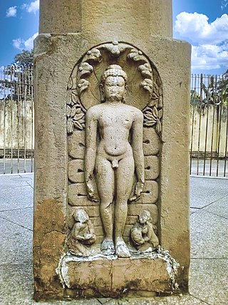
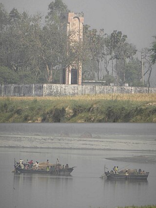
Gaura Barhaj is a town and a municipal board in Deoria district in the state of Uttar Pradesh, India. It is at the banks of the holy Saryu (Ghaghra) River. Along the river banks, Sona mandir, the work place of a saint Baba Raghav Das, is located and it is a prominent place of attraction in the town.
Hussainpur is a census town in Jalandhar district in the Indian state of Punjab. It is situated in Jalandhar II Tehsil. The village code is 030405.
Lar is a town, a nagar panchayat, and is a block headquarter in Deoria district in the Indian state of Uttar Pradesh. It belongs to the Gorakhpur Division and is located 45 KM toward the south from District headquarter Deoria. Lar is noted by a single, old and historical, bazaar i.e., a business centre, in the town; it lies at a short distance 3.2 KM toward east of the nearest railway station Lar Road. In addition, the business centre, 5-8 KM toward the east within Lar block, is connected with many villages that exist on the western bank of river Chhoti Gandak or riverbanks partly surrounded by Chhoti Gandak and Ghaghara.
Ahirauli Baghel is an Indian village located in Uttar Pradesh, India. Ahirauli Baghel comes under Bankata Block of Deoria district. It belongs to Gorakhpur division. It is located 47 KM towards East from district headquarter Deoria. It distance is 374 KM from State capital Lucknow. Bhojpuri and Hindi is the primary language spoken in this village.

Akkiwat is a village in the southern state of Karnataka, India. It is located in the Hukeri taluk of Belgaum district in Karnataka. It is situated 23km away from sub-district headquarter Hukkeri and 58km apart from district headquarter Belgaum. As per 2009 stats, Kesthi is the gram panchayat of Akkiwat village.
Reoli is a village of block Bhagalpur in Deoria district in the state of Uttar Pradesh, India. It comes under Tehsil Salempur. It is situated 5 kilometres east to Bhagalpur. Pindi Bazar is 5 km east to it. Lar Bazar is nearly 6.5 km in northeast. Barhaj Bazar is 25 km in northwest. Deoria is 53 km from Reoli. SalemPur is just 24 km from Reoli. Belthra Road is just 10 km away in south from Reoli. Saryu (Ghaghra) river flows parallel to Bhagalpur, west to Reoli. On the other side of river there is another District named Balia.
Gudas, Belgaum is a village According to Census 2011 information the location code or village code of Gudas village is 597594. Gudas village is located in Hukeri taluka of Belgaum district in Karnataka, India. It is situated 11km away from sub-district headquarter Hukkeri and 63km away from district headquarter Belgaum. As per 2009 stats, Gudas village is also a gram panchayat.
Hattar Gunji is a village in khanapur Talukha and Belgaum district in the southern state of Karnataka, India. It comes under Hattar Gunji Panchayath. It belongs to Belgaum Division. Bharatiya Janata Party, BJP, Indian National Congress (INC), INC are the major political parties in this area.

Honnihalli is a village in Belagavi district in the southern state of Karnataka, India.
Shivanoor is a village in Belgaum district of Karnataka, India. According to Census 2011 information the location code or village code of Shivanoor village is 597265. Shivanoor village is located in Athni Tehsil of Belgaum district in Karnataka, India. It is situated 13km away from sub-district headquarter Athani and 167km away from district headquarter Belgaum. As per 2009 stats, Jambagi is the gram panchayat of Shivanoor village.
Renwadi is a village in Parner taluka in Ahmednagar district of state of Maharashtra, India. According to Census 2011 information the location code or village code of Renwadi village is 558343. Renwadi is situated 36km away from sub-district headquarter Parner and 41km away from district headquarter Ahmadnagar. As per 2009 stats, Renawadi is the gram panchayat of Renwadi village.
Gopankop is a village in Dharwad district of Karnataka, India. According to Census 2011 information the location code or village code of Gopankop village is 602377. Gopankop village is located in Hubli Tehsil of Dharwad district in Karnataka, India. It is situated 6 km (3.7 mi) away from sub-district headquarter Hubli and 26 km (16 mi) away from district headquarter Dharwad.
Khukhundoo, is a small town in the state of Uttar Pradesh in northern India, approximately 15 kilometres (9.3 mi) east of Deoria city near the border with Bihar state on Deoria Salempur road in Deoria district.

Bhagipur is a village in Unchahar block of Raebareli district, Uttar Pradesh, India. It is located 34 km from Raebareli, the district headquarters. As of 2011, it has a population of 446 people, in 89 households.
Paina is a village and Nyaya Panchayat situated along the bank of Sarayu (Ghaghra) river in the eastern part of the state of Uttar Pradesh in India. It comes under administration of Barhaj Tehsil of Deoria District and Gorakhpur Division. It is located 33 km towards South from District headquarters Deoria and 340 km from State capital Lucknow.
Matasukha is a mid sized village located in the district of Nagaur in the state of Rajasthan in India.
Pilode is a village located in Amalner Tehsil of Jalgaon district in Maharashtra, India. It is situated 10 km away from sub-district headquarter Amalner and 65 km away from district headquarter Jalgaon.

Awandiya is a village in Mandor ILRC in Phagi tehsil in Jaipur district, Rajasthan. It is situated 9 km away from sub-district headquarter Phagi and 51 km away from district headquarter Jaipur.