Related Research Articles

Hayward is a city located in Alameda County, California, United States, in the East Bay subregion of the San Francisco Bay Area. With a population of 162,954 as of 2020, Hayward is the sixth largest city in the Bay Area, and the third largest in Alameda County. Hayward was ranked as the 36th most populous municipality in California. It is included in the San Francisco–Oakland–San Jose Metropolitan Statistical Area by the US Census. It is located primarily between Castro Valley, San Leandro and Union City, and lies at the eastern terminus of the San Mateo–Hayward Bridge. The city was devastated early in its history by the 1868 Hayward earthquake. From the early 20th century until the beginning of the 1980s, Hayward's economy was dominated by its now defunct food canning and salt production industries.

Oak Park is an unincorporated community in southeastern Ventura County, California, United States. When developed in the Simi Hills in the late 1960s, a single road provided the only access to the community from Agoura Hills, California, in neighboring Los Angeles County. As of the 2010 census, Oak Park had a population of 14,266, down from 14,625 at the 2000 census. For statistical purposes, the United States Census Bureau has defined Oak Park as a census-designated place (CDP). The census definition of the area may not precisely correspond to local understanding of the area with the same name.

Connecticut's Beardsley Zoo, located in Bridgeport, Connecticut, is the only Association of Zoos and Aquariums (AZA)–accredited zoo in the state of Connecticut. The zoo includes one of the few carousels in the state. The zoo has around 500 animals, from over 100 species, and welcomes about 280,000 visitors a year.

Alum Rock Park, in the Alum Rock district of San Jose, California, is California's oldest municipal park, established in 1872 but serving as public land since the pueblo was established in 1777. Located in a valley in the Diablo Range foothills on the east side of San Jose, the 720 acre (2.9 km2) park offers 13 miles (21 km) of trails, varying from fairly level along Penitencia Creek to sharp switchbacks climbing to the ridges to the South Rim Trail and the North Rim Trail. The narrow floor of the valley includes a visitor center, a small museum/animal rehab facility, picnic areas, playgrounds, lawns, sand volleyball pits, mineral springs, lush plant life, woodlands, creek play opportunities, and occasional group camping.

The Monongahela National Forest is a national forest located in the Allegheny Mountains of eastern West Virginia, US. It protects over 921,000 acres of federally managed land within a 1,700,000 acres proclamation boundary that includes much of the Potomac Highlands Region and portions of 10 counties.

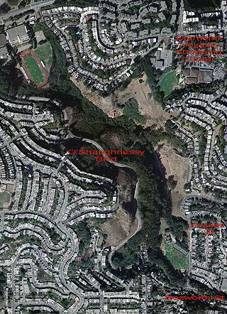
Glen Canyon Park is a city park in San Francisco, California. It occupies about 70 acres (28 ha) along a deep canyon adjacent to the Glen Park, Diamond Heights, and Miraloma Park neighborhoods. O'Shaughnessy Hollow is a rugged, undeveloped 3.6 acres (1.5 ha) tract of parkland that lies immediately to the west and may be considered an extension of Glen Canyon Park.

Montclair is a hillside neighborhood in Oakland, California, United States. Montclair is located along the western slope of the Oakland Hills from a valley formed by the Hayward Fault to the upper ridge of the hills.

Chickasaw National Recreation Area is a national recreation area in the foothills of the Arbuckle Mountains in south-central Oklahoma near Sulphur in Murray County. It includes the former Platt National Park and Arbuckle Recreation Area.

The Golden Gate National Recreation Area (GGNRA) is a U.S. National Recreation Area protecting 82,116 acres (33,231 ha) of ecologically and historically significant landscapes surrounding the San Francisco Bay Area. Much of the park is land formerly used by the United States Army. GGNRA is managed by the National Park Service and is the second-most visited unit of the National Park system in the United States, with more than 15.6 million visitors in 2022. It is also one of the largest urban parks in the world, with a size two-and-a-half times that of the consolidated city and county of San Francisco.

Strawberry Creek is the principal watercourse running through the city of Berkeley, California. Two forks rise in the Berkeley Hills of the California Coast Ranges, and form a confluence at the campus of the University of California, Berkeley. The creek then flows westward across the city to discharge into San Francisco Bay.

The Cascades Raptor Center is a nature center and wildlife hospital in Eugene, Oregon that specializes in raptor rehabilitation. As of November 2020, permanent inhabitants of the center include 37 individual birds from 21 species.
Pyramid State Recreation Area, the largest state recreation area in Illinois, contains 19,701 acres (7,973 ha). It is located within Perry County, and is administered by the Illinois Department of Natural Resources. The nearest large town is Pinckneyville, Illinois.

Erratic Rock State Natural Site is a state park in the Willamette Valley of Oregon, United States. Featuring a 40-short-ton (36 t) glacial erratic from the Missoula Floods, the small park sits atop a foothill of the Northern Oregon Coast Range in Yamhill County between Sheridan and McMinnville off Oregon Route 18. The day-use-only park is owned and maintained by the Oregon Parks and Recreation Department.

Beaver Creek State Park is a 2,722-acre (1,102 ha) public recreation area in Columbiana County, Ohio in the United States. The park is near East Liverpool on the banks of Little Beaver Creek. Remnants of the historic Sandy and Beaver Canal can be found throughout the park. It is open for year-round recreation including, camping, boating, hunting, fishing and hiking.

Placerita Canyon State Park is a California State Park located on the north slope of the western San Gabriel Mountains, in an unincorporated rural area of Los Angeles County, near the city of Santa Clarita. The park hosts a variety of historic and natural sites, as well as serving as a trailhead for several hiking trails leading into the San Gabriel Mountains.

The New Forest Wildlife Park is located on the edge of The New Forest close to the towns of Ashurst and Lyndhurst. The park specialises in native and past-native wildlife of Britain and otters and owls from around the globe, housing four species of the former and ten of the latter.
The Nature and Wildlife Discovery Center (NWDC) is a multi-campus nature preserve and educational center in Pueblo County, Colorado. It includes a 611-acre mountain park, a lodge, a gift shop, a museum in Beulah, Colorado, a small museum and educational center, an open-space park on the Arkansas River in Pueblo, and an adjacent raptor education and rehabilitation facility.

The Hayward Area Recreation and Park District (H.A.R.D.) is the park management agency for most of the parks in the city of Hayward, California. It was created in 1944 and is an independent special district under California law. H.A.R.D. is the largest recreation district in California. It also manages parks in the bordering unincorporated communities of Castro Valley, San Lorenzo, Fairview, Ashland and Cherryland. It manages the park grounds for numerous schools in the region. Events and classes are scheduled and listed in a quarterly brochure. The parks' 2021 budget is $24,306,495.

The Hayward Shoreline Interpretive Center is a natural history and ecology interpretive nature center located in Hayward, California. It is directly adjacent to the north side of Highway 92 as it approaches the San Mateo–Hayward Bridge, and is accessed from the highway by the last offramp in the westbound direction before the bridge toll gates. The Center was dedicated in 1986, and is operated by the Hayward Area Recreation and Park District.
References
- ↑ Stephanie Wright Hession (May 4, 2011). "Sulphur Creek Nature Center, Hayward". Sfgate.com. Retrieved August 11, 2016.
- ↑ Eric Kurhi (March 23, 2012). "Live barn owl webcam at Sulphur Creek Nature Center – The HayWord". Ibabuzz.com. Archived from the original on August 16, 2016. Retrieved August 11, 2016.