Summergangs, Kingston upon Hull

Last updated

Summergangs (archaic Somergang) is a suburb of Kingston upon Hull, near the A165 road, in the East Riding of Yorkshire, England. The area contains the model village development known as The Garden Village and East Park.

Contents

History

'Somergang' is referred to in the early 14th century as common pasture land, [1] and to a cross in Somergang during the same period, also as a pasture called Suttecotes Som'gang (or Suttecotessomergang [2] ). [3]

The drainage canal known as the 'Somergangs Dike' originates to a 13th-century ditch created by Saer de Sutton, [4] this ditch formed the boundary with Sutton to the north. [5]

The name may derive from the indo-European word "gang/geng" [6] meaning a road or way plus "summer", [7] referring to a road which was only usable in summer, or from "South" + "Mer" (Mere). [8] The etymologies refer to the wetness of the (low lying) land and to the use of the land during the (drier) summer months. [1] [9]

The fields in Summergangs were enclosed in 1748, [4] a large residence with grounds was constructed soon after on the north side of the road, this was later called Holderness House after rebuilding in the 1830s. Apart from this the Summergangs area remained unused for housing until the 1850s. [10]

By 1855 there were several windmills, a brickworks, as well as the Crown Inn at Mile House; all on the Holderness Road, as well as Holderness House, and the nearby Summergangs Cottages. [11] East Park was opened in 1887, and expanded north-eastward in the next half century to occupy much of Summergangs north of Holderness Road and Holderness House; [12] by the 1890s housing had begun to spread north-eastwards along Holderness Road from Drypool and The Groves as far as Holderness Road, and urbanisation had started to spread into the formerly rural area; along Durham and Jalland Street north-westwards, as well as eastwards along Southcoates Lane towards Southcoates. [13]

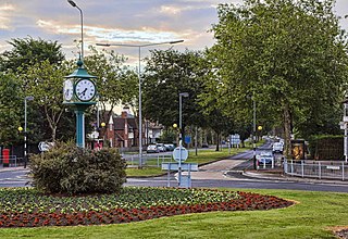
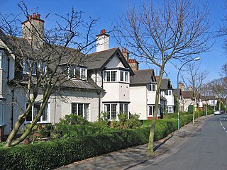
In 1908 The Garden Village housing development opened, eventually taking up much of the land south-west of Holderness House and north of Holderness Road. All of the Summergangs area was converted into suburban or urban parkland from 1900 to the 1940s. [14] Since the 1940s the pattern of land usage has remained the same up to 2010.

Holderness House

'Summergangs House', pre-1828 Old house on site of Holderness House.jpg
'Summergangs House', pre-1828

After the enclosure of Summergangs in 1748 a part owned by William Constable on the north side of the Hull to Hedon road (Holderness Road) was built upon, [10] this dwelling was named Summergangs Hall, and modernised in 1800. [15]

In 1838 the land was sold to Boswell Middleton Jalland who demolished the old house and built Holderness House. [10] [Map 1] The building is now a grade II listed building, and functions as a residential home for Ladies. [16] [17]

See also

Related Research Articles

Hullshire was a county corporate in the East Riding of Yorkshire, England from 1440 to 1889. Hullshire may refer to the area outside the town of Kingston upon Hull, whilst the entire entity was sometimes referred to as the "Town and County of Kingston upon Hull".

<span class="mw-page-title-main">Kingston upon Hull East (UK Parliament constituency)</span> Parliamentary constituency in the United Kingdom

Kingston upon Hull East is a borough constituency for the House of Commons of the Parliament of the United Kingdom. It elects one Member of Parliament (MP) at least once every five years by the first-past-the-post electoral system. The constituency has been represented by Karl Turner of the Labour Party since the 2010 general election.

<span class="mw-page-title-main">Willerby, East Riding of Yorkshire</span> Village and civil parish in the East Riding of Yorkshire, England

Willerby is a village and civil parish located on the western outskirts of the city of Kingston upon Hull in the East Riding of Yorkshire, England.

<span class="mw-page-title-main">Trams in Kingston upon Hull</span> Historic tram system in Kingston upon Hull

The Kingston upon Hull tramway network was a network of 4 ft 8+12 instandard gauge tram lines following the five main roads radially out of the city centre of Kingston upon Hull, East Riding of Yorkshire, England. Two of these lines went west, and two east. The fifth went to the north, and branched to include extra lines serving suburban areas. Additionally a short line linked the city centre to the Corporation Pier where a ferry crossed the Humber Estuary to New Holland, Lincolnshire.

<span class="mw-page-title-main">Drypool</span> Area of Kingston upon Hull, East Riding of Yorkshire, England

Drypool is an area within the city of Kingston upon Hull, England.

<span class="mw-page-title-main">Victoria Dock railway station</span> Disused railway station in the East Riding of Yorkshire, England

Victoria Dock railway station was the terminus of the York and North Midland Railway's Victoria Dock Branch Line in Kingston upon Hull, East Riding of Yorkshire, England.

<span class="mw-page-title-main">Hull History Centre</span>

The Hull History Centre is an archive and local studies library in Hull, England. It houses the combined collections of both the Hull City Council and Hull University archives and local studies resources. This collaboration between Hull City Council, Hull University, and the Heritage Lottery Fund made Hull the first city in the UK to unite local council and university collections under one roof.

<span class="mw-page-title-main">Sutton-on-Hull</span> Suburb of Kingston upon Hull, East Riding of Yorkshire, England

Sutton-on-Hull is a suburb of the city of Kingston upon Hull, in the ceremonial county of the East Riding of Yorkshire, England. It is located 3 miles (4.8 km) north east of the city centre and has the B1237 road running through it which connects the A165 road with the A1033.

<span class="mw-page-title-main">Stoneferry</span>

Stoneferry is a suburb of Kingston upon Hull, East Riding of Yorkshire, England. It was formerly a small hamlet on the east bank of the River Hull, the site of a ferry, and, after 1905, a bridge. The area is primarily industrial, and is situated on the east bank of the river, as well as close by areas on the west bank.

Marfleet is an area of Kingston upon Hull, East Riding of Yorkshire, England, in the east of the city, near King George Dock.

<span class="mw-page-title-main">Garden Village, Kingston upon Hull</span>

The Garden Village is an area of model village housing built in the early 1900s, in the Summergangs area of Kingston upon Hull, England, for the workers of Reckitt & Sons.

<span class="mw-page-title-main">Southcoates</span> Area of Kingston upon Hull, East Riding of Yorkshire, England

Southcoates is an urban area in the eastern part of Kingston upon Hull, England.

<span class="mw-page-title-main">North Hull Estate</span> Area of Kingston upon Hull, East Riding of Yorkshire, England

The North Hull Estate is a residential area in the north of Kingston upon Hull, west of the River Hull, built by Hull Corporation in the interwar period.

<span class="mw-page-title-main">Dairycoates</span> Area of Kingston upon Hull in the East Riding of Yorkshire, England

Dairycoates is an area of Kingston upon Hull, East Riding of Yorkshire, England, a former hamlet.

<span class="mw-page-title-main">Greatfield Estate, Kingston upon Hull</span> Estate in Kingston upon Hull, East Riding of Yorkshire, England

Greatfield Estate is a housing estate in the east of Kingston upon Hull, East Riding of Yorkshire. England, built in the late 1950s.

<span class="mw-page-title-main">Preston Road Estate</span> Area of Kingston upon Hull, East Riding of Yorkshire, England

Preston Road Estate, also known as the East Hull Estate, is a housing estate in the east of Kingston upon Hull built from the 1920s to the 1940s by Hull Corporation. At the beginning of the 21st century considerable redevelopment of the estate took place, with a large community centre established, and demolition or modification of older substandard houses.

<span class="mw-page-title-main">Kingswood, Kingston upon Hull</span> Area in Kingston upon Hull, East Riding of Yorkshire, England

Kingswood, occasionally referred to as Kingswood Parks, is a modern housing estate on the northern fringe of Kingston upon Hull, England.

References

  1. 1 2 Allison, K. J., ed. (1969). Outlying villages: Drypool : Agriculture. A History of the County of York East Riding. Vol. 1: The City of Kingston upon Hull. pp. 460–464.
  2. Brown, William, ed. (1906). "Yorkshire inquisitions of the reigns of Henry III. and Edward I". p. 48.
  3. Blashill 1900, p. 79.
  4. 1 2 Allison, K. J., ed. (1969). "Outlying villages: Sutton : Agriculture". A History of the County of York East Riding. Vol. 1: The City of Kingston upon Hull. pp. 470–475.
  5. Blashill 1900, p. 130.
  6. Wiktionary-logo-en-v2.svg The dictionary definition of gang at Wiktionary
  7. Cameron, Kenneth (1961). "15. Roads and Ways". English Place Names. B.T. Batsford / Methuen & Co. Ltd. / Redwood Press Limited. p. 159.
  8. Poulson, George (1841). The history and antiquities of the seigniory of Holderness, in the East-Riding of the county of York. Vol. 2. Thomas Topping, Bowlalley-Lane, Hull / W. Pickering, London. p.  341.
  9. Blashill 1903, pp. 44–45.
  10. 1 2 3 Blashill 1903 , p. 62
  11. Ordnance Survey, 1855–1856, 1:10.560
  12. "East Park". Hull City Council . Retrieved 21 August 2011.
  13. Ordnance Survey, 1893–1894, 1:10,560
  14. Ordnance Survey, 1910, 1928, and 1938–46 editions
  15. "Holderness Road (West), Hull City Council, section 6.8
  16. "Holderness House, Kingston Upon Hull". British Listed Buildings. Retrieved 27 January 2013.
  17. "Holderness House". Holderness House Trust. Retrieved 27 January 2013.

Sources

Maps

  1. 53°45′32″N0°18′29″W / 53.758870°N 0.307964°W Holderness House, Holderness Road, Kingston upon Hull

Further information

53°45′36″N0°18′39″W / 53.76010°N 0.310971°W / 53.76010; -0.310971