Summit, Utah

Last updated
Summit, Utah
Iron County Utah incorporated and unincorporated areas Summit highlighted.svg
Location in Iron County and the state of Utah
Coordinates: 37°47′47″N112°56′42″W / 37.79639°N 112.94500°W / 37.79639; -112.94500 Coordinates: 37°47′47″N112°56′42″W / 37.79639°N 112.94500°W / 37.79639; -112.94500
Country United States
State Utah
County Iron
Settled1858
Area
  Total0.7 sq mi (1.8 km2)
  Land0.7 sq mi (1.8 km2)
  Water0.0 sq mi (0.0 km2)
Elevation
[1]
5,955 ft (1,815 m)
Population
 (2010) [2]
  Total160
  Density230/sq mi (89/km2)
Time zone UTC-7 (Mountain (MST))
  Summer (DST) UTC-6 (MDT)
ZIP code
84772
Area code(s) 435
FIPS code 49-74040
GNIS feature ID2629954 [1]

Summit is an unincorporated community and census-designated place (CDP) in east-central Iron County, Utah, United States. The population was 160 at the 2010 census. [2]

Contents

History

Summit was named for the fact that it sits on the divide between the Parowan Valley and Cedar Valley.

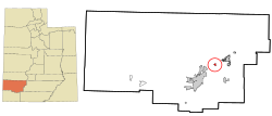
At first the area around Summit Creek was a grazing area for Parowan to the north. In the spring of 1858, Samuel T. Orton and other families moved to Summit Creek and began farming and tending bees, sheep and cattle. By July 1877 an LDS ward was organized in Summit. Sylvanus C. Hulet was its first bishop. Originally educating their children in a one-room log schoolhouse, it was upgraded later to a concrete building, then from 1920 to 1936, to a two-room brick schoolhouse for students up to the seventh grade. [3] :184

Demographics

As of the census [4] of 2010, there were 160 people living in the CDP. There were 79 housing units. The racial makeup of the town was 92.5% White, 3.1% American Indian and Alaska Native, 3.1% from some other race, and 1.3% from two or more races. Hispanic or Latino of any race were 8.1% of the population.

Climate

The climate in this area has mild differences between highs and lows, and there is adequate rainfall year-round. According to the Köppen Climate Classification system, Summit has a marine west coast climate, abbreviated "Cfb" on climate maps. [5]

See also

Related Research Articles

Iron County, Utah U.S. county in Utah

Iron County is a county in southwestern Utah, United States. As of the 2010 United States Census, the population was 46,163. Its county seat is Parowan, and the largest city is Cedar City.

Hope, Alaska Census-designated place in Alaska, United States

Hope is a census-designated place (CDP) in Kenai Peninsula Borough in the U.S. state of Alaska. As of the 2010 census the population was 192, up from 137 in 2000.

Warm Springs, Oregon Census-designated place in Oregon, United States

Warm Springs is a census-designated place (CDP) and an unincorporated community in Jefferson County, Oregon, United States. Located on the Warm Springs Indian Reservation, the community is also known as the "Warm Springs Agency". The population was 2,945 at the 2010 census, up from 2,431 at the 2000 census.

Providence, Utah City in Utah, United States

Providence is a city in Cache County, Utah, United States. The population was 7,075 at the 2010 census. It is included in the Logan, Utah-Idaho Metropolitan Statistical Area.

Cedar City, Utah City in Utah, United States

Cedar City is the largest city in Iron County, Utah, United States. It is located 250 miles (400 km) south of Salt Lake City, and 170 miles (270 km) north of Las Vegas on Interstate 15. It is the home of Southern Utah University, the Utah Shakespeare Festival, the Utah Summer Games, the Simon Fest Theatre Co., and other events. As of the 2010 census the city had a population of 28,857, up from 20,257 in 2000. As of 2018 the estimated population was 33,055.

Kanarraville, Utah Town in Utah, United States

Kanarraville is a town in Iron County, Utah, United States. The population was 355 at the 2010 census.

Paragonah, Utah Town in Utah, United States

Paragonah is a town in Iron County, Utah, United States. The population was 488 at the 2010 census.

Parowan, Utah City in Utah, United States

Parowan is a city in and the county seat of Iron County, Utah, United States. The population was 2,790 at the 2010 census, and in 2018 the estimated population was 3,100.

Millcreek, Utah City in Utah, United States

Millcreek is a city in Salt Lake County, Utah, United States, and is part of the Salt Lake City Metropolitan Statistical Area. Prior to its incorporation on December 28, 2016, Millcreek was a census-designated place (CDP) and township.

New Harmony, Utah Town in Utah, United States

New Harmony is a town in northern Washington County, Utah, United States. The population was 207 at the 2010 census.

Snoqualmie Pass, Washington Census-designated place in Washington, United States

Snoqualmie Pass is a census-designated place (CDP) in Kittitas County, Washington, United States. It includes the unincorporated community of Hyak. The population was 311 at the 2010 census.

Park Valley, Utah Unincorporated community in Utah, United States

Park Valley is an unincorporated community in north-central Box Elder County, Utah, United States.

Williams, Oregon Census-designated place in Oregon, United States

Williams is an unincorporated community and census-designated place (CDP) in Josephine County, Oregon, United States. As of the 2010 census it had a population of 1,072.

Kenilworth, Utah Census-designated place in Utah, United States

Kenilworth is a census-designated place in northern Carbon County, Utah, United States.

Peoa, Utah Census-designated place in Utah, United States

Peoa is an unincorporated census-designated place in southwestern Summit County, Utah, United States, between Jordanelle and Rockport State Parks. It lies along State Route 32 south of the city of Coalville, the county seat of Summit County. Its elevation is 6,191 feet (1,887 m). The population was 253 at the 2010 census. Peoa is unincorporated with the ZIP code of 84061.

Newcastle, Utah Census-designated place in Utah, United States

Newcastle is an unincorporated community and census-designated place (CDP) in southwestern Iron County, Utah, United States. It lies along State Route 56, 30 miles (48 km) west of Cedar City. Its elevation is 5,312 feet (1,619 m) above sea level. Newcastle has a post office with the ZIP code of 84756. The population was 247 at the 2010 census. Newcastle was founded in 1910 by citizens of the more isolated Pinto.

Teasdale, Utah Census-designated place in Utah, United States

Teasdale is a census-designated place in western Wayne County, Utah, United States, between the Dixie and Fishlake National Forests and near Capitol Reef National Park. The population was 191 at the 2010 census. Teasdale lies along local roads south of State Route 24, southeast of the town of Loa, the county seat of Wayne County. Although it is unincorporated, Teasdale has a post office, with the ZIP code of 84773.

Clear Creek, Utah Census-designated place in Utah, United States

Clear Creek is a small census-designated place on the western edge of Carbon County, Utah, United States. It is located at the south end of State Route 96 and the Pleasant Valley Branch of the Union Pacific Railroad (ex-D&RGW).

Spring Glen, Utah Census-designated place in Utah, United States

Spring Glen is a census-designated place in Carbon County, in eastern Utah, United States. The population was 1,126 at the 2010 census. Founded in 1878, Spring Glen was the first permanent settlement in what is now Carbon County. First settled principally by white Mormon farmers, the community became much more diverse after about 1890, when the development of the area's coal mines brought an influx of immigrants from Southern Europe and other regions.

Hoopers Creek, North Carolina Census-designated place in North Carolina, United States

Hoopers Creek is an unincorporated community and census-designated place (CDP) in Henderson County, North Carolina, United States. Its population was 1,056 as of the 2010 census.

References

  1. 1 2 U.S. Geological Survey Geographic Names Information System: Summit, Utah
  2. 1 2 "Geographic Identifiers: 2010 Census Summary File 1 (G001): Summit CDP, Utah". American Factfinder. U.S. Census Bureau. Archived from the original on February 13, 2020. Retrieved April 13, 2018.
  3. Janet Burton Seegmiller, A History of Iron County, Community Above Self; Utah Centennial County History Series: The Face and Faces of Iron County; Physical Characteristics; Ancient Peoples; Explorers, Traders, Trappers and Expeditions; Utah State Historical Society, Iron County Commission, 1998
  4. "U.S. Census website". United States Census Bureau . Retrieved May 23, 2011.
  5. Climate Summary for Summit, Utah

Commons-logo.svg Media related to Summit, Utah at Wikimedia Commons