
The Denver & Rio Grande Western Railroad, often shortened to Rio Grande, D&RG or D&RGW, formerly the Denver & Rio Grande Railroad, was an American Class I railroad company. The railroad started as a 3 ft narrow-gauge line running south from Denver, Colorado, in 1870. It served mainly as a transcontinental bridge line between Denver, and Salt Lake City, Utah. The Rio Grande was also a major origin of coal and mineral traffic.

Iron County is a county in southwestern Utah, United States. As of the 2010 United States Census, the population was 46,163. Its county seat is Parowan, and the largest city is Cedar City.
Syracuse is a city in Davis County, Utah, United States. It is situated between the Great Salt Lake and Interstate 15, about 30 miles (48 km) north of Salt Lake City. It is part of the Ogden–Clearfield, Utah Metropolitan Statistical Area. The city has seen rapid growth and development since the 1990s. The city population was 24,331 at the time of the 2010 census, an increase of 158.9% since the 2000 census.

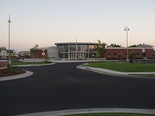
Cedar City is the largest city in Iron County, Utah, United States. It is located 250 miles (400 km) south of Salt Lake City, and 170 miles (270 km) north of Las Vegas on Interstate 15. It is the home of Southern Utah University, the Utah Shakespeare Festival, the Utah Summer Games, the Simon Fest Theatre Co., and other events. As of the 2010 census the city had a population of 28,857, up from 20,257 in 2000. As of 2019 the estimated population was 34,764.

The Salt Lake City Union Pacific Depot is a building on the western edge of downtown Salt Lake City, Utah, United States. Built in 1908–09, it dates back to the more prosperous era in the history of American railroad travel. As Salt Lake Union Pacific Railroad Station, it is listed on the National Register of Historic Places.
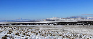
The Escalante Desert is a geographic Great Basin region and arid desert ecoregion, in the deserts and xeric shrublands biome, located in southwestern Utah.
The Utah Parks Company, a subsidiary of Union Pacific Railroad, owned and operated restaurants, lodging, and bus tours in Bryce Canyon and Zion National Parks, the north rim of Grand Canyon National Park, and Cedar Breaks National Monument from the 1920s until 1972. Operating as a concessionaire of the National Park Service, the company operated from a base in Cedar City, Utah. The company's bus tours connected there with Union Pacific trains as well as tour buses from Los Angeles, San Francisco and other west coast cities, and offered a loop tour of the region's parks and monuments, escorted by a Utah Parks Company driver/guide.

Thistle is a ghost town in Spanish Fork Canyon in southeastern Utah County, Utah, United States. During the era of steam locomotives, the town's primary industry was servicing trains for the Denver and Rio Grande Western Railroad. The fortunes of the town were closely linked with those of the railroad until the changeover to diesel locomotives, when the town started to decline.
Soldier Summit is the name of both a mountain pass in the Wasatch Mountains in Utah, United States and an unincorporated community that is a near-ghost town located at the pass. Soldier Summit has been an important transportation route between the Wasatch Front and Price, Utah, since the area was settled by the Mormon pioneers. It is on the route of both U.S. Route 6 and the old main line of the Denver and Rio Grande Western Railroad (D&RGW), now the Provo Subdivision of the Central Corridor. Located where the road makes a brief bend through the extreme southwest corner of Wasatch County, Soldier Summit historically had more to do with nearby Utah County.
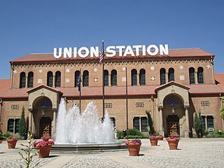
Union Station, also known as Ogden Union Station, is a train station in Ogden, Utah, at the west end of Historic 25th Street, just south of the Ogden Intermodal Transit Center. Formerly the junction of the Union Pacific and Central Pacific Railroads, its name reflects the common appellation of train stations whose tracks and facilities are shared by railway companies.
Beryl is an unincorporated community in west-central Iron County, Utah, United States.

The Los Angeles and Salt Lake Railroad was a rail company in California, Nevada, and Utah in the United States, that completed and operated a railway line between its namesake cities, via Las Vegas, Nevada. Incorporated in Utah in 1901 as the San Pedro, Los Angeles and Salt Lake Railroad, the line was largely the brainchild of William Andrews Clark, a Montana mining baron and United States Senator. Clark enlisted the help of Utah's U.S. Senator Thomas Kearns, mining magnate and newspaper man, to ensure the success of the line through Utah. Construction of the railroad's main line was completed in 1905. Company shareholders adopted the LA&SL name in 1916. The railway was also known by its official nickname, "The Salt Lake Route", and was sometimes informally referred to as "The Clark Road". The tracks are still in use by the modern Union Pacific Railroad, as the Cima, Caliente, Sharp, and Lynndyl Subdivisions.
Union Pacific Railroad Depot, or similar, may refer to:

Mill Fork is a ghost town located approximately 12 miles (19 km) east of Thistle in Spanish Fork Canyon in Utah County, Utah, United States. Named for its sawmills, Mill Fork was important in the development of the railroad through the canyon. The arched entrance to the small, well-tended Mill Fork Cemetery is a landmark on U.S. Route 6 between the cities of Spanish Fork and Price.

Lund Highway is a road connecting Cedar City to the ghost town of Lund in Iron County, Utah. Although it is classified as a minor collector, it was once an important connection between the Union Pacific Railroad at Lund and the national parks of southern Utah and northern Arizona.

Wahsatch is a ghost town in Summit County, Utah, United States. It lies along I-80 at the northeastern end of Echo Canyon some 23 miles (37 km) east of Echo, and 11 miles (18 km) west of Evanston, Wyoming. Wahsatch was established as a railroad camp, later achieving local prominence in sheep ranching. It was inhabited from 1868 until the 1930s.
The Utah Southern Railroad was built by the Mormons in 1871-2 to connect Salt Lake City to points south. The line was acquired by the Union Pacific Railroad (UP) in 1875. The Utah Southern Railroad name was initially kept as a separate division of the UP, but over time the line was moved around and divided among different UP subsidiaries. While most of the corridor is still used today it is no longer contiguous. The southern portion of the line, from Provo to Lynndyl, remains under UP ownership and is today known as the Sharp Subdivision. The portion through the Salt Lake Valley is today owned by the Utah Transit Authority and used for the TRAX light rail system, primarily the Blue Line. The portion between the end of the Blue line and Provo has had the rails removed, however UTA has retained the right to extend the TRAX system to Provo along the former Utah Southern right of way.
The Cedar City Historic District is a set of one hundred and seventy-two buildings in Cedar City, Utah. Of these, one hundred and four contribute to its historical integrity. Cedar City was originally an iron works near the Latter-day Saint city of Parowan. After Brigham Young shut down the iron facilities, two-thirds of Cedar City's residents left for other settlements. The remaining families prospered from sheep ranching. The Union Pacific Railroad connected to the town in the early 1900s and provided a tourism boom for the city. The district represents some of the oldest houses for Cedar City residents, most of which were farmers or ranchers. Later houses in the district represent early 20th century revivals.

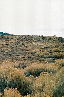
The Cedar Valley of Iron County, Utah, United States is a 25-mile (40 km) long valley located in the southeast of the county, against the Hurricane Cliffs which border the Cedar Mountains and the Markagunt Plateau.


