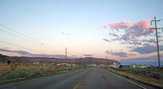
Price is a city in the U.S. state of Utah and the county seat of Carbon County. The city is home to Utah State University Eastern, as well as the USU Eastern Prehistoric Museum. Price is located within short distances of both Nine Mile Canyon and the Manti-La Sal National Forest.

Wellington is a city in Carbon County, Utah, United States. The population was 1,676 at the 2010 census. The community was settled in 1878 by a band of thirteen Mormons led by Jefferson Tidwell. The town was named for Justus Wellington Seeley, Jr., of the Emery County Court. Many residents commute to nearby Price for their jobs, or work in one of the various coal mines in the area.

Roosevelt is a city in Duchesne County, Utah, United States. The population was 6,046 at the 2010 census, with an estimated population of 7,070 in 2018.

Cedar City is the largest city in Iron County, Utah, United States. It is located 250 miles (400 km) south of Salt Lake City, and 170 miles (270 km) north of Las Vegas on Interstate 15. It is the home of Southern Utah University, the Utah Shakespeare Festival, the Utah Summer Games, the Simon Fest Theatre Co., and other events. As of the 2020 census the city had a population of 35,235, up from 28,857 in the 2010 census.

Enoch is a city in Iron County, Utah, United States, and is located approximately 7 miles (11 km) northeast of Cedar City in the northeast part of Cedar Valley. The population was 5,803 at the 2010 census, up from 3,467 at the 2000 census. As of 2018 the estimated population was 7,039.

Kanarraville is a town in Iron County, Utah, United States. The population was 355 at the 2010 census.

Parowan is a city in and the county seat of Iron County, Utah, United States. The population was 2,790 at the 2010 census, and in 2018 the estimated population was 3,100.

Blanding is a city in San Juan County, Utah, United States. The population was 3,375 at the 2010 census, making it the most populated city in San Juan County. It was settled in the late 19th century by Mormon settlers, predominantly from the famed Hole-In-The-Rock expedition. Economic contributors include mineral processing, mining, agriculture, local commerce, tourism, and transportation.

Ephraim is a city in Sanpete County, Utah, United States. The population was 5,611 at the 2020 census, making it the largest city in Sanpete County. It is the location of Snow College and is located along U.S. Route 89.

Moroni is a city in Sanpete County, Utah, United States. The population was 1,423 at the 2010 census.

Aurora is a city in north-central Sevier County, Utah, United States. The population was 1,016 at the 2010 census.

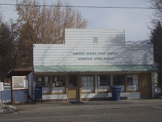
Henefer is a town in Summit County, Utah, United States. It is part of the Salt Lake City, Utah Metropolitan Statistical Area. The population was 766 at the 2010 census.

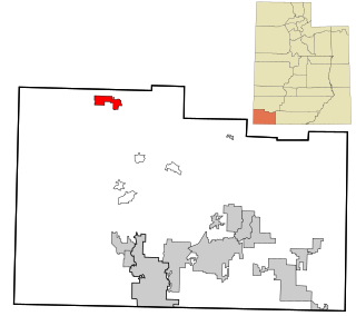
Vernon is a town in southeastern Tooele County, Utah, United States.

Salem is a city in Utah County, Utah. It is part of the Provo–Orem metropolitan area. The population was 9,298 at the time of the 2020 U.S. census. Landmark locations in Salem include the Dream Mine of John Hyrum Koyle and the Salem Pond.

Enterprise is a city in northwestern Washington County, Utah, United States. The population was 1,711 at the 2010 census.

Hildale is a city in Washington County, Utah, United States. The population was 1,127 at the 2020 census.

Ivins is a city in southwestern Washington County, Utah, United States. It is a part of the St. George Metropolitan Area as a suburb or "bedroom" community. The population was 8,978 at the 2020 census, up from 6,753 at the 2010 census. Although Ivins was listed as a town in the 2000 census, it became a city in 1998.

New Harmony is a town in northern Washington County, Utah, United States. The population was 207 at the 2010 census.

Atlantic City is a census-designated place (CDP) in Fremont County, Wyoming, United States. The population was 37 at the 2010 census. The community is a small mining settlement in a gulch near South Pass in southwestern Wyoming. It was founded as a mining camp following the 1867 gold rush in the region. The town declined following the end of the placer gold rush in the early 1870s, but continued to exist as advances in mining technology allowed further extraction of gold. From the 1960s until 1983, it was the location of US Steel iron ore mine. The town is accessible by gravel roads from nearby Wyoming Highway 28.

Beryl Junction is a census-designated place (CDP) in Iron County, Utah, United States. The population was 197 at the 2010 census. Beryl Junction Airport, a small, private airport, is located here.


