Swan Lake, Montana

Last updated

Swan Lake, Montana
USA Montana location map.svg
Red pog.svg
Swan Lake
Usa edcp location map.svg
Red pog.svg
Swan Lake
Coordinates: 47°55′45″N113°50′41″W / 47.92917°N 113.84472°W / 47.92917; -113.84472
Country United States
State Montana
County Lake
Area
[1]
  Total7.61 sq mi (19.71 km2)
  Land7.61 sq mi (19.71 km2)
  Water0.00 sq mi (0.00 km2)
Elevation
[2]
3,104 ft (946 m)
Population
 (2020)
  Total102
  Density13.40/sq mi (5.17/km2)
Time zone UTC-7 (Mountain (MST))
  Summer (DST) UTC-6 (MDT)
Area code 406
GNIS feature ID791786 [2]
FIPS code 30-72850

Swan Lake is a census-designated place and unincorporated community in Lake County, Montana, United States. [2] Its population was 113 as of the 2010 census. [3]

Contents

Geography

The Swan Lake CDP is in northeastern Lake County, on the east shore of the south end of the lake of the same name. The CDP extends east to the Lake County/Flathead County line, which runs along the crest of the Swan Range. The northern edge of the CDP follows Groom Creek, while the southern edge follows Bond Creek. Elevations range from 3,066 feet (935 m) on Swan Lake to 7,218 feet (2,200 m) at the summit of Con Kelly Mountain in the Swan Range. Montana Highway 83 runs through the community close to the shore of Swan Lake; it leads northwest 20 miles (32 km) to Montana Highway 35 north of Bigfork and south 71 miles (114 km) to Montana Highway 200 at Clearwater. Kalispell is 35 miles (56 km) northwest of Swan Lake via Highways 83, 82, and 93.

According to the U.S. Census Bureau, the Swan Lake CDP has an area of 7.6 square miles (19.7 km2), all land. [4]

Climate

According to the Köppen Climate Classification system, Swan Lake has a warm-summer humid continental climate, abbreviated "Dfb" on climate maps. The hottest temperature recorded in Swan Lake was 106 °F (41.1 °C) on August 11, 2018, while the coldest temperature recorded was −40 °F (−40.0 °C) on December 30, 1968. [5]

Climate data for Swan Lake, Montana, 1991–2020 normals, extremes 1963–present
MonthJanFebMarAprMayJunJulAugSepOctNovDecYear
Record high °F (°C)58
(14)
60
(16)
76
(24)
86
(30)
93
(34)
99
(37)
102
(39)
106
(41)
98
(37)
84
(29)
70
(21)
55
(13)
106
(41)
Mean maximum °F (°C)46.8
(8.2)
49.2
(9.6)
61.6
(16.4)
74.0
(23.3)
83.5
(28.6)
88.8
(31.6)
95.0
(35.0)
95.5
(35.3)
87.6
(30.9)
75.4
(24.1)
57.2
(14.0)
45.2
(7.3)
97.1
(36.2)
Average high °F (°C)30.7
(−0.7)
36.1
(2.3)
45.2
(7.3)
54.1
(12.3)
64.2
(17.9)
70.7
(21.5)
81.8
(27.7)
81.7
(27.6)
70.1
(21.2)
54.8
(12.7)
38.9
(3.8)
30.4
(−0.9)
54.9
(12.7)
Daily mean °F (°C)24.3
(−4.3)
27.0
(−2.8)
35.4
(1.9)
42.7
(5.9)
51.2
(10.7)
57.6
(14.2)
64.7
(18.2)
63.8
(17.7)
54.5
(12.5)
43.4
(6.3)
32.2
(0.1)
25.3
(−3.7)
43.5
(6.4)
Average low °F (°C)17.8
(−7.9)
17.9
(−7.8)
25.6
(−3.6)
31.3
(−0.4)
38.1
(3.4)
44.4
(6.9)
47.6
(8.7)
46.0
(7.8)
38.9
(3.8)
32.1
(0.1)
25.5
(−3.6)
20.1
(−6.6)
32.1
(0.1)
Mean minimum °F (°C)−6.9
(−21.6)
−1.3
(−18.5)
8.8
(−12.9)
20.6
(−6.3)
26.8
(−2.9)
33.5
(0.8)
37.7
(3.2)
36.1
(2.3)
29.0
(−1.7)
17.8
(−7.9)
9.2
(−12.7)
−1.7
(−18.7)
−12.7
(−24.8)
Record low °F (°C)−36
(−38)
−28
(−33)
−13
(−25)
5
(−15)
18
(−8)
24
(−4)
28
(−2)
27
(−3)
16
(−9)
−2
(−19)
−10
(−23)
−40
(−40)
−40
(−40)
Average precipitation inches (mm)2.60
(66)
2.10
(53)
1.98
(50)
1.85
(47)
2.59
(66)
3.00
(76)
1.40
(36)
1.38
(35)
1.72
(44)
2.07
(53)
3.19
(81)
2.87
(73)
26.75
(680)
Average snowfall inches (cm)24.5
(62)
17.0
(43)
11.9
(30)
4.1
(10)
0.4
(1.0)
0.0
(0.0)
0.0
(0.0)
0.0
(0.0)
0.1
(0.25)
0.9
(2.3)
15.5
(39)
32.6
(83)
107.0
(272)
Average precipitation days (≥ 0.01 in)12.710.911.38.811.111.04.35.27.69.611.514.1118.1
Average snowy days (≥ 0.1 in)10.47.45.02.30.10.00.00.00.00.55.910.341.9
Source 1: NOAA (precip 19812010) [6] [7]
Source 2: National Weather Service (precip days, snow/snow days 19812010) [5]

Demographics

Historical population
CensusPop.Note
2020 102
U.S. Decennial Census [8]

Notable person

Notes

  1. "ArcGIS REST Services Directory". United States Census Bureau. Retrieved September 5, 2022.
  2. 1 2 3 "Swan Lake, Montana". Geographic Names Information System . United States Geological Survey, United States Department of the Interior.
  3. "Total Population: 2010 Census DEC Summary File 1 (P1), Swan Lake CDP, Montana". data.census.gov. U.S. Census Bureau. Retrieved April 21, 2020.
  4. "U.S. Gazetteer Files: 2019: Places: Montana". U.S. Census Bureau Geography Division. Retrieved April 21, 2020.
  5. 1 2 "NOAA Online Weather Data – NWS Missoula". National Weather Service. Retrieved August 9, 2023.
  6. "U.S. Climate Normals Quick Access – Station: Swan Lake, MT (19912020)". National Oceanic and Atmospheric Administration. Retrieved August 9, 2023.
  7. "U.S. Climate Normals Quick Access – Station: Swan Lake, MT (19812010)". National Oceanic and Atmospheric Administration. Retrieved August 9, 2023.
  8. "Census of Population and Housing". Census.gov. Retrieved June 4, 2016.
  9. Burke Riley, signer of AK Constitution, dead at 92


Related Research Articles

<span class="mw-page-title-main">Roosevelt County, Montana</span> County in Montana, United States

Roosevelt County is a county in the U.S. state of Montana. As of the 2020 census, the population was 10,794. Its county seat is Wolf Point. Roosevelt County was created by the Montana Legislature in 1919 from a portion of Sheridan County. The name honors former president Theodore Roosevelt, who had died earlier that year.

<span class="mw-page-title-main">Tavernier, Florida</span> Census-designated place in Florida, United States

Tavernier is a census-designated place (CDP) and unincorporated community in Monroe County, Florida, United States on Key Largo, the largest island in the upper Florida Keys. Tavernier's population was 2,530 at the 2020 census, up from 2,136 in 2010.

<span class="mw-page-title-main">Busby, Montana</span> Census-designated place in Big Horn County, Montana, United States

Busby is a census-designated place (CDP) in Big Horn County, Montana, United States. It is on the Northern Cheyenne reservation. The population was 745 at the 2010 census.

<span class="mw-page-title-main">Sun River, Montana</span> CDP in Montana, United States

Sun River is a census-designated place (CDP) in Cascade County, Montana, United States. The population was 124 at the 2010 census. It is part of the Great Falls, Montana Metropolitan Statistical Area.

<span class="mw-page-title-main">Loma, Montana</span> Census-designated place in Montana, United States

Loma is a census-designated place (CDP) in Chouteau County, Montana, United States. The population was 85 at the 2010 census.

<span class="mw-page-title-main">Bigfork, Montana</span> Unincorporated community in Montana, United States

Bigfork is a census-designated place (CDP) in Flathead County, Montana, United States. It is within Montana's Rocky Mountains. The population was 4,270 at the 2010 census, up from 1,421 in 2000.

<span class="mw-page-title-main">Jordan, Montana</span> Town in Montana, United States

Jordan is a town in and the county seat of Garfield County, Montana, United States. The population was 356 at the 2020 census. It is Garfield County's only incorporated community.

<span class="mw-page-title-main">Cut Bank, Montana</span> City in Montana, United States

Cut Bank is a city in and the county seat of Glacier County, Montana, United States, located just east of the "cut bank" (gorge) along Cut Bank Creek. The population was 3,056 at the 2020 census, The town began in 1891 with the arrival of the Great Northern Railway.

<span class="mw-page-title-main">Big Arm, Montana</span> Census-designated place in Montana, United States

Big Arm is a census-designated place (CDP) in Lake County, Montana, United States. The population was 177 at the 2010 census, up from 131 in 2000.

<span class="mw-page-title-main">Elmo, Montana</span> Census-designated place in Montana, United States

Elmo is a census-designated place (CDP) in Lake County, Montana, United States. The population was 180 at the 2010 census, up from 143 in 2000.

<span class="mw-page-title-main">Ravalli, Montana</span> Place in Montana, United States

Ravalli is an unincorporated community in Lake County, Montana, United States. The population was 76 at the 2010 census, down from 119 in 2000. For statistical purposes, the United States Census Bureau has defined Saticoy as a census-designated place (CDP). In the early 1900s, the Pablo-Allard herd in Ravalli was said to be the largest collection of the bison remaining in the U.S. and played a critical role in the conservation of bison.

<span class="mw-page-title-main">Augusta, Montana</span> Census-designated place in Montana, United States

Augusta is an unincorporated community and census-designated place (CDP) in Lewis and Clark County, Montana, United States. The population was 309 at the 2010 census and rose to 316 in the 2020 census. The most accepted version in the naming of this town is after Augusta Hogan, thought to be the first child born in this town, the daughter of J. D. Hogan, an early rancher.

<span class="mw-page-title-main">Lincoln, Montana</span> Census-designated place in Montana, United States

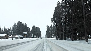
Lincoln is an unincorporated community and census-designated place (CDP) in Lewis and Clark County, Montana, United States. As of the 2010 census, the population was 1,013.

<span class="mw-page-title-main">Seeley Lake, Montana</span> CDP in Montana, United States

Seeley Lake is a census-designated place (CDP) in Missoula County, Montana, United States. It is part of the 'Missoula, Montana Metropolitan Statistical Area'. The town sits beside the 1,031.5 acres lake Seeley Lake. The population was 1,659 at the 2010 census, an increase from its population of 1,436 in 2000.

<span class="mw-page-title-main">Trout Creek, Montana</span> CDP in Montana, United States

Trout Creek is a census-designated place (CDP) in Sanders County, Montana, United States. The population was 261 at the 2000 census. Population increased to 277 per the United States Census [2020] Trout Creek was proclaimed "Huckleberry Capital of Montana" by the state's legislature in 1981.

<span class="mw-page-title-main">Lake Sumner, New Mexico</span> Census-designated place in De Baca County, New Mexico, United States

Lake Sumner is a census-designated place (CDP) in De Baca County, New Mexico, United States. The population was 143 at the 2010 census, up from the figure of 86 recorded in 2000.

<span class="mw-page-title-main">Daniel, Wyoming</span> CDP in Wyoming, United States

Daniel is a census-designated place in Sublette County, Wyoming, United States. The population was 150 at the 2010 census.

<span class="mw-page-title-main">Glenbrook, Nevada</span> Census-designated place in Nevada, United States

Glenbrook is a census-designated place (CDP) on the east shore of Lake Tahoe in Douglas County, Nevada, United States. The population was 215 at the 2010 census. Beach and Bay are for residents and renters living in Glenbrook's gated community. There is no public access to the beach or bay.

Rader Creek is a census-designated place (CDP) in Jefferson County, Montana, United States. The population was 363 at the 2010 census.

Potomac is an unincorporated community and census-designated place (CDP) in Missoula County, Montana, United States. It is in the southeastern part of the county, in the valley of Camas Creek and Union Creek, which flows northwest to the Blackfoot River, part of the Clark Fork watershed.