The University of Auckland is a public research university based in Auckland, New Zealand. The institution was established in 1883 as a constituent college of the University of New Zealand. Initially located in a repurposed courthouse, the university has grown substantially over the years. As of 2024, it stands as the largest university in New Zealand by enrolment, teaching approximately 43,000 students across three major campuses in central Auckland.

Karangahape Road is one of the main streets in the central business district (CBD) of Auckland, New Zealand. The massive expansion of motorways through the nearby inner city area – and subsequent flight of residents and retail into the suburbs from the 1960s onwards – turned it from one of Auckland's premier shopping streets into a marginal area with the reputation of a red-light district. Now considered to be one of the cultural centres of Auckland, since the 1980s–1990s it has been undergoing a slow process of gentrification, and is now known for off-beat cafes and boutique shops.

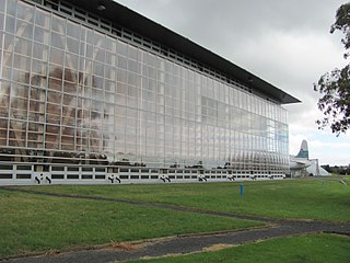
The Museum of Transport and Technology (MOTAT) is a transport and technology museum located in Western Springs, Auckland, New Zealand. It is located close to the Western Springs Stadium, Auckland Zoo and the Western Springs Park. The museum has large collections of civilian and military aircraft and other land transport vehicles. An ongoing programme is in place to restore and conserve items in the collections. This work is largely managed by volunteers but, since the passing of the Museum of Transport and Technology Act in 2000, has been supported by full-time professional museum staff. New public programmes and facilities now promote the collections.

Eden Terrace is an inner city suburb of Auckland, located 2 km south of the Auckland CBD, in the North Island of New Zealand. Eden Terrace is one of Auckland's oldest suburbs, and also one of the smallest; at just 47 hectares only Newton is smaller.

Newton is a small suburb of Auckland, New Zealand, under the local governance of the Auckland Council. It had a population of 1,641 in the 2013 census.

Grafton is a suburb of Auckland, New Zealand. The suburb is named for the Duke of Grafton, a patron of the first Governor of New Zealand, William Hobson, and the grandfather of a subsequent Governor, Robert FitzRoy. Once known as 'Grafton Heights', denoting its history as a well-off suburb in Auckland's earliest decades.

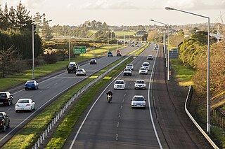
The Central Motorway Junction or CMJ, is the intersection of State Highways 1 and 16, just south of the central business district of Auckland. A multilevel structure, it has been described as a "fiendishly complicated, multi-layered puzzle of concrete, steel and asphalt". Carrying around 200,000 vehicles a day, it is one of the busiest stretches of road in New Zealand.
Transport in Auckland, New Zealand's largest city, is defined by factors that include the shape of the Auckland isthmus, the suburban character of much of the urban area, a history of focusing investment on roading projects rather than public transport, and high car-ownership rates.

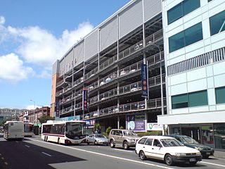
The Central Connector, is a bus route between Britomart Transport Centre in the Auckland CBD, New Zealand, and the commercial suburb of Newmarket. It has some aspects of a bus rapid transit link. It was expected to improve journey times by about 14 minutes for around 2,600 buses per week, about 65,000 passengers daily. Work began in April 2008 and is now finished.

Grafton Bridge is a road bridge spanning Grafton Gully in Auckland, New Zealand. Built of reinforced concrete in 1910, it connects the Auckland CBD and Karangahape Road with Grafton. It spans about 97.6 metres, rises 25.6 metres above the abutments to a height of around 43 metres over the gully. When the bridge was constructed, it contained the largest reinforced concrete arch in the world.

The Auckland Southern Motorway is the major route south out of the Auckland Region of New Zealand. It is part of State Highway 1.

Trams in New Zealand were a major form of transport from the 19th century into the mid-20th century. New Zealand's first (horse) tramway was established in 1862 (Nelson), followed by a steam tramway in 1871 (Thames), and the first electric tramway in 1900. In New Zealand railway terminology a bush tramway is an industrial tramway, which usually did not carry passengers.

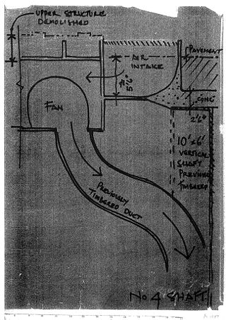
The Albert Park tunnels are found largely beneath Albert Park, in central Auckland, New Zealand. The tunnels were constructed as air raid shelters during the Second World War. At the conclusion of the war they were sealed to prevent vandalism or misuse by the public, and as a protection against carbon dioxide build-up or tunnel collapse.

Symonds Street is a street in Auckland, New Zealand's most populous city. The road runs southwest and uphill from the top of Anzac Avenue, through the City Campus of University of Auckland, over the Northwestern Motorway and Auckland Southern Motorway and to the start of New North Road and Mount Eden Road.

Symonds Street Cemetery is a historic cemetery and park in central Auckland, New Zealand. It is in 5.8 hectares of deciduous forest on the western slope of Grafton Gully, by the corner of Symonds Street and Karangahape Road, and is crossed by the Grafton Bridge. The street is named for William Cornwallis Symonds, a British Army officer prominent in the early colonisation of New Zealand. It has a Historic Place – Category I listing with the New Zealand Historic Places Trust. Maintenance and administration of the cemetery is provided by the Auckland Council.
Between 2015 and 2023, Auckland, New Zealand's largest city, considered introducing light rail lines to replace some of its most heavily used bus routes. Many of these new light rail lines would have reused the routes of Auckland's former tram system. Light rail systems have been proposed in Auckland throughout the late-20th and early 21st centuries following the closure of the tram system in the 1950s.

New Regent Street is a pedestrian mall in Christchurch. Built as a private development in the early 1930s with 40 shops in Spanish Mission architectural style, it is one of the city's major tourist attractions. Providing a number of small shops as a comprehensive development was an advanced idea at the time, and New Regent Street is regarded as a forerunner to modern shopping malls. Due to its coherent architectural character, the buildings in the streets are listed as Category I heritage items by Heritage New Zealand, and in addition, the entire street has a historic area listing. The street was pedestrianised in 1994 in preparation for the introduction of the Christchurch heritage tram, which began operation in February 1995. Damaged in the February 2011 Christchurch earthquake, the street and buildings reopened in April 2013, and the tram returned from November of that year. Following the 2016 Valentine's Day earthquake, five of the buildings that had not been repaired after the previous earthquakes had been cordoned off, which stopped the tram from operating on its original heritage loop until May.

Taylor Square Substation No.6 and Underground Conveniences is a heritage-listed electrical substation and underground public toilets at the intersection of Taylor Square, Oxford, Forbes and Bourke Streets, in the inner city Sydney suburb of Darlinghurst in the City of Sydney local government area of New South Wales, Australia. Both the substation and the underground conveniences were designed by Robert Hargreave Brodrick and built from 1904 to 1907, with Owen Ridge & Sons building the substation and G. D. Getherson the underground public conveniences. The property is owned by City of Sydney. It was added to the New South Wales State Heritage Register on 2 July 2004.

Khyber Pass Road is a street in the Auckland City Centre, New Zealand, connecting Upper Symonds Street to Broadway in Newmarket. The road is intersected by both the Western Line and the Auckland Southern Motorway.

Kāhui St David's is a music and community centre in Khyber Pass Road, Auckland, New Zealand. It is housed in the historic former St David's Presbyterian Church which was built as a memorial church to soldiers. It was also known as the Soldiers' Church or St David's Memorial Church.


