Taconic Crest Trail | |
---|---|
Taconic Crest Trail marker | |
Length | 35 mi (56 km) |
Location | Berkshire County, Massachusetts, Rensselaer County, New York, and Bennington County, Vermont |
Use | Hiking, backpacking, snowshoeing |
Elevation | |
Highest point | Berlin Mountain, New York, 2,818 ft (859 m) |
Lowest point | NY Route 346, North Petersburgh, New York, 500 ft (150 m) |
Hiking details | |
Trail difficulty | Moderately difficult |
Season | easiest mid-May through early October |
Hazards | deer ticks, poison ivy, weather |
The Taconic Crest Trail is a 35 mi (56 km) hiking trail in the Taconic Mountains in the northeastern United States. The trail extends from U.S. Route 20 in Hancock, Massachusetts, less than 1 mi (1.6 km) east of the New York border, north along the ridgecrest of the Taconic Range, first within Massachusetts, then weaving along the border of New York and Massachusetts and New York and Vermont, and ending in Petersburgh, New York, on NY Route 346, near the Vermont border. Much of the route has been conserved as state forest, conservation easement, or forest preserve.
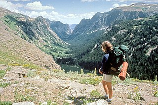
Hiking is the preferred term, in Canada and the United States, for a long, vigorous walk, usually on trails (footpaths), in the countryside, while the word walking is used for shorter, particularly urban walks. On the other hand, in the United Kingdom, and the Republic of Ireland, the word "walking" is acceptable to describe all forms of walking, whether it is a walk in the park or backpacking in the Alps. The word hiking is also often used in the UK, along with rambling, hillwalking, and fell walking. The term bushwalking is endemic to Australia, having been adopted by the Sydney Bush Walkers club in 1927. In New Zealand a long, vigorous walk or hike is called tramping. It is a popular activity with numerous hiking organizations worldwide, and studies suggest that all forms of walking have health benefits.
The Taconic Mountains or Taconic Range are a physiographic section of the larger New England province and part of the Appalachian Mountains, running along the eastern border of New York State and adjacent New England from northwest Connecticut to western Massachusetts, north to central western Vermont. The range includes notable summits such as Mount Equinox and Mount Greylock, the highest point in Massachusetts. Currently local residents, consistent with the prominent 19th century geologist, T. Nelson Dale, consider the Mount Greylock Massif as a subsidiary of the main Taconic Range to the west.
U.S. Highway 20 (US 20) is an east–west United States highway that stretches from the Pacific Northwest all the way to New England. The "0" in its route number indicates that US 20 is a coast-to-coast route. Spanning 3,365 miles (5,415 km), it is the longest road in the United States, and particularly from Newport, Oregon to Boston, Massachusetts, the route is roughly parallel to that of the newer Interstate 90 (I-90), which is in turn the longest Interstate Highway in the U.S. There is a discontinuity in the official designation of US 20 through Yellowstone National Park, with unnumbered roads used to traverse the park.
Forest types on the Taconic Crest Trail are mixed oak-hickory forest and northern hardwood forest with microclimate summit balds, alkaline-loving plant communities, and red spruce/ balsam fir stands on the higher summits. The geology is thrust faulted metamorphic rock over younger sedimentary rock.
The northern hardwood forest is a general type of North American forest ecosystem found over much of southeastern and south central Canada, Ontario and Quebec, extending south into the United States in northern New England, New York, and Pennsylvania, and west along the Great Lakes to Minnesota and western Ontario. Some ecologists consider it a transitional forest because it contains species common to both the oak-hickory forest community to the south and the Boreal forest community to the north. The trees and shrub species of the Northern Hardwood Forest are known for their brilliant fall colors, making the regions that contain this forest type popular fall foliage tourist destinations.
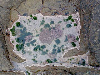
A microclimate is a local set of atmospheric conditions that differ from those in the surrounding areas, often with a slight difference but sometimes with a substantial one. The term may refer to areas as small as a few square meters or square feet or as large as many square kilometers or square miles. Because climate is statistical, which implies spatial and temporal variation of the mean values of the describing parameters, within a region there can occur and persist over time sets of statistically distinct conditions, that is, microclimates. Microclimates can be found in most places.
In the Appalachian Mountains of the eastern United States, balds are mountain summits or crests covered primarily by thick vegetation of native grasses or shrubs occurring in areas where heavy forest growth would be expected.
The Taconic Crest Trail passes through the New York towns of Stephentown, Berlin and Petersburgh; the Massachusetts towns of Hancock and Williamstown; and Pownal, Vermont. It is crossed by New York Route 2, Massachusetts Route 43, the seasonal Pittsfield State Forest Berry Pond Campground access road, and by Lebanon Springs Road in Hancock. The trail is supported by the New York State Department of Environmental Conservation (NYSDEC), the Taconic Hiking Club, the Trust for Public Land, the National Park Service, Williams College, Rensselaer Land Trust, the Massachusetts Department of Conservation and Recreation, and the Williamstown Rural Lands Foundation.
Stephentown is a town in Rensselaer County, New York, United States. The population was 2,903 at the 2010 census. The town, which was originally Jericho Hallow in the Massachusetts Bay Colony, was renamed for Stephen Van Rensselaer. The town is in the southeast corner of the county, and has a sign proclaiming it to be the only Stephentown on Earth.
Berlin is a town in Rensselaer County, New York, United States. The population was 1,880 at the 2010 census. The town is named after Berlin in Germany, although natives pronounce the name differently, with the accent on the first syllable.
Williamstown is a town in Berkshire County, in the northwest corner of Massachusetts, United States. It shares a border with Vermont to the north and New York to the west. It is part of the Pittsfield, Massachusetts Metropolitan Statistical Area. The population was 7,754 at the 2010 census. A college town, it is home to Williams College, the Clark Art Institute and the Tony-awarded Williamstown Theatre Festival, which runs every July and August.
The trail utilizes two distinct ridgelines of the Taconic Mountains. From Route 20 north, the trail passes through Pittsfield State Forest in Massachusetts; features include the highland Cranberry Pond and Twin Ponds, Doll Mountain, Smith Mountain, Tower Mountain, and Berry Pond, 2,150 feet (660 m), reputedly the highest pond in Massachusetts. A state campground is located at Berry Pond.
Pittsfield State Forest is an 11,000-acre (4,500 ha) Massachusetts state forest located in the town of Pittsfield and managed by the Department of Conservation and Recreation. The forest is the location of Berry Pond, which sitting atop Berry Mountain at an elevation of 2,150 feet (660 m) is the highest natural body of water in the state.
Doll Mountain, 1,930 feet (590 m), is a prominent peak in the Taconic Mountains of western Massachusetts. The mountain is located in Pittsfield State Forest. The summit is wooded and trailless, but the multi-use Doll Mountain Trail traverses its northern slopes. The mountain is wooded with northern hardwood tree species.
Tower Mountain, 2,193 feet (668 m), is a prominent peak in the Taconic Mountains of western Massachusetts. The mountain is located in Pittsfield State Forest and is traversed by the 35 mi (56 km) Taconic Crest hiking trail and the 12.1 mi (19.5 km) multi-use Taconic Skyline Trail. The summit is partially open with views to the west; the slopes are wooded with northern hardwood tree species.
From Berry Pond, the trail descends the ridgeline into the village of Hancock, Massachusetts, then ascends the second ridge, which straddles the New York border. Features along this section include Rounds Mountain, Misery Mountain, Berlin Mountain (the trail's high point), Mount Raimer, White Rock, and a crevasse called the Snow Hole where ice has been known to persist year round. The trail utilizes conservation land and easements including the Taconic Ridge State Forest (NYSDEC) and 2,500 acres (10 km2) Hopkins Memorial Forest, owned and managed by Williams College.
Rounds Mountain, 2,257 feet (688 m), is a prominent peak in the Taconic Mountains of western Massachusetts and adjacent New York. The west side of the mountain and summit are located in New York; the east side is located within Massachusetts. The summit a bald; the slopes are wooded with northern hardwood tree species. It is notable for its views of the Hudson River Valley to the west and the Green River and Kinderhook Creek valleys of Hancock, Massachusetts to the east. The 35 mi (56 km) Taconic Crest Trail traverses the mountain. Much of the upper slopes and summit are within protected conservation land.
Misery Mountain, 2,671 feet (814 m), with at least ten well-defined summits, is a prominent 6 mi (9.7 km) long rideline in the Taconic Mountains of western Massachusetts and adjacent New York. The west side of the mountain is located in New York; the east side and high point lie within Massachusetts. The summit ridge is part meadow and part wooded with red spruce, balsam fir, and northern hardwood tree species. It is notable for its views of the Hudson River Valley to the west. The 35 mi (56 km) Taconic Crest Trail traverses the crest of the ridgeline, but does not cross the summit.
Berlin Mountain, 2,818 feet (859 m), is a prominent peak in the Taconic Mountains of western New England and is located adjacent to Massachusetts's border with New York State. It is the highest point in Rensselaer County, and the highest mountain in New York outside the Adirondacks and Catskills. The summit and west side of the mountain are located in New York; the east side lies within Williamstown, Massachusetts. The mountain is a bald, notable for its grassy summit and expansive views of the Hudson River Valley to the west. The 37-mile (60 km) Taconic Crest Trail traverses the mountain. Several other hiking trails approach the summit from the east. Much of the upper slopes and summit are within protected conservation land.
The trail is marked with blue squares containing white blazes throughout its length. All NYSDEC portions of the trail are also posted with blue DEC markers. The trail follows a series of high, open summits and ridgeline overlooking the Hudson River Valley to the west. The entirety of the trail is open to hiking, backpacking, snowshoeing, cross-country skiing, and backcountry skiing, and many sections permit mountain biking, horseback riding and snowmobiling as well. [1] Overnight camping is allowed on the trail; a seasonal campground with facilities is located at Berry Pond.
Backpacking is the outdoor recreation of carrying gear on one's back, while hiking for more than a day. It is often but not always an extended journey, and may or may not involve camping outdoors. In North America tenting is common, where simple shelters and mountain huts widely found in Europe are rare. In New Zealand, tramping is the term applied though overnight huts are frequently used. Hill walking is an equivalent in Britain, though backpackers make use of all kinds of accommodation, in addition to camping. Backpackers use simple huts in South Africa. Similar terms used in other countries are trekking and bushwalking.
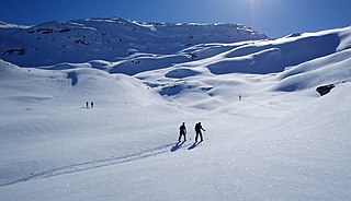
A snowshoe is footwear for walking over snow. Snowshoes work by distributing the weight of the person over a larger area so that the person's foot does not sink completely into the snow, a quality called "flotation". Snowshoeing is a form of hiking.
Cross-country skiing is a form of skiing where skiers rely on their own locomotion to move across snow-covered terrain, rather than using ski lifts or other forms of assistance. Cross-country skiing is widely practiced as a sport and recreational activity; however, some still use it as a means of transportation. Variants of cross-country skiing are adapted to a range of terrain which spans unimproved, sometimes mountainous terrain to groomed courses that are specifically designed for the sport.
The Taconic Crest Trail originally extended 29 miles (47 km) from Berry Pond in Pittsfield State Forest to North Pownal, Vermont. In the late 1990s, the Taconic Skyline Trail in Pittsfield State Forest was separated into two parallel trails: one retained the name "Taconic Skyline" and was designated a motorized recreation trail; the other trail was added on to the southern end of the Taconic Crest Trail, extending it by 6 miles (10 km). To the north, in Vermont, the Taconic Crest Trail once extended into North Pownal, but was closed by request of a property owner; the trail terminus was re-routed north to a newly constructed DEC trailhead at NY Route 346 in North Petersburgh, New York. Not visible from the road, the new trailhead shares a driveway with a private residence and with an old, barred forest road, which are visible; box 25, on the south side of 346, marks the trailhead entrance. It is 0.3 miles (0.48 km) west of the "Entering NY" sign and 0.2 miles (0.32 km) from the railroad tracks. A NYSDEC access trail, marked yellow, still leads down to the former terminus of the trail, at the old Prosser Hollow trailhead.
Taconic State Park is located in Columbia and Dutchess County, New York abutting Massachusetts and Connecticut within the Taconic Mountains. The state park is located off New York State Route 344 south of Interstate 90 and 110 miles (180 km) north of New York City. It features camping, hiking, bicycling, hunting, cross county skiing and other recreational opportunities.
Taconic Trails or Taconic Trail may refer to any or all of three long distance recreational trails and associated networks of shorter trails within the Taconic Mountains of Massachusetts, New York, Connecticut, and Vermont.
The South Taconic Trail is a 15.7 mi (25.3 km) hiking trail in the Taconic Mountains of southwest Massachusetts and adjacent New York. The trail extends from Shagroy Road in Millerton, New York, north along the ridgecrest of the southern Taconic Range and the border of New York and Massachusetts, and ends at the Catamount Ski Area on Massachusetts Route 23 700 feet (210 m) east of the New York border in Egremont, Massachusetts. The Appalachian Trail, which traverses an adjacent ridgeline in the same mountain range, parallels the South Taconic Trail 3 mi (4.8 km) to the east. The trails are connected to one another via shorter trails.
Mount Raimer, 2,572 feet (784 m), is a prominent peak in the Taconic Mountains of western Massachusetts and adjacent New York. The west side and summit are located in New York; the east slopes lie within Massachusetts. The summit ridge is part meadow and part wooded with red spruce, balsam fir, and northern hardwood tree species. It is notable for its views of the Hoosic River valley and Hudson River Valley. The 35 mi (56 km) Taconic Crest Trail traverses the mountain. Much of the upper slopes and summit are within protected conservation land. The mountain is the location of a defunct ski area.
The Taconic Skyline Trail is a 12.1 mi (19.5 km) multi-use trail in the Taconic Mountains of Berkshire County, Massachusetts. The trail extends from U.S. Route 20 in Hancock, Massachusetts, less than 1 mi (1.6 km) east of the New York border, north along the ridgecrest of the Taconic Range within Pittsfield State Forest and officially ending at Brodie Mountain Road on the Hancock/ Lanesborough town line.
White Rock, 2,550 feet (780 m), is the high point on a 7 mi (11 km) ridgeline in the Taconic Mountains. The ridge is located in the tri-state corner of New York, Massachusetts, and Vermont in the towns of Petersburgh, Williamstown, and Pownal. The ridge has several distinct knobs; those with names are, from south to north: White Rocks, 2,365 feet (721 m); Smith Hill, 2,330 feet (710 m); White Rock, the high point 2,550 feet (780 m); and Bald Mountain 2,485 feet (757 m). The Snow Hole, located along the ridgeline between Bald Mountain and the White Rock, is a crevasse in which snow can be found well into the summer.
Pine Mountain, 2,221 feet (677 m), is a prominent peak in the Taconic Mountains of western Massachusetts. The mountain is located in Pittsfield State Forest and is traversed by the Pine Mountain Trail, which connects to the 35 mi (56 km) Taconic Crest hiking trail and the 12.1 mi (19.5 km) multi-use Taconic Skyline Trail.
Berry Mountain, east peak 2,203 feet (671 m) and west peak 2,188 feet (667 m), is a prominent mountain in the Taconic Mountains of western Massachusetts. The mountain is located in Pittsfield State Forest. The west peak is traversed by the 35 mi (56 km) Taconic Crest hiking trail and the east peak is traversed by the 12.1 mi (19.5 km) multi-use Taconic Skyline Trail. The summits are mostly wooded with northern hardwood forest species, but also support a 65-acre (260,000 m2) field of wild azaleas. A microwave tower stands on the east peak. A park loop automobile road and a campground, maintained for summer use, are located just to the north of the summits. Berry Pond, 2,150 feet (660 m), presumed the highest natural pond in the state of Massachusetts, is located on the ridge between Berry Mountain and Berry Hill to the north.
Berry Hill, 2,200 feet (670 m), is a prominent mountain in the Taconic Mountains of western Massachusetts. The mountain is located in Pittsfield State Forest and is traversed by a short spur trail from a park automobile road. The Taconic Crest hiking trail and the multi-use Taconic Skyline Trail are located nearby. The mountain is known for its wild azalea fields. Its slopes are wooded with northern hardwood forest species. A park loop automobile road nearly encircles the summit, and a campground, maintained for summer use, is located just to the south of the summit. Berry Pond, 2,150 feet (660 m), presumed the highest natural pond in the state of Massachusetts, is located on the ridge between Berry Hill and Berry Mountain to the south.
Honwee Mountain, east summit 2,313 feet (705 m) and west summit 2,280 feet (690 m), is a prominent mountain in the Taconic Mountains of western Massachusetts. The mountain is located in Pittsfield State Forest. The east (highest) summit is traversed by the Honwee Circuit multi-use trail. The west summit is crossed by the 35 mi (56 km) Taconic Crest hiking trail and the 12.1 mi (19.5 km) multi-use Taconic Skyline Trail. The mountain is wooded with northern hardwood forest species.
Poppy Mountain, 2,311 feet (704 m), sometimes identified as Pease Ridge, its northwest descending crest, is a prominent peak in the Taconic Mountains of western Massachusetts. The mountain is located in Pittsfield State Forest and is traversed by the 35 mi (56 km) Taconic Crest hiking trail. The overgrown summit is wooded with northern hardwood forest species.
Smith Mountain, 2,170 feet (660 m), is a prominent peak in the Taconic Mountains of western Massachusetts, USA. The mountain is located in Pittsfield State Forest and is traversed by the 12.1 mi (19.5 km) multi-use Taconic Skyline Trail. The summit is known for its extensive stand of wild azalea and is wooded with northern hardwood tree species.
Holy Mount, 1,968 feet (600 m), is a prominent peak in the Taconic Mountains of western Massachusetts, formerly used as the location of religious ceremonies by a nearby Shaker community.
Mountain Meadow Preserve is a 176-acre (71 ha) open space preserve located in the Berkshires and Green Mountains of northwest Massachusetts and adjacent Vermont in the towns of Williamstown and Pownal. The property, acquired in 1998 by the land conservation non-profit organization The Trustees of Reservations, includes highland meadows, wetlands, forested hills, and 4 miles (6.4 km) of trails.