
The General Sánchez Cerro Province is the smallest of three provinces in the Moquegua Region of Peru. The capital of the province is Omate. The province was named after the former Peruvian army officer and president Luis Miguel Sánchez Cerro.

San Juan de Tarucani District is one of 29 districts of the province Arequipa in Peru.

Jichu Qullu is a 5,025-metre-high (16,486 ft) mountain in the Andes of Peru. It is situated in the Moquegua Region, General Sanchez Cerro Province, in the districts Ichuña and Yunga. Jichu Qullu lies southwest of Wankarani and northwest of Machuyuq (Machuyoc) and Pachakutiq.

Qillqata is a mountain in the Andes of Peru, about 5,200 metres (17,060 ft) high. It is located southeast of Lake Salinas in the Arequipa Region, Arequipa Province, Tarucani District, and in the Moquegua Region, General Sánchez Cerro Province, Coalaque District. Some of the highest mountains near Qillqata are Wilani in the northeast, Q'uwa Laki in the southeast and Pachakutiq.
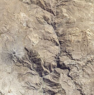
Pirhuane is a 4,994-metre-high (16,385 ft) mountain in the Moquegua Region in the Andes of Peru. It is situated in the General Sánchez Cerro Province, Ubinas District. Pirwani is situated northeast of the active volcano Ubinas. Like the mountains south of Pirhuane, Pacoorcco and Huitoni, Pirhuane lies on the eastern border of the buffer zone of the Salinas and Aguada Blanca National Reservation.
Larama Quta is a 5,098-metre-high (16,726 ft) mountain in the Andes of southern Peru. It is situated in the Moquegua Region, General Sánchez Cerro Province, Ichuña District, northeast of Jukumarini Lake. Larama Quta lies at a river of the same name which originates northeast of the mountain. It flows to the south.
Wallqani is a 5,334-metre-high (17,500 ft) mountain in the Andes of southern Peru. It is located at the border of the Moquegua Region, General Sánchez Cerro Province, Ichuña District, and the Puno Region, Puno Province, Pichacani District. It lies northeast of Jukumarini Lake and the mountains Larama Quta and Jaqhi Jaqhini. The Larama Quta River originates south of the mountain. It flows to the south.
Jaqhi Jaqhini is a 5,055-metre-high (16,585 ft) mountain in the Andes of southern Peru. It is situated in the Moquegua Region, General Sánchez Cerro Province, Ichuña District, northeast of Jukumarini Lake. Jaqhi Jaqhini lies southwest of the mountain Wallqani, northwest of Larama Quta and northeast of Salla Qullu (Sallacollo).
Ch'unch'uni is mountain in the Andes of southern Peru, about 5,000 metres (16,404 ft) high. It is situated in the Moquegua Region, General Sánchez Cerro Province, Ichuña District, northeast of Jukumarini Lake. Jaqhi Jaqhini lies west of the mountain Wallqani and north of Jaqhi Jaqhini.
Janq'u Saxa is a mountain in the Andes of southern Peru, about 4,825 metres (15,830 ft) high. It is located in the Moquegua Region, General Sánchez Cerro Province, Ichuña District, and the Puno Region, Puno Province, Pichacani District, northeast of Jukumarini Lake. Janq'u Saxa lies south of the mountain Wallqani, southwest of Wilaqullu and southeast of Larama Quta. It is situated at the Larama Quta River which originates northwest of the mountain. It is a tributary of Jukumarini Lake.
Chuqipata is a mountain in the Andes of southern Peru, about 5,050 metres (16,568 ft) high. It is situated on the border of the Moquegua Region, General Sánchez Cerro Province, Ichuña District, and the Puno Region, Puno Province, in the districts Pichacani and San Antonio. It lies northwest of the mountain Churi Wiqu, northeast of Millu and southeast of Tankani.
Churi Wiqu is a mountain in the Andes of southern Peru, about 5,000 metres (16,404 ft) high. It is situated on the border of the Moquegua Region, General Sánchez Cerro Province, Ichuña District, and the Puno Region, Puno Province, Pichacani District. It lies southeast of the mountains Tankani and Chuqipata.
Millu is a mountain in the Andes of southern Peru, about 5,225 metres (17,142 ft) high. It is located on the border of the Moquegua Region, General Sánchez Cerro Province, Ichuña District, and the Puno Region, Puno Province, San Antonio District. It lies southwest of the mountain Chuqipata.
Huitoni or Wit'uni is a mountain in the Moquegua Region in the Andes of Peru, about 4,800 metres (15,748 ft) high. It is situated in the General Sánchez Cerro Province, Ubinas District. Huitoni lies northeast of the active volcano Ubinas and southwest of Pirhuane and Pacoorcco.
Pukara is a mountain in the Moquegua Region in the Andes of Peru, about 4,400 metres (14,436 ft) high. It is located in the General Sánchez Cerro Province, Ubinas District. Pukara is situated northeast of the active volcano Ubinas and southwest of Wit'uni. The Para River flows along its western slopes.
Wilani is a mountain in the Andes of Peru, about 5,200 metres (17,060 ft) high. It is located in the Arequipa Region, Arequipa Province, Tarucani District, and in the Moquegua Region, General Sánchez Cerro Province, on the border of the districts Coalaque and Matalaque. Wilani lies southwest of Pukasaya, northwest of Ch'awarani and northeast of Qillqata.
Paqu Paquni is a 5,031-metre-high (16,506 ft) mountain in the Andes of Peru. It is situated in the Moquegua Region, General Sánchez Cerro Province, Chojata District, east of Jukumarini Lake.
Uturunqani is a mountain in the Andes of southern Peru, about 4,800 metres (15,748 ft) high. It is located in the Moquegua Region, General Sánchez Cerro Province, Ichuña District.
Wila Qullu is a 5,020-metre-high (16,470 ft) mountain in the Andes of southern Peru. It is located in the Moquegua Region, General Sánchez Cerro Province, Ichuña District, and the Puno Region, Puno Province, Pichacani District. Wila Qullu lies at the Larama Quta valley, northeast of Larama Quta and Janq'u Saxa and southeast of Wallqani. The river originates northwest of the mountain. It is a tributary of Jukumarini Lake.
Qullpani is a mountain in the Andes of Peru which reaches a height of approximately 4,800 m (15,700 ft). It is located in the Arequipa Region, Arequipa Province, Tarucani District, and in the Moquegua Region, General Sánchez Cerro Province, Matalaque District. Qullpani lies southwest of the Ubinas volcano.


