Taguatinga, Tocantins

Last updated
Taguatinga
Município de Taguatinga
Municipality of Taguatinga
Bandeira de Taguatinga (TO).png
Brasao de Taguatinga (TO).png
Nickname: 
Taguá
Tocantins Municip Taguatinga.svg
Localization of Taguatinga in Tocantins
Brazil location map.svg
Red pog.svg
Taguatinga
Localization of Taguatinga in Brazil
Coordinates: 12°24′22″S46°26′02″W / 12.40611°S 46.43389°W / -12.40611; -46.43389
Country Flag of Brazil.svg  Brazil
Region North Region
State Bandeira do Tocantins.svg Tocantins
FoundedJune 10, 1872
Government
   Mayor Altamirando Zequinha Gonçalves Taguatinga (PV)
(2017-2020)
Area
  Total2.437386 km2 (0.941080 sq mi)
Elevation
634 m (2,080 ft)
Population
 (2020 [1] )
  Total16,825
  Density6.18/km2 (16.0/sq mi)
Demonym Taguatinguense
Time zone UTC−3 (BRT)
Postal Code (CEP)
77320-000
Area code +55 63
Website www.taguatinga.to.gov.br

Taguatinga is a municipality in the state of Tocantins in Brazil. [2] [3] [4] [5]

Contents

History

Climate

Climate data for Taguatinga (1991–2020)
MonthJanFebMarAprMayJunJulAugSepOctNovDecYear
Mean daily maximum °C (°F)31.4
(88.5)
31.2
(88.2)
31.5
(88.7)
32.0
(89.6)
32.2
(90.0)
31.8
(89.2)
31.9
(89.4)
33.3
(91.9)
35.2
(95.4)
34.7
(94.5)
32.1
(89.8)
31.6
(88.9)
32.4
(90.3)
Daily mean °C (°F)25.3
(77.5)
25.1
(77.2)
25.3
(77.5)
25.8
(78.4)
25.7
(78.3)
24.9
(76.8)
24.8
(76.6)
26.2
(79.2)
28.0
(82.4)
28.0
(82.4)
25.9
(78.6)
25.6
(78.1)
25.9
(78.6)
Mean daily minimum °C (°F)21.3
(70.3)
21.1
(70.0)
21.3
(70.3)
21.5
(70.7)
20.9
(69.6)
19.9
(67.8)
19.6
(67.3)
20.7
(69.3)
22.6
(72.7)
22.9
(73.2)
21.7
(71.1)
21.5
(70.7)
21.3
(70.3)
Average precipitation mm (inches)264.1
(10.40)
215.3
(8.48)
270.4
(10.65)
160.1
(6.30)
35.3
(1.39)
1.7
(0.07)
0.3
(0.01)
1.3
(0.05)
17.2
(0.68)
115.8
(4.56)
246.0
(9.69)
237.5
(9.35)
1,565
(61.6)
Average precipitation days (≥ 1.0 mm)161517103000291516103
Average relative humidity (%)75.275.074.376.879.782.583.180.075.471.069.469.876.0
Mean monthly sunshine hours 160.3150.9164.6210.7249.4261.4275.9270.2221.0173.9152.8145.32,436.4
Source: Instituto Nacional de Meteorologia (sun 1981–2010) [6] [7] [8] [9] [10] [11] [12] [13]

See also

Related Research Articles

<span class="mw-page-title-main">Boa Esperança, Espírito Santo</span> Municipality in Southeast, Brazil

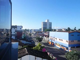
Boa Esperança is a municipality located in the Brazilian state of Espírito Santo. Its population was 15,092 (2020) and its area is 429 km². Its average altitude is 140 meters above sea level.

<span class="mw-page-title-main">São Mateus, Espírito Santo</span> Municipality in Southeast, Brazil

São Mateus is a municipality located in the Brazilian state of Espírito Santo. Its population was estimated at 132,642 in 2020, and its area is 2,346 km². São Mateus is located at 36 meters above sea level.

<span class="mw-page-title-main">Muniz Freire, Espírito Santo</span> Municipality in Brazil

Muniz Freire is a municipality located in the Brazilian state of Espírito Santo. Its population was 17,319 (2020) and its area is 680 km2.

<span class="mw-page-title-main">Arinos</span> Place in Minas Gerais, Brazil

Arinos is a municipality in northern Minas Gerais state in Brazil. Arinos is located east of the Federal District on the Urucuia River, a major tributary of the São Francisco. The city is 333 km from Brasília.

<span class="mw-page-title-main">Alagoinhas</span> Place in Nordeste, Brazil

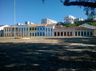
Alagoinhas is a city in the Brazilian state of Bahia. It is located at around 12°8′9″S38°25′8″W. It was founded in 1852. In 1974, the city was made the seat of the Roman Catholic Diocese of Alagoinhas.

<span class="mw-page-title-main">Palmeira dos Índios</span> Municipality in Alagoas, Brazil

Palmeira dos Índios is a municipality located in the western of the Brazilian state of Alagoas. As of 2010, it has a population of around 70,000.

<span class="mw-page-title-main">Codajás</span> Municipality in North, Brazil

Codajás is a municipality located in the Brazilian state of Amazonas. Its population was 29,168 (2020) and its area is 18,712 km2.

<span class="mw-page-title-main">Iguaba Grande</span> Municipality in Southeast, Brazil

Iguaba Grande is a municipality located in the Brazilian state of Rio de Janeiro. Its population was 28,837 (2020) and its area is 54 km².

<span class="mw-page-title-main">Conceição do Mato Dentro</span> Place in Southeast, Brazil

Conceição do Mato Dentro is a Brazilian municipality located in the state of Minas Gerais. The city belongs to the mesoregion Metropolitana de Belo Horizonte and to the microregion of Conceição do Mato Dentro.

<span class="mw-page-title-main">Bom Jesus, Rio Grande do Sul</span> Municipality in Rio Grande do Sul, Brazil

Bom Jesus is a municipality in the state of Rio Grande do Sul, Brazil. Its population was approximately 11,309 in 2020.

<span class="mw-page-title-main">Encruzilhada do Sul</span> Municipality in Rio Grande do Sul, Brazil

Encruzilhada do Sul is a municipality in the state of Rio Grande do Sul, Brazil.

<span class="mw-page-title-main">Juramento</span> Municipality in the north of the Brazilian state of Minas Gerais

Juramento is a municipality in the north of the Brazilian state of Minas Gerais. As of 2020 the population was 4,345 in a total area of 432 km2. It became a municipality in 1953.

<span class="mw-page-title-main">Carbonita</span> Municipality in Minas Gerais, Brazil

Carbonita is a municipality in the northeast of the Brazilian state of Minas Gerais. As of 2020 the population was 9,414 in a total area of 1,454 km2. The elevation of the town center is 751 meters. It is part of the IBGE statistical meso-region of Jequitinhonha and the micro-region of Capelinha. It became a municipality in 1963.

<span class="mw-page-title-main">Cametá</span> Place in Norte, Brazil

Cametá is a Brazilian municipality in the state of Pará.

<span class="mw-page-title-main">Floriano, Piauí</span> Municipality in Northeast, Brazil

Floriano is a Brazilian municipality in the state of Piauí. It was founded by the Arabs and Syrians. It is situated in the physiographic zone of the Médio Parnaíba, on the right side of the Parnaíba River, in front of the city of Barão de Grajaú, in the Maranhão. It is also intersected by the rivers Gurguéia and Itaueira.

Jaguaruana is a municipality in the state of Ceará in the Northeast region of Brazil.

Barra do Corda is a municipality in the state of Maranhão in the Northeast region of Brazil.

<span class="mw-page-title-main">Monte Alegre, Pará</span> Municipality in Northern, Brazil

Monte Alegre, Pará is a municipality in the state of Pará in the Northern region of Brazil. It is located along the Amazon River in northern Brazil.

<span class="mw-page-title-main">Matupá</span> Municipality in Center-West, Brazil

Matupá is a municipality in the state of Mato Grosso in the Central-West Region of Brazil.

<span class="mw-page-title-main">Cristino Castro</span> Municipality in Nordeste, Brazil

Cristino Castro is a municipality in the state of Piauí in the Northeast region of Brazil. A significant production of cacao, latex and bananas takes place in the region.

References

  1. "IBGE 2020" . Retrieved 26 January 2021.
  2. "Divisão Territorial do Brasil" (in Portuguese). Divisão Territorial do Brasil e Limites Territoriais, Instituto Brasileiro de Geografia e Estatística (IBGE). July 1, 2008. Retrieved December 17, 2009.
  3. "Estimativas da população para 1º de julho de 2009" (PDF) (in Portuguese). Estimativas de População, Instituto Brasileiro de Geografia e Estatística (IBGE). August 14, 2009. Retrieved December 17, 2009.
  4. "Ranking decrescente do IDH-M dos municípios do Brasil" (in Portuguese). Atlas do Desenvolvimento Humano, Programa das Nações Unidas para o Desenvolvimento (PNUD). 2000. Retrieved December 17, 2009.
  5. "Produto Interno Bruto dos Municípios 2002-2005" (PDF) (in Portuguese). Instituto Brasileiro de Geografia e Estatística (IBGE). December 19, 2007. Retrieved December 17, 2009.
  6. "Temperatura Máxima Mensal e Anual (°C)". Normais Climatológicas do Brasil 1991-2020 (in Portuguese). Instituto Nacional de Meteorologia. Archived from the original on 24 March 2022. Retrieved 22 May 2024.
  7. "Temperatura Média Compensada Mensal e Anual (°C)". Normais Climatológicas do Brasil 1991-2020 (in Portuguese). Instituto Nacional de Meteorologia. Archived from the original on 24 March 2022. Retrieved 22 May 2024.
  8. "Temperatura Mínima Mensal e Anual (°C)". Normais Climatológicas do Brasil 1991-2020 (in Portuguese). Instituto Nacional de Meteorologia. Archived from the original on 24 March 2022. Retrieved 22 May 2024.
  9. "Precipitação Acumulada Mensal e Anual (mm)". Normais Climatológicas do Brasil 1991-2020 (in Portuguese). Instituto Nacional de Meteorologia. Archived from the original on 24 March 2022. Retrieved 22 May 2024.
  10. "Número de dias no mês ou no ano com precipitação maior ou igual a (1 mm) (dias)". Normais Climatológicas do Brasil 1991-2020 (in Portuguese). Instituto Nacional de Meteorologia. Archived from the original on 24 March 2022. Retrieved 22 May 2024.
  11. "Umidade Relativa do Ar Compensada Mensal e Anual (%)". Normais Climatológicas do Brasil 1991-2020 (in Portuguese). Instituto Nacional de Meteorologia. Archived from the original on 24 March 2022. Retrieved 22 May 2024.
  12. "Insolação Total (horas)". Normais Climatológicas do Brasil 1991-2020 (in Portuguese). Instituto Nacional de Meteorologia. Archived from the original on 24 March 2022. Retrieved 22 May 2024.
  13. "Normais Climatológicas Do Brasil 1981–2010" (in Portuguese). Instituto Nacional de Meteorologia. Retrieved 22 May 2024.