The Brazilian Institute of Geography and Statistics is the agency responsible for official collection of statistical, geographic, cartographic, geodetic and environmental information in Brazil. IBGE performs a decennial national census; questionnaires account for information such as age, household income, literacy, education, occupation and hygiene levels.

Papagaios is a municipality in Minas Gerais, Brazil. Its population was 15,800 in 2020 and its area is 554 square kilometres. Its economy is based on exports of slate.
Wenceslau Braz is a Brazilian municipality in the state of Minas Gerais. As of 2020, its population was estimated to be 2,548.
Governador Archer is a Brazilian municipality in the state of Maranhão. Its population is 10,886 (2020) and its total area is 446 km2.

Esmeraldas is a Brazilian municipality located in the state of Minas Gerais. The city belongs to the mesoregion Metropolitana de Belo Horizonte and to the microregion of Belo Horizonte. In 2020 its population was estimated to be 71,551 inhabitants.

Tombos is a municipality in southeast Minas Gerais state, Brazil. It is located in the Zona da Mata region and its population was approximately 7,850 inhabitants in 2020 (IBGE).

Dores de Campos is a Brazilian municipality. It is about 40 kilometers from São João del Rey at BR-265. About 30% of active people work in its principal factory: Marluvas.
Aracitaba is a Brazilian municipality located in the state of Minas Gerais. Its population as of 2020 is estimated to be 2,059 people living in a total area of 105,885 km². The city belongs to the mesoregion of Zona da Mata and to the microregion of Juiz de Fora.

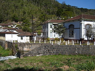
Barroso is a Brazilian municipality located in the south of the state of Minas Gerais. Its population as of 2020 was 20,897 people living in an area of 83 km2 (32 sq mi). The elevation is 920 meters (3,020 ft). The city belongs to the mesoregion of Campo das Vertentes and to the microregion of Barbacena. An important regional center, Barbacena, is located 27 km (17 mi) to the east and is connected by MG-265.
Vista Gaúcha is a municipality in the state of Rio Grande do Sul, Brazil.

Durandé is a Brazilian municipality located in the state of Minas Gerais. The city belongs to the mesoregion of Zona da Mata and to the microregion of Manhuaçu. Districts within the county are St. John Figueira and São José da Figueira.

Guanambi is a municipality in Bahia, Brazil, with an area of 1,272.367 km², and with 84,928 inhabitants in 2020, according to estimates by the IBGE, making it the 20th most populous municipality of Bahia. It was founded in 1919 and Nilo Coelho is its current mayor.

Várzea do Poço is a municipality in the state of Bahia in the North-East region of Brazil. Its population was 9,210 (2020) and its area is 206.5 km².

Xique-Xique is a municipality in the state of Bahia in the North-East region of Brazil. Its estimated population in 2020 was 46,523 inhabitants. It is situated on the right bank of São Francisco River and is a regional economic center. Xique-Xique takes its name from a cactus, Pilosocereus gounellei, common to the region.
Ibitiúra de Minas is a municipality in the state of Minas Gerais in the Southeast region of Brazil.Its estimated population in 2020 was 3,492 inhabitants.
Teixeira Soares is a municipality in the state of Paraná in the Southern Region of Brazil. Its population estimated by the IBGE is 12,567 inhabitants (2020).

Goiabeira is a municipality in the state of Minas Gerais in the Southeast region of Brazil. As of 2020, its estimated population is 3,378.
Pinto Bandeira is a municipality in the state of Rio Grande do Sul, Brazil. Its population was 3,036 (2020) and its area is 105 km2.
Nazária is a municipality in the state of Piauí in the Northeast region of Brazil. Its population is 8,602 (2020) and its area is 363.6 km2.
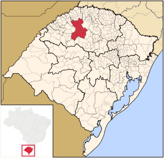
The Microregion of Ijuí was one of the Microregions of the Rio Grande do Sul state, in Brazil. It belonged to the mesoregion of the Noroeste Rio-Grandense. Its population was estimated by the IBGE to be of 183.142 inhabitants in 2005, and it was divided in 15 Municipalities. Its total area was of 5.100,402 km². The IBGE has since discontinued the microregion system for population tracking, replacing it with the term "immediate geographic region".