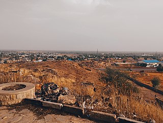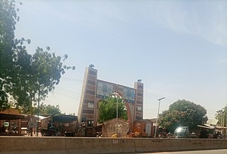
Dutse is the capital city of Jigawa State in northern Nigeria, and also the capital of Dutse Emirate. It is a home to Federal University, Dutse established in November 2011. In addition to the Federal University Dutse, there is also a Research Institute for Date Palm (Sub-Station) and state polytechnic in Dutse. The Jigawa State Polytechnic has its College of Business and Management Studies at Dutse.
Gaya is a Local Government Area in Kano State, Nigeria. Its headquarters are in the town of Gaya in the north of the area.
Danbatta is a Local Government Area in Kano State, Nigeria. It is located about 49 miles north of Kano city at the Northern border of Kano state with Jigawa state. It has headquarters at Danbatta town, located on the A2 highway.
Minjibir is a Local Government Area in Kano State, Nigeria. Its headquarters are in the town of Minjibir, about 20 km northeast of the state capital Kano.

Tsanyawa is a Local Government Area in Kano State, Nigeria. Its headquarters are in the town of Tsanyawa.
Rogo is a Local Government Area in Kano State, Nigeria. Its headquarter is in the town of Rogo.
Kabo is a Local Government Area in Kano State, Nigeria. Its headquarters are in the town of Kabo.
Rimin Gado is a Local Government Area in Kano State, Nigeria. Its headquarters are in the town of Rimin Gado about 20 km west of the state capital Kano.
Kumbotso is a Local Government Area in Kano State, Nigeria. Its headquarters are in the town of Kumbotso. It has an area of 158 km2 and a population of 409,500 based on the 2016 population projection census.
Fagge is a Local Government Area in Kano State, Nigeria, within the state metropolitan. Its headquarters are in the suburb of Waje.
Kano Municipal is a Local Government Area within the Kano Urban Area in Kano State, also known as capital of kano state, Nigeria. Its Secretariat is at Kofar Kudu, in the south of the city of Kano.
Tarauni is a Local Government Area in Kano State, Nigeria. Its Secretariat is in the locality of Unguwa Uku within the city of Kano.

Nassarawa is a Local Government Area in Kano State, Nigeria. Its headquarters are in the locality of Bompai, within the city of Kano.
Madobi is a Local Government Area in Kano State, Nigeria. Its headquarters are in the town of Madobi.
Rano is a Local Government Area and headquarters of Rano Emirate council in Kano State, Nigeria. Rano is a local government area in Kano State with administrative headquarters in the town of Rano. Rano local government area is a Hausa-Fulani community in the southern senatorial district of Kano State otherwise known as Kano South Senatorial District alongside Albasu, Bebeji, Bunkure, Doguwa, Gaya, Kiru, Takai, Ajingi, Rogo, Kibiya, Tudun Wada, Garko, Wudil and Sumaila local government areas. Rano local government area also forms a federal constituency alongside Bunkure and Kibiya local government areas. It has an area of 520 km2 and a population of 145,439 at the 2006 census. The local government area is bounded to the north by Garun Mallam and Bunkure local government areas, to the east by Kibiya local government area, to the south by Tudun Wada local government area, and to the west by Bebeji local government area. The Rano local government council is in charge of public administration in Rano local government area. The council is led by a chairman who is the executive head of the local government. The Rano legislative council make laws governing Rano local government area. It consists of 10 Councillors representing the 10 wards of the local government area.
Sumaila is a historic town and the headquarters of a Local Government Area in Kano State, Nigeria.
Ajingi is a Local Government Area in Kano State, Nigeria. Its headquarters are in the town of Ajingi.
Kiru is a Local Government Area in Kano State, Nigeria. Its headquarters are in the town of Kiru.
Garun Mallam is a Local Government Area in Kano State, Nigeria. Its headquarters are in the town of Garun Mallam on the A2 highway.
Tudun Wada is a local government area in Kano State. The postal code is 710104.


