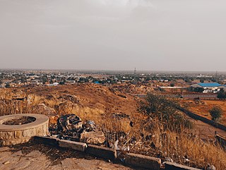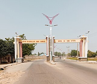
Dutse is the capital city of Jigawa State in northern Nigeria, and also the capital of Dutse Emirate. It is a home to Federal University, Dutse established in November 2011. In addition to the Federal University Dutse, there is also a Research Institute for Date Palm (Sub-Station) and state polytechnic in Dutse. The Jigawa State Polytechnic has its College of Business and Management Studies at Dutse.

Birnin Kudu is a town and a Local Government Area in the south of Jigawa State, Nigeria, some 120 kilometres south-east of Kano. As of 2006 the town of Birnin Kudu had an estimated population of 419,800 and is the most populous local government in the state.
Gwarzo is a Local Government Area in Kano State, Nigeria. Its headquarters are in the town of Gwarzo.
Bebeji is a Local Government Area in Kano State, Nigeria. Its headquarters are in the town of Bebeji.
Ankpa is a Local Government Area in Kogi State, Nigeria. Its headquarters are in the town of Ankpa on the A233 highway in the west of the area at7°22′14″N7°37′31″E.
Demsa is a Local Government Area of Adamawa State, Nigeria with headquarters located in Demsa. Demsa lies on the Benue River.

Ganye is a town and Local Government Area of Adamawa State, Nigeria. Jada and Toungo Local Governments were carved out from Ganye local government area of Adamawa state Nigeria. Ganye is bordered by Jada Local Government Area to the North and East, Toungo Local Government Area to the South and Taraba State to the West. It is the headquarter of the Sama (Chamba) people worldwide.

Gombi is the Local Government Headquarter of Gombi Local Government Area of Adamawa State, Nigeria.
Ringim is a Local Government Area (LGA) of Jigawa State, Nigeria. Its headquarters are in the town of Ringim, the LGA has an area of 1,057 km² and a population of 192,024 at the 2006 census.
Danbatta is a Local Government Area in Kano State, Nigeria. It is located about 49 miles north of Kano city at the Northern border of Kano state with Jigawa state. It has headquarters at Danbatta town, located on the A2 highway.

Gezawa is a Local Government Area in Kano State, Nigeria. Gezawa Local Government Area administrative headquarters is in the town of Gezawa with its area council made up of Jogana, Gawo, Zango, Tumbau, Wangara, Sarain-Gezawa, Babawa, Ketatwa and Tsamiya-Dabba. It has an area of 340 km2 and a population of 282,069 at the 2006 census. Hausa and Fulani ethnic groups make up the majority of the local population. The majority religion practiced in the region is Islam, and the languages spoken there are Fufulde and Hausa.

Bichi is a Local Government Area and a headquarter of Bichi Emirate council in Kano State, Nigeria. Its headquarters are in the town of Bichi on the A9 highway. Bichi was founded by danejawa the white herders under the leadership of Ardo buba the grandfather of Malam danzabuwa
Bagwai is a local government area in Kano State, Nigeria. Its headquarters is in the town of Bagwai.

Dawakin Tofa is a Local Government Area in Kano State, Nigeria. Its headquarters are in the town of Dawakin Tofa and It includes a number of cities and villages, such as Alajawa, Bagari, Bankaura, Dandalama, Jobenkun, Kaleku, Rumi and Yelwa. Hausa and Fulani ethnic divides being the two most notable tribes. The Hausa and Fufulde languages are widely spoken in the region, and Islam is the most commonly practiced religion there. The Dawakin Tofa General Hospital and the Dawakin Tofa Science College are well-known structures in Dawakin Tofa.
Fagge is a Local Government Area in Kano State, Nigeria, within the state metropolitan. Its headquarters are in the suburb of Waje.
Bunkure is a Local Government Area in Kano State, Nigeria. Its headquarters are in the town of Bunkure.
Garko is a Local Government Area in Kano State, Nigeria. Its headquarters are in the town of Garko on the A237 highway.
Ajingi is a Local Government Area in Kano State, Nigeria. Its headquarters are in the town of Ajingi.
Warawa is a Local Government Area in Kano State, Nigeria. Its Secretariat is in the town of Warawa on the A237 highway. It was created out of Dawakin Kudu Local Government in the early 90s.
Garun Mallam is a Local Government Area in Kano State, Nigeria. Its headquarters are in the town of Garun Mallam on the A2 highway.


