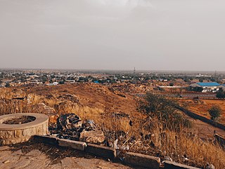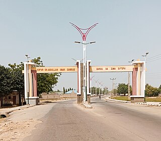
Kano State is one of the 36 states of Nigeria, located in the northern region of the country. According to the national census done in 2006, Kano State is the most populous state in Nigeria. The recent official estimates taken in 2016 by the National Bureau of Statistics found that Kano State was still the largest state by population in Nigeria. Created in 1967 out of the former Northern Region, Kano State borders on Katsina State to the northwest for about 210 km, Jigawa State to the northeast for 355 km, Bauchi State to the southeast for 131 km, and Kaduna State to the southwest for 255 km. The state's capital and largest city is the city of Kano, the second most populous city in Nigeria after Lagos. The incumbent governor of the state is Abba Kabir Yusuf. He was sworn in on 29 May 2023.

Northern Nigeria was an autonomous division within Nigeria, distinctly different from the southern part of the country, with independent customs, foreign relations and security structures. In 1962, it acquired the territory of the British Northern Cameroons, which voted to become a province within Northern Nigeria.

Dutse is the capital city of Jigawa State in northern Nigeria, and also the capital of Dutse Emirate. It is a home to Federal University, Dutse established in November 2011. In addition to the Federal University Dutse, there is also a Research Institute for Date Palm (Sub-Station) and state polytechnic in Dutse. The Jigawa State Polytechnic has its College of Business and Management Studies at Dutse.

Jalingo is the capital city of Taraba State in north-eastern Nigeria, named in fulfulde and has been estimated with population of 418,000 as of 2018, The city has received the highest number of immigrants mainly from, Kano, Borno, Gombe and the neighboring Cameroon. As of November, 2022 the city is estimated to have around 581,000 people.
Gwarzo is a Local Government Area in Kano State, Nigeria. Its headquarters are in the town of Gwarzo.
Bebeji is a Local Government Area in Kano State, Nigeria. Its headquarters are in the town of Bebeji.
Lamurde is a town and Local Government Area of Adamawa State, Nigeria inhabited predominantly by the Bwatiye (Bachama) people.

Kafin Hausa is a Local Government Area of Jigawa State, Nigeria. Its headquarters are in the town of Kafin Hausa.
Maigatari is a border town located in the Sahel along the Niger-Nigeria border. The town is known for its large market founded in 1870 and trading in horses, camels, cattle and other livestock between Niger, Mali, Chad and Cameroon.
Danbatta is a Local Government Area in Kano State, Nigeria. It is located about 49 miles north of Kano city at the Northern border of Kano state with Jigawa state. It has headquarters at Danbatta town, located on the A2 highway.

Gezawa is a Local Government Area in Kano State, Nigeria. Gezawa Local Government Area administrative headquarters is in the town of Gezawa with its area council made up of Jogana, Gawo, Zango, Tumbau, Wangara, Sarain-Gezawa, Babawa, Ketatwa and Tsamiya-Dabba. It has an area of 340 km2 and a population of 282,069 at the 2006 census. Hausa and Fulani ethnic groups make up the majority of the local population. The majority religion practiced in the region is Islam, and the languages spoken there are Fufulde and Hausa.

Bichi is a Local Government Area and a headquarter of Bichi Emirate council in Kano State, Nigeria. Its headquarters are in the town of Bichi on the A9 highway. Bichi was founded by danejawa the white herders under the leadership of Ardo buba the grandfather of Malam danzabuwa

Dawakin Tofa is a Local Government Area in Kano State, Nigeria. Its headquarters are in the town of Dawakin Tofa and It includes a number of cities and villages, such as Alajawa, Bagari, Bankaura, Dandalama, Jobenkun, Kaleku, Rumi and Yelwa. Hausa and Fulani ethnic divides being the two most notable tribes. The Hausa and Fufulde languages are widely spoken in the region, and Islam is the most commonly practiced religion there. The Dawakin Tofa General Hospital and the Dawakin Tofa Science College are well-known structures in Dawakin Tofa.
Fagge is a Local Government Area in Kano State, Nigeria, within the state metropolitan. Its headquarters are in the suburb of Waje.
Rano is a Local Government Area and headquarters of Rano Emirate council in Kano State, Nigeria. Rano is a local government area in Kano State with administrative headquarters in the town of Rano. Rano local government area is a Hausa-Fulani community in the southern senatorial district of Kano State otherwise known as Kano South Senatorial District alongside Albasu, Bebeji, Bunkure, Doguwa, Gaya, Kiru, Takai, Ajingi, Rogo, Kibiya, Tudun Wada, Garko, Wudil and Sumaila local government areas. Rano local government area also forms a federal constituency alongside Bunkure and Kibiya local government areas. It has an area of 520 km2 and a population of 145,439 at the 2006 census. The local government area is bounded to the north by Garun Mallam and Bunkure local government areas, to the east by Kibiya local government area, to the south by Tudun Wada local government area, and to the west by Bebeji local government area. The Rano local government council is in charge of public administration in Rano local government area. The council is led by a chairman who is the executive head of the local government. The Rano legislative council make laws governing Rano local government area. It consists of 10 Councillors representing the 10 wards of the local government area.
Bunkure is a Local Government Area in Kano State, Nigeria. Its headquarters are in the town of Bunkure.
Garko is a Local Government Area in Kano State, Nigeria. Its headquarters are in the town of Garko on the A237 highway.
Dawakin Kudu is a Local Government Area in Kano State, Nigeria. Its headquarters are in the town of Dawakin Kudu.99% of inhabitants are Hausa people.
Garun Mallam is a Local Government Area in Kano State, Nigeria. Its headquarters are in the town of Garun Mallam on the A2 highway.

Potiskum is a local government area and city in Yobe State, Nigeria. It's the largest, most populous and fastest growing city in Yobe State. Of the native languages in Yobe State, Potiskum is home to several major groups which include the Karai-Karai, Bolewa and Ngizim and Hausa-Fulani. It is on the A3 highway at 11°43′N11°04′E. It has an area of 559 square kilometres (216 sq mi).


