
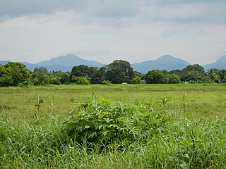
Sibalom Natural Park is a 5,511.47-hectare (13,619.1-acre) protected area in the Philippines on the island of Panay in the municipality of Sibalom, Antique. It was proclaimed a natural park on 23 April 2000. It is considered as one of the last remaining lowland rainforests on Panay.

The Roosevelt Protected Landscape, also known as Roosevelt Park, is a protected area in the Central Luzon region in the Philippines. It occupies an area of 786.04 hectares of grasslands and old-growth forest in northern Bataan province near Olongapo and the Subic Bay Freeport Zone. The park was established as Roosevelt National Park covering an area of 1,485 hectares on 30 March 1933 through Proclamation No. 567 signed by Governor-General Theodore Roosevelt, Jr. In 1965, the national park was reduced to 1,334 hectares. On 23 April 2000, the park was reclassified as a protected landscape area and was further reduced to its present area of 786.04 hectares.

The Magapit Protected Landscape is a protected area of forested limestone hills and grasslands in the Cagayan Valley of northern Luzon island in the Philippines. It covers an area of 3,403.62 hectares in northeastern Cagayan province straddling the municipalities of Lal-lo and Gattaran. The park was established as a game refuge and bird sanctuary on 15 August 1947 covering an initial area of 4,554 hectares declared through Administrative Order No. 10 by President Manuel Roxas. On 23 April 2000, the park was redesignated as a protected landscape area under the National Integrated Protected Areas System Act through Proclamation No. 285 signed by President Joseph Estrada. The park is a component of the Northeastern Cagayan Key Biodiversity Area and also contains the Lal-lo and Gattaran Shell Middens, a proposed World Heritage Site.
The Mounts Palay-Palay–Mataas-na-Gulod Protected Landscape is a 3,973.13-hectare (9,817.8-acre) protected area encompassing the Palay-Palay Mountain Range in southwestern Luzon island near Manila in the Philippines. It was established on 26 October 1976 as a national park and game refuge and bird sanctuary covering an initial area of 4,000 hectares. In 2007, the national park was designated as a protected landscape area under the National Integrated Protected Areas System through Proclamation No. 1315 signed by President Gloria Arroyo. The park is the last remaining lowland rainforest in the province of Cavite and is well known for Mount Pico de Loro, a popular destination for mountaineers and hikers from Metro Manila.
The Casecnan Protected Landscape is a protected area in the Casecnan River watershed of eastern Luzon in the Philippines. It has a total area of 88,846.80 hectares straddling the provinces of Nueva Vizcaya, Quirino and Aurora. The 57,930-hectare (143,100-acre) Casecnan River Watershed Forest Reserve was established in August 1987 by virtue of Executive Order No. 136 issued by President Corazon Aquino. In April 2000, the forest reserve was enlarged to 88,846.80 hectares and was reclassified as a protected landscape area through Proclamation No. 289. It is considered as one of the last remaining substantial water source for the region of Central Luzon.

The Lidlidda Protected Landscape, also known as the Lidlidda–Banayoyo Protected Landscape, is a protected area of natural springs and surrounding mountain forests in Ilocos Sur on the island of Luzon in the Philippines. It is an important watershed providing the agricultural and household water requirements of the communities in the municipalities of Lidlidda and Banayoyo. It was established in 1936 as the Lidlidda Watershed Forest Reserve through Proclamation No. 79 signed by President Manuel Luis Quezon with an initial area of 1,228 hectares. In 2000, under the National Integrated Protected Areas System, it was redesignated as a protected landscape area covering its present size of 1,157.44 hectares.
The Santa Lucia Protected Landscape, also known as the Salcedo Protected Landscape, is a protected area located in the foothills of the Cordillera Central mountain range in the Ilocos Sur province of the Philippines. It protects an important watershed that serves as the water source for the surrounding communities in the municipality of Salcedo. It had an initial area of 174 hectares proclaimed as the Santa Lucia Watershed Forest Reserve in 1938 through Proclamation No. 333 issued by President Manuel Luis Quezon. In 2000, the forest reserve was reestablished as a protected landscape area under the National Integrated Protected Areas System with the signing of Proclamation No. 296 by President Joseph Estrada.
The Mati Protected Landscape is a protected area located in Davao Oriental on the southern Philippine island of Mindanao. It protects the watershed in Mati which is the source of water supply for the city's Mati Waterworks System. The protected area was established in 1967 when 890 hectares of forest in Central Mati was proclaimed as the Mati Watershed Forest Reserve through Proclamation No. 222 issued by President Ferdinand Marcos. Under the National Integrated Protected Areas System, the area was reclassified as a protected landscape with the signing of Proclamation No. 912 in 2005 by President Gloria Arroyo.
The Mimbilisan Protected Landscape is a protected landscape area located in the province of Misamis Oriental in Northern Mindanao in the Philippines. It was established in 1936 to protect the watershed forest surrounding the Mimbilisan Falls in the municipality of Talisayan declared through Proclamation No. 51 by President Manuel Luis Quezon. It had an initial area of 72 hectares and is an important source for Mimbilisan Water System that supplies water to the surrounding communities in eastern Misamis Oriental. In 1999 and again, in 2007, the forest reserve was reestablished as a protected landscape under the National Integrated Protected Areas System with the enactment of Proclamation No. 134 and Republic Act No. 9494. It is one of five declared protected areas of the Philippines in Misamis Oriental.
The Maulawin Spring Protected Landscape is a protected landscape area of forested hills and several rivers and streams located in the province of Quezon on southern Luzon island in the Philippines. It was originally created in 1939 to protect the watershed in the municipality of Guinayangan known as the Maulawin Spring Watershed Forest Reserve declared through Proclamation No. 365 by President Manuel Luis Quezon. It had an initial area of 60 hectares. In 2000, the forest reserve was enlarged and was redesignated as a protected landscape under the National Integrated Protected Areas System by virtue of Proclamation No. 295 issued by President Joseph Estrada. It is the only source of potable water for domestic consumption of the more than 40,000 residents of Guinayangan.

The La Mesa Watershed Reservation is a protected area that preserves the only major watershed in Metro Manila, Philippines. Also known as the Novaliches Watershed, it contains the last remaining rainforest of its size in Metro Manila surrounding the La Mesa Dam and Reservoir, the primary source of potable drinking water for 12 million residents in the Manila metropolitan area. The area is under the joint administration, supervision and control of the Department of Environment and Natural Resources and the Metropolitan Waterworks and Sewerage System. It was established in 2007 through Proclamation No. 1336 issued by President Gloria Arroyo.
The Amro River Protected Landscape is a protected landscape area located in the province of Aurora in eastern Central Luzon in the Philippines. It preserves the primary water source for agricultural, power generation and domestic consumption of the remote northern Auroran communities on the Pacific coast. The area was first established in 1990 as the Amro River Watershed Forest Reserve to protect, maintain and improve the water yield of the Amro River as declared through Proclamation No. 633 by President Corazón Aquino. In 2000, the forest reserve was reclassified as a protected landscape under the National Integrated Protected Areas System with the enactment of Proclamation No. 274 by President Joseph Estrada. It is one of five declared protected areas of the Philippines in Aurora.

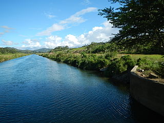
The Dinadiawan River Protected Landscape is a protected area covering the stretch of the Dinadiawan River from its headwaters in the Sierra Madre mountain range to its mouth on the Philippine Sea coast of the village of Dinadiawan in Aurora province, Philippines. The park covers an area of 3,371.332 hectares and includes its surrounding forested mountains, waterfalls and springs in Dipaculao municipality. It is composed of 2,645 hectares of forested area, 323 hectares of grassland, 151 hectares of forested shrubland, 144 hectares of cultivated area, and 108 hectares of the Dinadiawan River. Its forest cover consists primarily of dipterocarp trees like tanguile, mayapis, white lauan, red lauan and bagtikan. It serves as a habitat of wild fauna such as the Philippine deer, Philippine long-tailed macaque, Philippine warty pig, spotted wood kingfisher and pygmy swiftlet.
The Simbahan–Talagas Protected Landscape is a protected area in northern Aurora, Philippines that preserves a major watershed in the Sierra Madre mountain range of Central Luzon. It contains the headwaters of the Simbahan and Talagas rivers, including the Sangay River and Umihiem Creek in Dinalungan municipality which empty into the Casiguran Sound. A large portion of the park is under forest cover, while the remaining areas are cultivated land, shrubland, grassland, built-up area and river-wash area. Some of the park's fauna include the Philippine deer, Philippine long-tailed macaque, and an abundant species of avifauna. Its location in north central Sierra Madre is covered by dipterocarp forest, composed of Shorea almon, Shorea polysperma (tanguile), Shorea squamata (mayapis), Shorea contorta, Shorea negrosensis, and Parashorea malaanonan (bagtikan).

The Sierra Madre a 540 km (340 mi) is the longest mountain range in the Philippines. Through the north–south direction from Santa Ana in the province of Cagayan to the north and Quezon province to the south, the mountains form the eastern backbone of Luzon Island, the largest island of the archipelago. It is bordered by the Pacific Ocean to the east. The Pacific coast of Luzon along the Sierra Madre is less developed as the lofty and continuous mountains form a bold and almost inaccessible shore, exposed to the full force of the northeast monsoon and the waves of the Pacific Ocean. Some of communities east of the mountain range and along the coast are so remote they are only accessible by plane or boat.
The Baganga Protected Landscape, in Mindanao in the Philippines, is one of four protected watershed areas of the province of Davao Oriental. It covers the Upper Baganga River Basin in the Mindanao Pacific Cordillera, the primary source of water for the Baganga Water District. The Baganga River, the main river channel of the municipality of Baganga, flows on a northeastern direction towards the Baganga Bay. The river system includes the Languyon River, Daquit River, Mahanob River, Dapnan River and Kinablang River all emptying into the Philippine Sea. It was established in 1987 as the Baganga Watershed Forest Reserve with an area of 114 hectares. The watershed was declared a protected landscape in 2000.

Mounts Banahaw–San Cristobal Protected Landscape is a protected landscape park in the Calabarzon region of the Philippines, 120 kilometres (75 mi) south of Manila. It is the second largest protected area in Calabarzon, after the Upper Marikina River Basin Protected Landscape, with an area of 10,900.59 hectares. The park is located at the border of Laguna and Quezon provinces and includes the features it is named after: Mount Banahaw and, 7 kilometres (4.3 mi) to its west, Mount San Cristobal.

The Angat Watershed Forest Reserve is a conservation area that protects the drainage basin in the southern Sierra Madre range north of Metro Manila in the Philippines where surface water empties into the Angat River and its tributaries. It is spread over an area of 62,309 hectares in the eastern portion of Bulacan and northern Rizal province at an altitude of between 490 and 1,206 metres. The conservation area also extends to the provinces of Nueva Ecija and Quezon and is centered on an artificial lake created by the Angat Dam which, together with the Ipo Dam located 7.5 kilometres (4.7 mi) downstream, supply 97% of the water requirement of Metro Manila via an aqueduct system to the La Mesa Dam and Reservoir and the Balara Filtration Plant in Quezon City. The Angat Dam and Reservoir is also a major source of hydroelectricity for Metro Manila and surrounding provinces, contributing some 200 megawatts to the Luzon grid. The watershed is a popular birdwatching site and is a biodiversity hotspot containing most of the remaining closed-canopy forests in Central Luzon.

The Pantabangan–Carranglan Watershed Forest Reserve is a conservation area located in the upper reaches of the Pampanga River in Nueva Ecija, Philippines, and borders the Sierra Madre and Caraballo Mountains in Aurora and Nueva Vizcaya. It encompasses 84,500 hectares of the drainage basin surrounding the Pantabangan Lake, an impoundment of the Pampanga River by the Pantabangan Dam. The multi-purpose dam is situated at the confluence of Pampanga River's two headwaters, namely the Pantabangan and Carranglan Rivers in the municipality of Pantabangan. It stretches above the dam site for 21 kilometres (13 mi) to where Carranglan River originates in the Caraballo on the north, and for 18 kilometres (11 mi) to where Pantabangan River originates in the Sierra Madre on the east. It is considered a critical watershed for the agricultural economy and hydroelectric power generation in the region of Central Luzon.

The Pamitinan Protected Landscape is a Philippine protected area of approximately 608 hectares in the Sierra Madre mountain range, just 34 kilometres (21 mi) northeast of Manila. It contains and protects the Montalban Gorge formed by the Marikina River that separates Mount Pamitinan and Mount Binacayan in the municipality of Rodriguez in Rizal. Established in 1996 through Proclamation No. 901 issued by President Fidel Ramos, the park is originally a component of the Mariquina Reserve founded in 1904 to protect the watershed of the Marikina River that supplied water to the city of Manila from the Wawa Dam located just above the Montalban Gorge in the early 1900s.
