
Agusan del Norte, officially the Province of Agusan del Norte, is a province in the Caraga region of the Philippines. Its capital is the city of Cabadbaran with several government offices located in the city of Butuan. It is bordered on the northwest by Butuan Bay; northeast by Surigao del Norte; mid-east by Surigao del Sur; southeast by Agusan del Sur, and southwest by Misamis Oriental.
Agusan del Sur, officially the Province of Agusan del Sur, is a province in Caraga region, Mindanao, Philippines. Its capital is the municipality of Prosperidad. It is bordered on the northwest by Agusan del Norte and Misamis Oriental; east by Surigao del Sur; southeast by Davao Oriental; mid-south by Davao de Oro; southwest by Davao del Norte and, mid-west by Bukidnon. It is the fourth largest province in the country in terms of area.

Surigao del Norte is a province in the Philippines located in the Caraga region of Mindanao. The province was formerly under the jurisdiction of Region 10. Its capital is Surigao City. The province comprises two major islands—Siargao and Bucas Grande—in the Philippine Sea, plus a small area at the northeastern tip of mainland Mindanao and other surrounding minor islands and islets. This mainland portion borders Agusan del Norte – between the Municipality of Alegria, Surigao del Norte and the Municipality of Kitcharao, Agusan del Norte; and Surigao del Sur, to the south.

Surigao del Sur is a province in the Philippines located in the Caraga region in Mindanao. Its capital is Tandag City. Surigao del Sur is situated at the eastern coast of Mindanao and faces the Philippine Sea to the east.

Caraga, officially the Caraga Administrative Region and designated as Region XIII, is an administrative region in the Philippines occupying the northeastern section of Mindanao. The region was created through Republic Act No. 7901 on February 23, 1995. The region comprises five provinces: Agusan del Norte, Agusan del Sur, Dinagat Islands, Surigao del Norte, and Surigao del Sur; six cities: Bayugan, Bislig, Butuan, Cabadbaran, Surigao and Tandag; 67 municipalities and 1,311 barangays. Butuan, the most urbanized city in Caraga, serves as the regional administrative center.
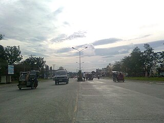
Sibagat, officially the Municipality of Sibagat, is a 1st class municipality in the province of Agusan del Sur, Philippines. According to the 2020 census, it has a population of 33,957 people.
Butuan, officially known as the City of Butuan, is a 1st class highly urbanized city in the region of Caraga, Philippines. It is the de facto capital of the province of Agusan del Norte where it is geographically situated but has an administratively independent government. According to the 2020 census, it has a population of 372,910 people.

Cabadbaran, officially known as the City of Cabadbaran, is a 6th class component city and de jure capital of the province of Agusan del Norte, Philippines. According to the 2020 census, it has a population of 80,354 people.

Las Nieves, officially the Municipality of Las Nieves, is a 2nd class municipality in the province of Agusan del Norte, Philippines. According to the 2020 census, it has a population of 30,240 people.
Bayugan, officially known as the City of Bayugan, is a 5th class component city in the province of Agusan del Sur, Philippines. According to the 2020 census, it has a population of 109,499 people. .
Esperanza, officially the Municipality of Esperanza, is a 1st class municipality in the province of Agusan del Sur, Philippines. According to the 2020 census, it has a population of 59,353 people.

Talacogon, officially the Municipality of Talacogon, is a 2nd class municipality in the province of Agusan del Sur, Philippines. According to the 2020 census, it has a population of 39,678 people.
Caraga Region is located at northeastern part of Mindanao. It includes the five provinces of Dinagat Province, Surigao del Norte, Surigao del Sur, Agusan del Norte and Agusan del Sur. Caraga Region is now hosting several mining projects producing various mineral commodities particularly but not limited to gold, copper, chrome, nickel, iron and limestone for concrete cement production. This makes the Department of Environment and Natural Resources, Mines and Geosciences Bureau, Regional Office No. 13 with Office located in Surigao City plays important role in the region's economy, job generation, social and environmental enhancement and protection and ensuring government shares through royalties and taxes.
The Wawa River is a river located in Caraga, in northeastern Mindanao, in the southern Philippine island. Its headwaters traverse the municipality of Sibagat, Bayugan, and Esperanza. The Wawa River is a tributary of the larger Agusan River.

Pinandagatan Falls is located in a far-flung barangay of New Tubigon, Sibagat, Agusan del Sur in the southern Philippine island of Mindanao. It is one of the tourist attractions of Sibagat, Agusan del Sur.

The Sibagat River is a stream located in Sibagat, Agusan del Sur, Caraga Region, Philippines. It is a tributary of the larger Wawa River with headwaters located in the northeastern mountain boundaries of Sibagat and Butuan City.
Managong Falls is known to be the biggest and tallest waterfalls in the province of Agusan del Sur. Located in barangay Padiay in the municipality of Sibagat, Agusan del Sur, Caraga Region, in the southern Philippine island of Mindanao, is one of the tourist attractions and ecotourism sites of Sibagat.
The Andanan River is a stream located in Sibagat, Agusan del Sur and Bayugan City, Caraga Region, Philippines. It is a tributary of the larger Wawa River.
The Boguko River is a stream located in Sibagat, Agusan del Sur, Caraga Region, Philippines. It is a tributary of the larger Wawa River with headwaters located in the mountain boundaries of Sibagat and the Province of Surigao del Sur.
The Tago River is a stream located in Sibagat, Agusan del Sur, and the municipalities of San Miguel and Tago, Surigao del Sur, Caraga Region, in northeastern Mindanao, in southern Philippines.