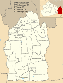
Tandridge is a local government district in east Surrey, England. Its council is based in Oxted, although the largest settlement is Caterham; other notable settlements include Warlingham, Godstone and Lingfield. In mid-2019, the district had an estimated population of 88,129.

East Surrey is a constituency represented in the House of Commons of the UK Parliament since 2019 by Claire Coutinho, a Conservative serving as Secretary of State for Energy Security and Net Zero. The seat covers an affluent area in the English county of Surrey.

Caterham is a town in the Tandridge District of Surrey, England. The town is administratively divided into two: Caterham on the Hill, and Caterham Valley, which includes the main town centre in the middle of a dry valley but rises to equal heights to the south. The town lies close to the A22, 21 miles from Guildford and 6 miles south of Croydon, in an upper valley cleft into the dip slope of the North Downs. Caterham on the Hill is above the valley to the west.
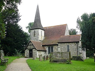
Chaldon is a village and civil parish in the Tandridge District of Surrey, England. The village is situated high on the North Downs, immediately west of Caterham and 15.8 miles (25.4 km) south of Charing Cross, the traditional centre of London.

Coulsdon and Purley Urban District was a local government district in northeast Surrey from 1915 to 1965. The local authority was Coulsdon and Purley Urban District Council. The former area of the district is now mostly part of the London Borough of Croydon in Greater London, with parts in the Tandridge District and the Borough of Reigate and Banstead in Surrey.

Penge was a civil parish and a local government district located to the southeast of London, England. It included the settlements of Penge, Anerley and part of Crystal Palace. It was part of the London postal district, Metropolitan Police District and, from 1933, the London Passenger Transport Area. In 1965 the urban district was abolished by the London Government Act 1963 and it became part of Greater London, being combined with other districts to form the London Borough of Bromley.

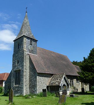
Limpsfield is a village and civil parish in Surrey, England, at the foot of the North Downs close to Oxted railway station and the A25. The composer Frederick Delius and orchestral conductor Sir Thomas Beecham are buried in the village churchyard and there are 89 listed buildings.

Walton and Weybridge Urban District was a local government district in Surrey, England from 1933 to 1974.

Whyteleafe Football Club was an English football club based in Whyteleafe, Surrey. The club was established in 1946 and joined the Athenian League in 1981. The club is an FA Chartered Standard club affiliated to the Surrey County Football Association.

Caterham and Warlingham was an Urban District of Surrey in England until 1974.

Tandridge is a village and civil parish in the Tandridge District, in the county of Surrey, England. Its nucleus is on a rise of the Greensand Ridge between Oxted and Godstone. It includes, towards its middle one named sub-locality (hamlet), Crowhurst Lane End. In 2011 the parish had a population of 663 and the district had a population of 82,998.
Chelsham and Farleigh is a civil parish in the Tandridge District of Surrey, England. The parish is high on the North Downs and centred 14 miles (23 km) south-southeast of central London and it adjoins the Greater London boundary; it is a predominantly rural/wooded parish aside from minority of land used for homes and gardens. Other than the villages of Chelsham and Farleigh, the parish also includes the hamlet of Fickleshole. The parish was created on 1 April 1969 as an amalgamation of its two named small villages.
Horne is a rural village and civil parish in the District of Tandridge in Surrey, England. The parish includes the hamlet of Newchapel, where the British Wildlife Centre is situated. Eastern fields forming a narrow part of the parish are split by the A22 road, a main road to East Grinstead.

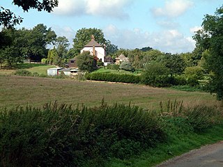
Titsey is a rural village and a civil parish on the North Downs almost wholly within the M25 London Orbital Motorway in the Tandridge District of Surrey, England.
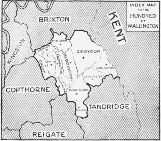
Wallington was an ancient hundred in the northeast of the historic county of Surrey, England. The majority of its area has been absorbed by the growth of London; with its name currently referring to the district of Wallington. Its former area now corresponds to the London Borough of Sutton, the majority of the London Borough of Croydon and parts of the London Borough of Merton as well as parts of the Districts of Epsom and Ewell, Reigate and Banstead and Tandridge in Surrey.
Reigate was a hundred in what is now Surrey, England. It was geographically consonant with the southern two thirds of Borough of Reigate and Banstead together with two parishes in Tandridge and fractions of former parishes in the London Borough of Croydon and Borough of Crawley, West Sussex. Accordingly, it included the medieval-established town of Reigate with its motte castle and land which become the towns of Redhill and Horley.
Godstone Rural District was a rural district in Surrey, England from 1894 to 1974, covering an area in the south-east of the county.
Lingfield Wildlife Area is a 6.3-hectare (16-acre) Local Nature Reserve in Lingfield in Surrey. It is owned by Tandridge District Council and managed by the Lingfield Wildlife Area Committee.
The 2019 Tandridge District Council election took place on 2 May 2019 to elect one third of members to Tandridge District Council in England coinciding with other local elections