Belitung is an island on the east coast of Sumatra, Indonesia in the Java Sea. It covers 4,859 km2 (1,876.1 sq mi), and had a population of 309,097 at the 2020 Census; the official estimate as at mid 2023 was 320,500. Administratively, it forms two regencies within the province of Bangka-Belitung Islands. The island is known for its pepper and for its tin. It was in the possession of the United Kingdom from 1812 until Britain ceded control of the island to the Netherlands in the Anglo-Dutch Treaty of 1824. Its main town is Tanjung Pandan. The United Nations Educational, Scientific and Cultural Organization has declared 17 tourist attractions in the Belitung Geopark as world geoparks.

The Lingga Regency is a group of 600 islands in Indonesia, located south of Singapore and along both sides of the equator, off the eastern coast of Riau Province on Sumatra island. They are due south of the populated Riau Archipelago, known for the industrial island of Batam and the tourist-frequented island of Bintan, although the Lingga Islands themselves are rarely visited due to the infrequent local transportation. The equator goes through the northern tip of Lingga Island, the main island in the archipelago.

Pangkalpinang, colloquially written as Pangkal Pinang, also known as Pin-kong in Hakka, is the capital and largest city of the Bangka Belitung Islands Province in Indonesia. It is located on Bangka Island's east coast, the city is divided into seven districts (kecamatan) and has 42 wards (kelurahan).

Banyumas Regency is an inland regency in the southwestern part of Central Java province in Indonesia. Its capital is the town of Purwokerto, but that town no longer has a central administration and is split over four of the districts within the Regency, with a combined area of 41.65 km2 and a population of 234,467 as of mid-2023. The Regency covers an area of 1,391.15 km2, and had a population of 1,554,527 at the 2010 Census and 1,776,918 at the 2020 Census; the official estimate of the population as of mid-2023 was 1,828,573.

North Jakarta, abbreviated as Jakut, is one of the five administrative cities which form Special Capital Region of Jakarta, Indonesia. North Jakarta is not self-governed and does not have a city council, hence it is not classified as a proper municipality. It contains the entire coastal area within the Jakarta Special Capital Region. North Jakarta, along with South Jakarta is the only two cities in Jakarta to border Banten and West Java. It is also the only city of Jakarta with a coastline and thus not landlocked. North Jakarta, an area at the estuary of Ciliwung river was the main port for the kingdom of Tarumanegara, which later grew to become Jakarta. Many historic sites and artefacts of Jakarta can be found in North Jakarta. Both ports of Tanjung Priok and historic Sunda Kelapa are located in the city. The city, which covers an area of 139.99 km2, had 1,645,659 inhabitants at the 2010 census and 1,778,981 at the 2020 census; the official estimate as at mid 2023 was 1,801,963. It has its administrative centre in Tanjung Priok.

Ende Regency is a regency on the island of Flores, within East Nusa Tenggara Province of Indonesia. The regency covers an area of 2,091.19 km2, and it had a population of 260,605 at the 2010 Census and 270,763 at the 2020 Census; the official estimate as at mid 2023 was 280,328. It is bordered to the west by Nagekeo Regency and to the east by Sikka Regency, while the Flores Sea lies to the north and the Savu Sea to the south.
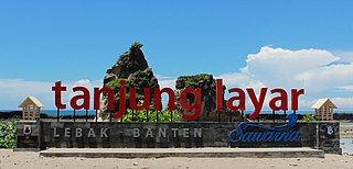
Lebak Regency is a regency of Banten province, Indonesia. It is located on the island of Java. The regency has an area of 3,481.35 km2 and had a population of 1,204,095 at the 2010 census and 1,386,793 at the 2020 census; the official estimate as at mid 2023 was 1,480,593. The town of Rangkasbitung in the north of the regency is the administrative centre. The regency is bordered by the Pandeglang Regency to the west, the Serang Regency to the north, and the Tangerang Regency to the north-east, by the Bogor and Sukabumi regencies to the east, and by the Indian Ocean to the south.

Pandeglang Regency is a regency of Banten province, Indonesia. It is mainly located on the west and south coasts of the island of Java and is the most westerly regency on Java Island, but it also includes several offshore islands such as Panaitan, Peucang, Deli and Tinjil. It is bounded by Serang Regency to the north, Lebak Regency to the east, the Java Sea to the south, and the Sunda Strait to the west. The regency has a land area of 3,053.13 km2, and a population at the 2010 Census of 1,149,610, rising to 1,272,687 at the 2020 Census; the official estimate as of mid-2023 was 1,391,056. The regency seat is the town of Pandeglang in the northeast of the regency, but the most densely-populated district outside of the northeast agglomeration is the town of Labuan on the west coast.

Tanjungbalai, also colloquially written as Tanjung Balai, is a city in North Sumatra province, Indonesia, on the estuary of the Asahan River. It has an area of 60.52 square kilometers (23.37 sq mi) and the sixth largest kota (urban) population in North Sumatra with 154,445 inhabitants in the 2010 census and 176,027 at the 2020 Census; the official estimate as at mid 2023 was 183,170 - comprising 92,715 males and 90,455 females. The town has a ferry terminal with services to Port Klang, Malaysia, and the city-island of Singapore.

Bintan Regency is an administrative area in the Riau Islands Province of Indonesia. Bintan Regency includes all of Bintan Island and also includes many outlying islands including the Tambelan Archipelago and Badas Islands situated between Bintan and West Kalimantan; altogether there are 273 islands comprising the regency.

East Kutai Regency is a regency of East Kalimantan province, Indonesia. It has an area of 31,239.84 km2 and had a population of 253,904 at the 2010 census and 434,459 at the 2020 census; the official estimate as at mid 2023 was 455,504. The town of Sangatta is the capital of the regency.

The Karimun Regency is located in the Riau Islands Province, Indonesia. Besides the central island of Great Karimun, the regency also includes the island of Kundur and over 240 lesser islands. The district covers a land area of 1,339.9 km2 and a sea area of 6,460 km2, and its population was 212,561 at the 2010 census and 253,457 at the 2020 census; the official estimate as at mid 2023 was 270,121.
Manggar is a town in the Indonesian province of Bangka-Belitung, Indonesia which is a port on the east coast of Belitung Island, and is the seat of the East Belitung Regency. The town was founded as a tin mining town in the 19th century.

West Bangka Regency is a regency (kabupaten) of Bangka Belitung Islands Province, Indonesia. It comprises the northwestern part of Bangka Island, together with a number of small islands off its coast. The regency covers an area of 2,820.61 km2 and had a population of 175,110 at the 2010 Census, rising to 204,612 at the 2020 census; the official estimate as at mid 2022 was 209,791 - comprising 108,102 males and 101,689 females. The town of Muntok is its regency seat.

Belitung Regency is a regency (kabupaten) of Bangka Belitung Islands Province, Indonesia, with the town of Tanjungpandan as the regency seat. It formerly covered the whole of Belitung island, but subsequently the eastern districts on the island have been cut out to create a new East Belitung Regency. The regency now covers an area of 2,293.69 km2, and had a population of 156,765 at the 2010 Census and 182,079 at the 2020 Census; the official estimate as at mid 2022 was 186,331.

Rote Ndao Regency is a regency in East Nusa Tenggara province of Indonesia, consisting primarily of the island of Rote, situated south-west of the western tip of West Timor with an area of 978.54 km2, together with minor offshore islands including Usu (19.4 km2), Ndana (13.83 km2), Ndao, Landu and Nuse; the total area including the minor offshore islands is 1,249.35 km2. The regency seat is in the village of Ba'a, which is situated in Lobalain District. The population of the Regency was 119,908 as of the 2010 census and 143,764 at the 2020 Census; the official estimate as at mid 2023 was 150,647.

Sabu Raijua Regency is one of the regencies in the province of East Nusa Tenggara, Indonesia. This regency has an area of 477.40 km2 which includes two main islands in the Sawu Sea, namely Sabu Island and Raijua Island, plus uninhabited Rai Dana Island. Sabu Island is the largest and is the center of government with its capital in West Sabu district, while Raijua Island is smaller and located to the west of Sabu Island. The regency was established by Indonesia's Minister of Home Affairs, Mardiyanto, on 29 October 2008, when it was partitioned from Kupang Regency. The population was 72,960 at the 2010 census, and 89,327 at the 2020 Census; the official estimate as at mid 2023 was 93,323.

Paser Regency is the southernmost regency within the East Kalimantan province of Indonesia. It was created in 26 June 1959 from the northern parts of Kotabaru. It was previously known as Pasir Regency until its renaming on 22 August 2007. Its northeastern districts were split off on 10 April 2002 to form the new Penajam North Paser Regency. The residual regency covers an area of 11,603.94 km2, and it had a population of 230,316 at the 2010 Census and 275,452 at the 2020 Census; the official estimate as at mid-2023 was 303,424. Its administrative centre is the town of Tana Paser.

Penajam North Paser Regency is a regency in the Indonesian province of East Kalimantan. Its administrative centre is the town of Penajam. The area which now forms Penajam North Paser was part of the Paser Regency until its creation as a separate regency on 10 April 2002. It covers an area of 3,455.86 km2 and it had 142,922 inhabitants at the 2010 census and 178,681 at the 2020 census; the official estimate as at mid-2023 was 196,566. Penajam North Paser Regency has the smallest area among the seven regencies in East Kalimantan province.

Meranti Islands is an archipelago, most of which forms a regency (kabupaten) of Riau Province and lies off the eastern coast of the island of Sumatra, Indonesia. It was created on 19 December 2008 by the separating of these large islands from the mainly mainland regency of Bengkalis. The regency comprises the islands of Tebing Tinggi, Rangsang, Padang, and Merbau, together with minor offshore islands, but does not include Bengkalis Island to the north, which is geographically part of the archipelago but remains within Bengkalis Regency. The principal town is Selat Panjang on Tebing Tinggi Island. The regency covers an area of 4,769.53 km2 and had a population of 176,290 at the 2010 Census and 206,116 at the 2020 Census; the official estimate as of mid-2023 was 211,611.


