Related Research Articles
In Greek mythology, the goddess Pandia or Pandeia was a daughter of Zeus and the goddess Selene, the Greek personification of the moon. From the Homeric Hymn to Selene, we have: "Once the Son of Cronos [Zeus] was joined with her [Selene] in love; and she conceived and bare a daughter Pandia, exceeding lovely amongst the deathless gods." An Athenian tradition perhaps made Pandia the wife of Antiochus, the eponymous hero of Antiochis, one of the ten Athenian tribes (phylai).

Mazandaran province is one of the 31 provinces of Iran. Its capital is the city of Sari. Located along the southern coast of the Caspian Sea and in the adjacent Central Alborz mountain range, the province is in the central-northern part of the country. Mazandaran, founded in 1937, covers an area of 23,842 km2.

Babol is a city in the Central District of Babol County, Mazandaran province, Iran, serving as capital of both the county and the district. Babol is divided into two metropolitan areas.
The Zygii or Zygians were described by Strabo as a nation to the north of Colchis. He wrote:
And on the sea lies the Asiatic side of the Bosporus, or the Syndic territory. After this latter, one comes to the Achaei and the Zygii and the Heniochi, and also the Cercetae and the Macropogones. And above these are situated the narrow passes of the Phtheirophagi (Phthirophagi); and after the Heniochi the Colchian country, which lies at the foot of the Caucasian, or Moschian, Mountains.
Baltia, Basilia or Abalus is a mythic island in northern Europe mentioned in Greco-Roman geography in the connection of amber.

Mount Tmolus, named after Tmolus, King of Lydia, is in "a mountain range on the south of Sardis, forming the watershed between the basins of the Hermus in the north and the Cayster in the south, and being connected in the east with Mount Messogis." It is situated in Lydia in western Turkey with the ancient Lydian capital Sardis at its foot and Hypaepa on its southern slope. The mountain was "celebrated for its excellent wine-growing slopes. It was equally rich in metals; and the river Pactolus, which had its source in Mount Tmolus, at one time carried from its interior a rich supply of gold." The geography of Tmolus and the contest between Pan and Apollo, associated with the mythical Tmolus, son of Ares, are mentioned in Ovid's Metamorphoses, 11.168.

Chalus is a city in the Central District of Chalus County, Mazandaran province, Iran, serving as capital of both the county and the district.

Seleucis of Syria was a region of the Seleucid Empire located in northern Syria. It was also known as the Syrian Tetrapolis,
on account of its four most important cities, for it had many. These four were, Antioch, Seleuceia in Pieria, Apameia, and Laodiceia. It also comprehended, according to Strabo, four satrapies; and it is clear that he uses the name in a much wider sense than Ptolemy, who places the four cities of the tetrapolis of Strabo's Seleucis in so many separate districts; Antioch in Cassiotis, Apameia in Apamene, Laodiceia in Laodicene, while he only implies, but does not state, that Seleuceia lies in Seleucis."

Serica was one of the easternmost countries of Asia known to the Ancient Greek and Roman geographers. It is generally taken as referring to North China during its Zhou, Qin, and Han dynasties, as it was reached via the overland Silk Road in contrast to the Sinae, who were reached via the maritime routes. A similar distinction was later observed during the Middle Ages between "Cathay" (north) and "Mangi" or "China" (south). The people of Serica were the Seres, whose name was also used for their region. Access to Serica was eased following the Han conquest of the Tarim Basin but largely blocked when the Parthian Empire fell to the Sassanids. Henry Yule summarized the classical geographers:
If we fuse into one the ancient notices of the Seres and their country, omitting anomalous statements and manifest fables, the result will be something like the following:—"The region of the Seres is a vast and populous country, touching on the east the Ocean and the limits of the habitable world, and extending west to Imaus and the confines of Bactria. The people are civilized, mild, just, and frugal, eschewing collisions with their neighbours, and even shy of close intercourse, but not averse to dispose of their own products, of which raw silk is the staple, but which include also silk-stuffs, fine furs, and iron of remarkable quality." That is manifestly a definition of the Chinese.

The Porta Esquilina was a gate in the Servian Wall, of which the Arch of Gallienus is extant today. Tradition dates it back to the 6th century BC, when the Servian Wall was said to have been built by the Roman king Servius Tullius. However modern scholarship and evidence from archaeology indicate a date in the fourth century BC. The archway of the gate was rededicated in 262 as the Arch of Gallienus.
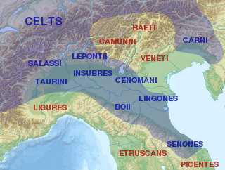
The Cenomani, was an ancient tribe of the Cisalpine Gauls, who occupied the tract north of the Padus, between the Insubres on the west and the Veneti on the east. Their territory appears to have extended from the river Addua to the Athesis.
Milyas was a mountainous country in ancient south-west Anatolia. However, it is generally described as being mostly in the northern part of the successor kingdom of Lycia, as well as southern Pisidia, and part of eastern Phrygia. According to Herodotus, the boundaries of Milyas were never fixed.

The Supsa is a river in the Black Sea basin of Georgia. It has a basin of 1,130 square kilometres (440 sq mi) and flows roughly west for 108 kilometres (67 mi) until it joins the Black Sea near the village Supsa.

The Seleucid–Parthian Wars were a series of conflicts between the Seleucid Empire and the Parthian Empire which resulted in the ultimate expulsion of the Seleucids from the Iranian Plateau and the surrounding regions. The wars were caused by the mass migration of the nomadic Iranian Parni tribe into Parthia and the establishment of the Parthian state, which challenged Seleucid hegemony.
Tymandus or Tymandos also known as Mandos, Mandas Kiri, or Yassi Veran, was a Roman and Byzantine-era city in northern Pisidia. A number of monuments from Roman times remain in the area.
Hexamilium was a Roman and Byzantine-era bishopric possibly centered on Lysimachia, on the Gallipoli Peninsula in modern Turkey.

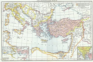
Tapuri or Tapyri were a tribe in the Medes south of the Caspian Sea mentioned by Ptolemy and Arrian. Ctesias refers to the land of Tapuri between the two lands of Cadusii and Hyrcania.
The Abii were possibly an ancient people described by several ancient authors. They were placed by Ptolemy in the extreme north of Scythia extra Imaum, near the Hippophagi ; but there are very different opinions about whether they existed. Strabo discourses on the various opinions respecting the Abii up to his time.
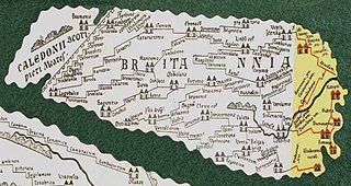
Sitomagus was a town in Roman Britain located in the province Flavia Caesariensis about 30 miles south of Venta Icenorum on the road to Londinium on route IX in the Antonine Itinerary, the location of which in Suffolk or Norfolk is uncertain.

The Oritae or Oreitae were a tribe of the sea-coast of Gedrosia, mentioned by several ancient writers.
References
- ↑ William Smith, LLD (1854). "Dictionary of Greek and Roman Geography, illustrated by numerous engravings on wood". www.perseus.tufts.edu. London: Walton and Maberly, Upper Gower Street and Ivy Lane, Paternoster Row; John Murray, Albemarle Street. Retrieved 2021-02-04.; TAPUREI
- ↑ "Dictionary of Greek and Roman Geography, illustrated by numerous engravings on wood. William Smith, LLD. London. Walton and Maberly, Upper Gower Street and Ivy Lane, Paternoster Row; John Murray, Albemarle Street. 1854. ,TAPU´RI". www.perseus.tufts.edu. Retrieved 2021-02-04.
- ↑ Tapuri. The mountains inland from the coast of Hyrcania are called the “Tapurian mountains” by Arrian, after the people there, settled in the mountains between the Derbices and the Hyrcanii (Str., 11.9.1, 11.11.8). They are spread toward the Caspian Gates and Rhaga in Media (Ptol., 6.2.6).These western Tapuri could have resulted from a tribal division north of the Sarnius/Atrak river—another, perhaps ancestral, group, the Tapurei, is located by Ptolemy (6.14.12) in Scythia. The remainder moved south and east into Margiana (“between the Hyrcani and the Arii,” Str., 11.8.8; Ptol., 6.10.2) along the Ochus/Arius (mod. Tejen/Hari-rud) river into Aria (cf. Polyb., 10.49). The Tapuri on the Caspian could, alternatively, represent a later westward migration along the main east-west highway from Margiana. These Tapuri furnished 1,000 cavalry for the battle of Gaugamela (Curt., 3.2.7), apparently aligned with the Hyrcanii (the “Topeiri,” Arr., An. 3.8.4). Alexander later subdued them (Arr., An. 3.23.1-2; Polyb., 5.44.5; Curt., 6.4.24-25). A separate satrap administered them at the time of Alexander’s arrival, and this official was assigned the Caspian Mardi as well (Arr., An. 3.22.7, 24.3; 4.18.2)., IRANICAONlINE IRAN v. PEOPLES OF IRAN (2) Pre-Islamic
![]() This article incorporates text from a publication now in the public domain : Smith, William, ed. (1854–1857). "Tapuri". Dictionary of Greek and Roman Geography . London: John Murray.
This article incorporates text from a publication now in the public domain : Smith, William, ed. (1854–1857). "Tapuri". Dictionary of Greek and Roman Geography . London: John Murray.
| Peoples |  | |
|---|---|---|
| Culture | ||
| Regions | ||
| Related |
| |
| | This Asian history–related article is a stub. You can help Wikipedia by expanding it. |