Tatrovice | |
|---|---|
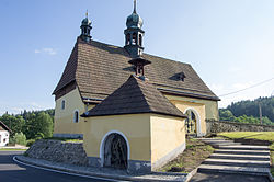 Church of Saint Erhard | |
 Flag  Coat of arms | |
 Tatrovice Location in the Czech Republic | |
| Coordinates: 50°16′37″N12°41′50″E / 50.27694°N 12.69722°E | |
| Country | |
| Region | Karlovy Vary |
| District | Sokolov |
| First mentioned | 1356 |
| Area | |
• Total | 10.13 km2 (3.91 sq mi) |
| Elevation | 564 m (1,850 ft) |
| Population (2025-01-01) [1] | |
• Total | 162 |
| • Density | 16/km2 (41/sq mi) |
| Time zone | UTC+1 (CET) |
| • Summer (DST) | UTC+2 (CEST) |
| Postal code | 357 35 |
| Website | www |
Tatrovice (German : Dotterwies) is a municipality and village in Sokolov District in the Karlovy Vary Region of the Czech Republic. It has about 200 inhabitants.