
The Coos River flows for about 5 miles (8.0 km) into Coos Bay along the Pacific coast of southwest Oregon in the United States. Formed by the confluence of its major tributaries, the South Fork Coos River and the Millicoma River, it drains an important timber-producing region of the Southern Oregon Coast Range. The course of the main stem and the major tributaries is generally westward from the coastal forests to the eastern end of Coos Bay near the city of Coos Bay.
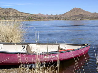
Patagonia Lake State Park is a state park of Arizona, USA, containing Patagonia Lake. The 2.5-mile-long (4.0 km), 250-acre (100 ha) lake located near Patagonia, Arizona, is a popular southern Arizona site for fishing, camping, boat rental, picnicking, hiking, and birding. Located inside the park is the recently established Sonoita Creek State Natural Area, Arizona's first major state natural area. Created by the damming of Sonoita Creek, the lake is habitat for reproducing largemouth bass, black crappie, bluegill, green sunfish, flathead catfish, threadfin shad, redear sunfish, channel catfish, and American bullfrogs. Rainbow trout are stocked every three weeks from October to March. Sonoita Creek contains black bullhead, red shiner, mosquitofish, crayfish, American bullfrogs, largemouth bass, Gila topminnows, speckled dace, longfin dace, Sonora suckers, and desert suckers. Special events include an annual mariachi festival in March and bird tours and interpretive programs on request.

Wappinger Creek is a 41.7-mile-long (67.1 km) creek which runs from Thompson Pond to the Hudson River at New Hamburg in Dutchess County, New York, United States. It is the longest creek in Dutchess County, with the largest watershed in the county.
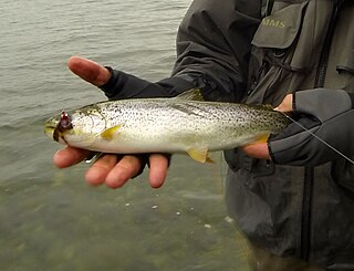
The coastal cutthroat trout also known as the sea-run cutthroat trout, blue-back trout or harvest trout is one of the several subspecies of cutthroat trout found in Western North America. The coastal cutthroat trout occurs in four distinct forms. A semi-anadromous or sea-run form is the most well known. Freshwater forms occur in both large and small rivers and streams and lake environments. The native range of the coastal cutthroat trout extends south from the southern coastline of the Kenai Peninsula in Alaska to the Eel River in Northern California. Coastal cutthroat trout are resident in tributary streams and rivers of the Pacific basin and are rarely found more than 100 miles (160 km) from the ocean.
Triangle Lake is an unincorporated community in Lane County, Oregon, United States. It is about 25 miles (40 km) west of Junction City on Oregon Route 36, on the southwest side of the lake of same name. Lake Creek, a tributary of the Siuslaw River, enters and exits the lake. Triangle Lake is closely linked to the unincorporated community of Blachly, on the northeast side of the lake, and the two communities share the K-12 Triangle Lake School, the only school in Blachly School District. Triangle Lake is served by the Blachly post office and the Pioneer Telephone Cooperative.

Siltcoos Lake (silt’-koos), at 3,164 acres (1,280 ha), is the largest lake on the Oregon Coast of the United States. Fed by runoff from a basin of about 68 square miles (180 km2) in Douglas and Lane counties, it is about 7 miles (11 km) south of Florence and 0.5 miles (1 km) east of U.S. Route 101. Its name comes from a Lower Umpqua (Siuslaw) placename, a variant of which is Tsiltcoos.

Rainbow Lake is a 116-acre manmade lake near the town of Pinetop-Lakeside in southern Navajo County, Arizona, United States. The lake was created in 1903 when Mormon settlers dammed Walnut Creek, a tributary of the Little Colorado River, to impound water for irrigation.

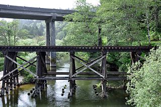
The West Fork Millicoma River is a tributary, about 34 miles (55 km) long, of the Millicoma River in the U.S. state of Oregon. Rising in northeastern Coos County near the Douglas County line, it flows generally southwest through the Elliott State Forest of the Southern Oregon Coast Range to the community of Allegany. There it joins the East Fork Millicoma River to form the Millicoma. In turn, the Millicoma, which is only about 9 miles (14 km) long, joins the South Fork Coos River to form the Coos River. The Coos River, itself only about 5 miles (8 km) long, empties into the eastern end of Coos Bay, which connects to the Pacific Ocean.
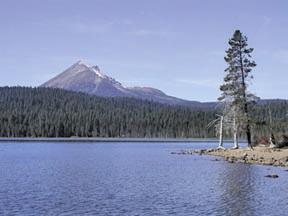
Lake of the Woods is a natural lake near the crest of the Cascade Range in the Fremont–Winema National Forest in southern Oregon in the United States. The lake covers 1,146 acres (4.64 km2). It was named by Oliver C. Applegate in 1870. Today, the Oregon Department of Fish and Wildlife manages the lake's fishery. The small unincorporated community of Lake of the Woods is located on the east shore of the lake. Lake of the Woods is one of southern Oregon's most popular outdoor recreation sites.

Clear Lake is a natural body of water impounded by sand dunes along the Oregon Coast of the Pacific Ocean in the United States. The lake is the municipal water supply for the city of Reedsport, which lies about 4 miles (6 km) northeast of the lake. Clear Lake is closed to public access to protect the purity of the water.

North Tenmile Lake is one of a chain of lakes along the Oregon Coast south of the Umpqua River in the United States. The chain includes Tenmile, Eel, Clear, and smaller lakes, which drain into the Pacific Ocean via Tenmile Creek. The lake is 8 miles (13 km) south of Reedsport and 1 mile (1.6 km) east of U.S. Route 101 near the community of Lakeside. North Tenmile Lake is connected to Tenmile Lake by a navigable 0.5-mile (0.80 km) channel.
Tenmile Creek is the outlet for a chain of lakes ending at Tenmile Lake near Lakeside in Coos County in the U.S. state of Oregon. The creek flows generally west for about 3 miles (5 km) from the lake to the Pacific Ocean. The stream's name stems from its approximate distance from Winchester Bay, the earliest pioneer village along this part of the coast.
Eel Lake is large, deep lake in a chain of water bodies along the Oregon Coast south of the Umpqua River in the United States. The chain includes other large lakes—Clear, North Tenmile, and Tenmile—as well as smaller lakes, which drain into the Pacific Ocean via Tenmile Creek.

Sprague Lake is a lake in Washington, straddling the border of Adams and Lincoln counties. It is two miles west of the town of Sprague. Sprague Lake is drained by Cow Creek, a tributary of the Palouse River. The lake was originally called Lake Colville.

The North Fork Smith River is a 34-mile (55 km) tributary of the Smith River in Douglas County in the U.S. state of Oregon. It begins in the Central Oregon Coast Range near Roman Nose Mountain and flows generally southwest to meet the larger river 16 miles (26 km) from its confluence with the Umpqua River at Reedsport. The entire course of the North Fork lies within the Siuslaw National Forest.
The West Fork Smith River is a tributary, about 10 miles (16 km) long, of the Smith River in Douglas County in the U.S. state of Oregon. It begins in the Central Oregon Coast Range near Roman Nose Mountain and flows generally south to meet the larger river 35 miles (56 km) from its confluence with the Umpqua River near Reedsport. The entire course of the river lies within the Siuslaw National Forest.

Fall Creek is a 34-mile (55 km) tributary of the Middle Fork Willamette River in Lane County in the U.S. state of Oregon. Beginning in the Cascade Range, the creek flows generally west through the Willamette National Forest to enter the Middle Fork upstream of Jasper, southeast of Springfield and Eugene.

Tahkenitch Lake, at 2,118 acres (857 ha), is one of the larger lakes along the coast of the U.S. state of Oregon. Fed by runoff from a basin of about 34 square miles (88 km2), it lies east of U.S. Route 101 in Douglas County between Florence and Reedsport. Its name comes from a Lower Umpqua (Siuslaw) placename meaning "having arms running out like a crab".
Pine Hollow Reservoir is an impoundment of water from Threemile and Pine Hollow creeks on the east flank of the Cascade Range in Wasco County, Oregon, United States. The reservoir, created in the 1960s to provide water for irrigation, lies on private land about 12 miles (19 km) west-northwest of Maupin near the boundary of the Mount Hood National Forest. Public access and fishing are permitted along most of the 3.2-mile (5.1 km) shoreline of the reservoir.


