Lakeside, Oregon

Last updated

Lakeside, Oregon
Lakeside, Oregon.jpg
Looking north on South Eighth Street
Coos County Oregon Incorporated and Unincorporated areas Lakeside Highlighted.svg
Location in Oregon
Coordinates: 43°34′44″N124°10′28″W / 43.57889°N 124.17444°W / 43.57889; -124.17444
Country United States
State Oregon
County Coos
Incorporated 1974
Government
   Mayor James Edwards
Area
[1]
  Total2.29 sq mi (5.93 km2)
  Land2.00 sq mi (5.18 km2)
  Water0.29 sq mi (0.76 km2)
Elevation
23 ft (7 m)
Population
 (2020) [2]
  Total1,904
  Density952.48/sq mi (367.82/km2)
Time zone UTC-8 (Pacific)
  Summer (DST) UTC-7 (Pacific)
ZIP code
97449
Area code 541
FIPS code 41-40650 [3]
GNIS feature ID1144789 [4]

Lakeside is a city in Coos County, Oregon, United States. The population was 1,699 at the 2010 census.

Contents

Geography and climate

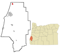
Lakeside is in Coos County, Oregon, along U.S. Route 101, about 1 mile (2 km) inland from the Pacific Ocean. [5] The city is 15 miles (24 km) north of Coos Bay and 197 miles (317 km) southwest of Portland. [6]

Lakeside borders Tenmile Lake and Tenmile Creek, which flows from the lake to the ocean. [5] The city is 23 feet (7.0 m) above sea level. [4] According to the United States Census Bureau, the city has a total area of 2.29 square miles (5.93 km2), of which 2.00 square miles (5.18 km2) is land and 0.29 square miles (0.75 km2) is water. [7]

Climate data for Lakeside, Oregon
MonthJanFebMarAprMayJunJulAugSepOctNovDecYear
Record high °F (°C)70
(21)
78
(26)
76
(24)
86
(30)
94
(34)
95
(35)
94
(34)
104
(40)
95
(35)
95
(35)
70
(21)
67
(19)
104
(40)
Mean daily maximum °F (°C)51
(11)
55
(13)
57
(14)
59
(15)
64
(18)
68
(20)
72
(22)
73
(23)
73
(23)
66
(19)
56
(13)
51
(11)
62
(17)
Mean daily minimum °F (°C)36
(2)
38
(3)
38
(3)
40
(4)
44
(7)
48
(9)
50
(10)
51
(11)
48
(9)
44
(7)
40
(4)
37
(3)
43
(6)
Record low °F (°C)18
(−8)
14
(−10)
18
(−8)
27
(−3)
31
(−1)
34
(1)
39
(4)
36
(2)
34
(1)
28
(−2)
24
(−4)
9
(−13)
9
(−13)
Average precipitation inches (mm)11.71
(297)
9.10
(231)
8.55
(217)
5.44
(138)
3.68
(93)
2.00
(51)
0.62
(16)
0.97
(25)
2.14
(54)
4.97
(126)
10.60
(269)
11.16
(283)
70.94
(1,802)
Average snowfall inches (cm)0.7
(1.8)
0.2
(0.51)
0
(0)
0
(0)
0
(0)
0
(0)
0
(0)
0
(0)
0
(0)
0
(0)
0
(0)
0.3
(0.76)
1.2
(3.0)
Source: [8]

Demographics

2010 census

As of the census of 2010, there were 1,699 people, 806 households, and 489 families residing in the city. The population density was 849.5 inhabitants per square mile (328.0/km2). There were 967 housing units at an average density of 483.5 per square mile (186.7/km2). The racial makeup of the city was 94.4% White, 0.3% African American, 1.5% Native American, 0.2% Asian, 0.9% from other races, and 2.6% from two or more races. Hispanic or Latino of any race were 3.2% of the population. [3]

There were 806 households, of which 14.0% had children under the age of 18 living with them, 49.3% were married couples living together, 6.6% had a female householder with no husband present, 4.8% had a male householder with no wife present, and 39.3% were non-families. 30.1% of all households were made up of individuals, and 15.3% had someone living alone who was 65 years of age or older. The average household size was 2.08 and the average family size was 2.49. [3]

The median age in the city was 57.9 years. 11.9% of residents were under the age of 18; 3.5% were between the ages of 18 and 24; 14.3% were from 25 to 44; 35.5% were from 45 to 64; and 34.7% were 65 years of age or older. The gender makeup of the city was 51.0% male and 49.0% female. [3]

2000 census

Historical population
CensusPop.Note
1910 125
1920 92−26.4%
1940 134
1950 15011.9%
1960 350133.3%
1970 900157.1%
1980 1,45361.4%
1990 1,437−1.1%
2000 1,371−4.6%
2010 1,69923.9%
2020 1,90412.1%
source: [3] [9] [2]

As of the census of 2000, there were 1,371 people, 649 households, and 436 families residing in the city. The population density was 692.7 inhabitants per square mile (267.5/km2). There were 764 housing units at an average density of 386.0 per square mile (149.0/km2). The racial makeup of the city was 93.73% White, 0.15% African American, 1.75% Native American, 0.44% Asian, 0.07% Pacific Islander, 0.95% from other races, and 2.92% from two or more races. Hispanic or Latino of any race were 2.55% of the population. [3]

There were 649 households, out of which 15.9% had children under the age of 18 living with them, 57.6% were married couples living together, 6.8% had a female householder with no husband present, and 32.7% were non-families. 26.8% of all households were made up of individuals, and 13.7% had someone living alone who was 65 years of age or older. The average household size was 2.11 and the average family size was 2.50. [3]

In the city, the population dispersal was 14.6% under the age of 18, 4.3% from 18 to 24, 17.9% from 25 to 44, 33.2% from 45 to 64, and 30.1% who were 65 years of age or older. The median age was 53 years. For every 100 females, there were 98.1 males. For every 100 females age 18 and over, there were 96.1 males. [3]

The median income for a household in the city was $25,781, and the median income for a family was $34,688. Males had a median income of $31,364 versus $20,568 for females. The per capita income for the city was $16,702. About 11.6% of families and 15.2% of the population were below the poverty line, including 25.3% of those under age 18 and 7.9% of those age 65 or over. [3]

Transportation

Related Research Articles

<span class="mw-page-title-main">Douglas County, Oregon</span> County in Oregon, United States

Douglas County is one of the 36 counties in the U.S. state of Oregon. As of the 2020 census, the population was 111,201. The county seat is Roseburg. The county is named after Stephen A. Douglas, an American politician who supported Oregon statehood. Douglas County comprises the Roseburg, OR Micropolitan Statistical Area. In regards to area, Douglas County is the largest county west of the Oregon Cascades.

<span class="mw-page-title-main">Coos County, Oregon</span> County in Oregon, United States

Coos County is one of the 36 counties in the U.S. state of Oregon. As of the 2020 census, the population was 64,929. The county seat is Coquille. The county was formed from the western parts of Umpqua and Jackson counties. It is named after a tribe of Native Americans who live in the region. Coos County comprises the Coos Bay, OR Micropolitan Statistical Area.

<span class="mw-page-title-main">Lakeside, Iowa</span> City in Iowa, United States

Lakeside is a city in Buena Vista County, Iowa, United States. The population was 700 at the time of the 2020 census. It is the most densely populated city in Iowa.

<span class="mw-page-title-main">Bunker Hill, Oregon</span> CDP in Oregon, United States

Bunker Hill is a census-designated place (CDP) in Coos County, Oregon, United States. As of the 2010 census the population was 1,444.

<span class="mw-page-title-main">Coquille, Oregon</span> City in Oregon, United States

Coquille is a city in, and the county seat of, Coos County, Oregon, United States. The population was 4,015 at the 2020 census. The primary economic base is the timber industry. The city derives its name from the Coquille Native American tribe.

<span class="mw-page-title-main">Myrtle Point, Oregon</span> City in Oregon, United States

Myrtle Point is a city in Coos County, Oregon, United States, established in 1887. The population was 2,514 at the 2010 census. Located in the Coquille River Valley, Myrtle Point is part of the Coos Bay/North Bend/Charleston Metropolitan Statistical Area, which consists of all of Coos County.

<span class="mw-page-title-main">Powers, Oregon</span> City in Oregon, United States

Powers is a city in Coos County, Oregon, United States. The population was 689 at the 2010 census.

<span class="mw-page-title-main">Winchester Bay, Oregon</span> Unincorporated community in the state of Oregon, United States

Winchester Bay, formerly Umpqua City, is an unincorporated community in Douglas County, Oregon, United States. For statistical purposes, the United States Census Bureau has defined Winchester Bay as a census-designated place (CDP). The census definition of the area may not precisely correspond to local understanding of the area with the same name. The population of the CDP was 382 at the 2010 census. The community of Umpqua City was established in 1850.

<span class="mw-page-title-main">Winston, Oregon</span> City in Oregon, United States

Winston is a city in Douglas County, Oregon, United States, located 7 miles southwest of Roseburg. The population was 5,379 according to the 2010 United States Census. Winston is probably best-known as the home of Wildlife Safari.

<span class="mw-page-title-main">Butte Falls, Oregon</span> City in Oregon, United States

Butte Falls is a city in Jackson County, Oregon, United States. The population was 423 at the 2010 census. As of July 1, 2018, the city's population was estimated to be 450.

<span class="mw-page-title-main">Central Point, Oregon</span> City in Oregon, United States

Central Point is a city in Jackson County, Oregon, United States. The population was 17,169 as of 2010. The city shares its southern border with Medford and is a part of the Medford metropolitan area. Central Point is home of the Jackson County Fair that occurs in July.

<span class="mw-page-title-main">Culver, Oregon</span> City in Oregon, United States

Culver is a city in Jefferson County, Oregon, United States. The population was 1,357 at the 2010 census.

<span class="mw-page-title-main">Dunes City, Oregon</span> City in Oregon, United States

Dunes City is a city in Lane County, Oregon, United States. The population was 1,303 at the 2010 census.

<span class="mw-page-title-main">Siletz, Oregon</span> City in Oregon, United States

Siletz is a city in Lincoln County, Oregon, United States. The population was 1,212 at the 2010 census. The city is located next to the Siletz Reservation and is the site of the annual Nesika Illahee Pow Wow in August.

<span class="mw-page-title-main">Harrisburg, Oregon</span> City in Oregon, United States

Harrisburg is a city in Linn County, Oregon, United States. The population was 3,567 at the 2010 census.

<span class="mw-page-title-main">Mosier, Oregon</span> City in Oregon, United States

Mosier is a city along the Columbia River in Wasco County, Oregon, United States. The population was 433 at the 2010 census.

<span class="mw-page-title-main">Banks, Oregon</span> City in Oregon, United States

Banks is a city in Washington County, Oregon, United States which is located in the Tualatin Valley. It is the southern anchor to the Banks–Vernonia State Trail, which is a 21-mile (34 km) long linear trail popular with bicyclists, hikers, and equestrians. The population was 1,777 at the 2010 census. The community was named for John and Nancy Banks, who owned a nearby dairy farm. Incorporated in 1921, it is located in the western part of the county where Oregon Route 6 intersects Oregon Route 47.

<span class="mw-page-title-main">West Point, Utah</span> City in Utah, United States

West Point is a city in Davis County, Utah, United States. It is part of the Ogden–Clearfield, Utah Metropolitan Statistical Area. The population was 9,511 at the 2010 census, up from 6,033 in 2000. The estimated population in 2019 was 10,957. The city has experienced quick growth centered primarily around single-family residential construction.

<span class="mw-page-title-main">Sutherlin, Oregon</span> City in Oregon, United States

Sutherlin is a city in Douglas County, Oregon, United States. As of the 2010 Census, the population was 7,810, making it the second most populous city in Douglas County. Located off of I-5, nearby features include Cooper Creek Reservoir, Ford's pond, the Umpqua River, a golf course, and numerous vineyards.

<span class="mw-page-title-main">Barview, Oregon</span> Census-designated place in Oregon, United States

Barview is a census-designated place (CDP) in Coos County, Oregon, United States. The population was 1,844 at the 2010 census.

References

  1. "ArcGIS REST Services Directory". United States Census Bureau. Retrieved October 12, 2022.
  2. 1 2 "Census Population API". United States Census Bureau. Retrieved October 12, 2022.
  3. 1 2 3 4 5 6 7 8 9 "American FactFinder". U.S. Census Bureau. Archived from the original on February 26, 2013. Retrieved August 12, 2013.
  4. 1 2 "Lakeside". Geographic Names Information System. United States Geological Survey. November 28, 1980. Retrieved August 12, 2013.
  5. 1 2 Oregon Atlas & Gazetteer (7th ed.). Yarmouth, Maine: DeLorme. 2008. p. 44. ISBN   978-0-89933-347-2.
  6. "Lakeside Community Profile". Infrastructure Finance Authority. 2009. Retrieved August 12, 2013.
  7. "U.S. Gazetteer: 2010, 2000, and 1990". United States Census Bureau . Retrieved August 12, 2013.
  8. "Zipcode 97499 - Lakeside, Oregon Hardiness Zones". www.plantmaps.com. Retrieved July 31, 2021.
  9. Moffatt, Riley Moore (1996). Population History of Western U.S. Cities and Towns, 1850–1990. Lanham, Maryland: Scarecrow Press. p. 211. ISBN   978-0-8108-3033-2.