Tennessee State Route 201

Last updated

Secondary Tennessee 201.svg

State Route 201

Tennessee State Route 201
SR 201 highlighted in red
Route information
Maintained by TDOT
Length23.0 mi (37.0 km)
ExistedJuly 1, 1983 [1] –present
Major junctions
South endTennessee 22.svg SR 22 near Sardis
Major intersectionsSecondary Tennessee 104.svgSecondary Tennessee 421.svg SR 104  / SR 421 in Sardis
Tennessee 100.svgSecondary Tennessee 114.svg SR 100  / SR 114 in Scotts Hill
North endSecondary Tennessee 202.svg SR 202 near Decaturville
Location
Country United States
State Tennessee
Counties Chester, Henderson, Decatur
Highway system
Secondary Tennessee 200.svg SR 200 Secondary Tennessee 202.svg SR 202

State Route 201 (SR 201) is a 23.0 mile long north-south state highway in West Tennessee.

Contents

Route description

SR 201 begins in Chester County at an intersection with SR 22. [2] It heads southeast through wooded areas to cross into Henderson County and pass through farmland for several miles to enter Sardis, where it has an intersection with SR 421 and has a short concurrency with SR 104. The highway then leaves Sardis and winds its way northeast through a mix of farmland and wooded areas to enter Scotts Hill and come to an intersection with SR 114 in downtown. SR 201 now turns northwest, concurrent with SR 114, to pass through a business district and have an intersection with SR 100. SR 114/SR 201 then leave Scotts Hill and wind their way north through a mix of farmland and wooded areas for several miles before SR 201 splits off goes east. Throughout the entire concurrency with SR 114, SR 201 is unsigned. [3] SR 201 continues east through rural areas before crossing into Decatur County and coming to an end shortly thereafter at an intersection with SR 202, just northwest of Decaturville. [4] The entire route of SR 201 is a two-lane highway. [5]

Major intersections

CountyLocationmikmDestinationsNotes
Chester 0.00.0Tennessee 22.svg SR 22  Milledgeville, Lexington Southern terminus
Henderson Sardis East plate.svg
Secondary Tennessee 104.svg
SR 104 east Saltillo
South plate.svg
Secondary Tennessee 421.svg
SR 421 south (Hinkle Road) Lebanon
Southern end of SR 104 concurrency; northern terminus of SR 421
West plate.svg
Secondary Tennessee 104.svg
SR 104 west Lexington
Northern end of SR 104 concurrency
Scotts Hill South plate.svg
Secondary Tennessee 114.svg
SR 114 south Saltillo
Southern end of SR 114 concurrency; SR 201 becomes unsigned
Tennessee 100.svg SR 100  Henderson, Decaturville
North plate.svg
Secondary Tennessee 114.svg
SR 114 north Chesterfield, Lexington
Northern end of SR 114 concurrency; SR 201 becomes signed
Decatur 23.037.0Secondary Tennessee 202.svg SR 202 (Beacon Road/Middleburg Road) Beacon, Decaturville Northern terminus
1.000 mi = 1.609 km; 1.000 km = 0.621 mi

Related Research Articles

<span class="mw-page-title-main">U.S. Route 412 in Tennessee</span> U.S. Highway in Tennessee

In Tennessee, U.S. Route 412 stretches for 181.93 miles (292.79 km) through the farmland of West Tennessee and the hills of Middle Tennessee, starting at the Missouri state line near Dyersburg and running to an interchange between I-65 and SR 99 in Columbia.

<span class="mw-page-title-main">Tennessee State Route 63</span> Highway in Tennessee

State Route 63 is an east–west state highway in the northern portion of eastern Tennessee. It goes from U.S. Route 27 in Huntsville to SR 33 in Sneedville, running 102 miles (164 km).

<span class="mw-page-title-main">Tennessee State Route 290</span>

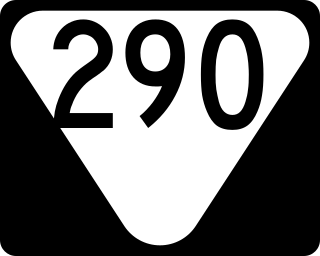
State Route 290 is a 19.7-mile-long (31.7 km) state highway in Jackson and Putnam counties in the U.S. state of Tennessee. It connects SR 53 northeast of Granville to SR 135 in Cookeville via SR 56 and Bloomington Springs.

<span class="mw-page-title-main">Tennessee State Route 297</span>

State Route 297 is a 62.0 mile long east-west secondary state highway in Middle and East Tennessee. It is the primary road in and out of Scott State Forest and Big South Fork National River and Recreation Area, where it is known as Leatherwood Ford Road.

<span class="mw-page-title-main">Tennessee State Route 142</span> Highway in Tennessee

State Route 142 is a 24.59 mile long east-west state highway in West Tennessee.

<span class="mw-page-title-main">Tennessee State Route 104</span>

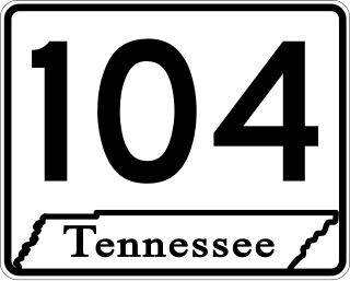
State Route 104 is 114.43 mile long east-west state highway in West Tennessee.

<span class="mw-page-title-main">Tennessee State Route 187</span> State highway in Gibson County, Tenessee

State Route 187 is a 7.8 mile long east-west state highway in Gibson County, Tennessee

<span class="mw-page-title-main">Tennessee State Route 188</span>

State Route 188 is a 22.2-mile-long (35.7 km) north–south state highway in West Tennessee, connecting the towns of Maury City and Alamo with Yorkville via Crockett Mills and Eaton.

<span class="mw-page-title-main">Tennessee State Route 190</span>

State Route 190 is a 55.3 mile long north-south state highway that traverses the farmland of West Tennessee. It connects Trezevant and South Fulton via Pillowville, Gleason, Palmersville, and Latham.

<span class="mw-page-title-main">Tennessee State Route 195</span> Highway in Tennessee

State Route 195 is a 7.6-mile long east-west state highway in Fayette County, Tennessee. It connects Macon with Somerville, as well as providing access to Fayette County Airport.

<span class="mw-page-title-main">Tennessee State Route 202</span>

State Route 202 is 20.5 mile long north-south state highway in Decatur County, Tennessee, connecting Saltillo with Beacon via Decaturville.

<span class="mw-page-title-main">Tennessee State Route 216</span>

State Route 216 is a 17.7 mile long east-west state highway in West Tennessee, connecting Rives with Martin.

<span class="mw-page-title-main">Tennessee State Route 443</span>

State Route 443 is a 12.2-mile-long (19.6 km) east–west state highway in East Tennessee, connecting SR 30 with the communities of New Harmony and Ogden along with other rural areas, which is primarily farmland.

<span class="mw-page-title-main">Tennessee State Route 224</span> State highway in Tennessee, United States

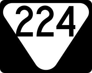
State Route 224 is a 26.6 miles (42.8 km) north-south state highway that is located almost entirely in McNairy County, Tennessee, connecting Michie with Enville via Stantonville and Adamsville.

<span class="mw-page-title-main">Tennessee State Route 226</span>

State Route 226, also known as Airport Road, is a 7.0-mile-long (11.3 km) north–south state highway in Hardin County, Tennessee.

<span class="mw-page-title-main">Tennessee State Route 269</span>

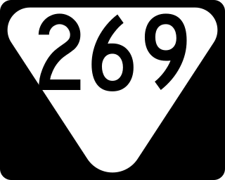
State Route 269 is a 49.2 miles (79.2 km) long east-west state highway in central Middle Tennessee.

<span class="mw-page-title-main">Tennessee State Route 270</span>

State Route 270, also known as Old Columbia Road, is a 9.5 miles (15.3 km) long east-west state highway in Middle Tennessee. It connects Chapel Hill with Unionville and Shelbyville.

<span class="mw-page-title-main">Tennessee State Route 271</span> State highway in Tennessee, United States

State Route 271, also known as Belfast Farmington Road, is a short 6.3 miles (10.1 km) long north-south state highway in Marshall County, Tennessee. It serves as a connection between the communities of Belfast and Farmington.

<span class="mw-page-title-main">Tennessee State Route 273</span>

State Route 273 is a 36.9 miles (59.4 km) long east-west state highway traversing the hills of southern Middle Tennessee.

<span class="mw-page-title-main">Tennessee State Route 421</span>

State Route 421 is a 5.4-mile-long (8.7 km) north-south state highway in Hardin and Henderson counties of eastern West Tennessee. It connects the community of Lebanon with the town of Sardis via Hinkle.

References

  1. "The Road To 100 Years" (PDF). Tennessee Road Builder. Vol. 17, no. 5. September 2014. p. 22. Retrieved April 6, 2019.
  2. https://www.tn.gov/content/dam/tn/tdot/maps/county-maps-(us-shields)/a-g/Chester%20County.pdf [ bare URL PDF ]
  3. https://www.tn.gov/content/dam/tn/tdot/maps/county-maps-(us-shields)/h-m/Henderson%20County.pdf [ bare URL PDF ]
  4. https://www.tn.gov/content/dam/tn/tdot/maps/county-maps-(us-shields)/a-g/Decatur%20County.pdf [ bare URL PDF ]
  5. "TN-201 · Tennessee".