
U.S. Route 411 (US 411) is an alternate parallel-highway associated with US 11. It extends for about 309.7 miles (498.4 km) from US 78 in Leeds, Alabama, to US 25W/US 70 in Newport, Tennessee. US 411 travels through northeastern Alabama, northwestern Georgia, and southeastern Tennessee. It is signed north-south, as with most highways that have odd numbers, but the route runs primarily in a northeast-southwest direction, and covers a more east-west mileage than it does north-south. Notable towns and cities along its route include Gadsden, Alabama; Rome, Georgia; Cartersville, Georgia; Maryville, Tennessee; Sevierville, Tennessee, and Newport, Tennessee.

State Route 42 (SR 42) is a 115.3-mile-long (185.6 km) state highway that runs southeast-to-northwest through portions of Peach, Crawford, Monroe, Butts, Henry, Clayton, and DeKalb counties in the central and north-central parts of the U.S. state of Georgia. The route connects Byron with the Atlanta metropolitan area, via Forsyth, McDonough, and Forest Park.

U.S. Route 11E (US 11E) is a divided highway of US 11 in the U.S. states of Tennessee and Virginia. The United States Numbered Highway, which is complemented by US 11W to the north and west, runs 120.94 miles (194.63 km) from US 11, US 11W, and US 70 in Knoxville, Tennessee, north and east to US 11, US 11W, US 19, and US 421 in Bristol, Virginia. US 11E connects Knoxville and the twin cities of Bristol, Virginia, and Bristol, Tennessee, with the East Tennessee communities of Morristown, Greeneville, and Johnson City. The U.S. Highway runs concurrently with US 70 and US 25W east of Knoxville, US 321 from Greeneville and Johnson City, and both US 19W and US 19 between Johnson City and Bristol. US 11E also has an unsigned concurrency with State Route 34 (SR 34) for almost all of its course in Tennessee.

State Route 154 (SR 154) is a 56.2-mile-long (90.4 km) state highway in the area around Atlanta in the U.S. state of Georgia. It begins in Sharpsburg and ends just to the east of Avondale Estates. The road also runs through portions of Atlanta.
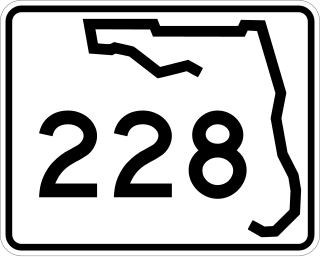
State Road 228 (SR 228) is a 32.532-mile-long (52.355 km) state highway in the northeastern part of the U.S. state of Florida. It exists in two distinct sections, separated by both Baker County Road 228 and Duval CR 228, which are former segments of SR 228.

State Route 22 is a 172.8-mile long (278.1 km) south-to-north state highway in the western part of Tennessee, United States. It begins at the Mississippi state line in McNairy County, where the roadway continues as Mississippi Highway 2. It ends at the Kentucky state line in Lake County, when it crosses into the Kentucky Bend, a detached portion of Fulton County, Kentucky. The monument for the 1862 Battle of Island Number Ten in the American Civil War is located on SR 22, about 3 mi (4.8 km) north of Tiptonville.

State Route 144 (SR 144) is an 83.0-mile-long (133.6 km) state highway that travels in a west-to-east direction through portions of Appling, Tattnall, Long, Liberty, Bryan counties in the east-central of the U.S. state of Georgia. It connects Baxley with southeastern Bryan County.

State Route 39 is a 118-mile-long (190 km) state highway that travels south-to-north through portions of Seminole, Miller, Early, Clay, Quitman, and Stewart counties in the southwestern part of the U.S. state of Georgia. The route proceeds north from its southern terminus along the shore of Lake Seminole in southern Seminole County to a point just southwest of Omaha, where it travels in an easterly direction until it meets its northern terminus, an intersection with US 27/SR 1 in a rural south of the unincorporated community of Louvale.

State Route 44 (SR 44) is a 94.2-mile-long (151.6 km) state highway that runs southwest-to-northeast through portions of Jones, Putnam, Greene, Taliaferro, Wilkes, and Lincoln counties in the central and east-central parts of the U.S. state of Georgia. The route connects Gray with the central portion of Lincoln County, northwest of Lincolnton.

State Route 46 (SR 46) is a 98.7-mile-long (158.8 km) state highway that travels west-to-east through portions of Dodge, Laurens, Wheeler, Treutlen, Emanuel, Candler, and Bulloch counties in the central part of the U.S. state of Georgia. The highway connects the Eastman area with the south-central part of Bulloch County. The highway closely parallels Interstate 16 (I-16) and serves local traffic.

State Route 66 is a state-maintained highway in eastern Tennessee, including a six-lane divided highway known as Winfield Dunn Parkway in Sevier County, a four-lane expressway in Hamblen and Jefferson counties and a two-lane rural collector through mountainous terrain continuing to the northeast terminus in Hancock County.

State Route 160 is a state highway in East Tennessee that has both four-lane expressway and two-lane rural collector sections. It serves as a arterial bypass route of US 11E/SR 34 in the city of Morristown in Hamblen County.

State Route 141 is an east–west highway in Middle Tennessee. The road begins southeast of Westmoreland and ends in Silver Point. The current length is 67.0 mi (107.8 km).
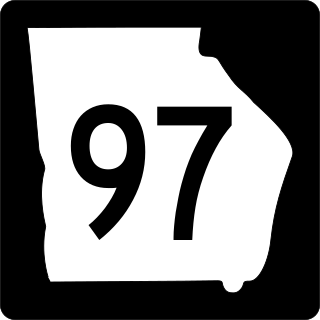
State Route 97 (SR 97) is a 57.2-mile-long (92.1 km) southwest-to-northeast state highway in the southwestern part of the U.S. state of Georgia. The highway's southern terminus is at the Florida state line, southwest of Faceville, where the roadway continues as County Road 269A to US 90 in Florida. Its northern terminus is at SR 37 in Camilla. The highway connects Faceville with Camilla, via Bainbridge, Vada, and Hopeful.

State Route 68 (SR 68) is a 106.89-mile-long (172.02 km) state highway in the eastern part of the U.S. state of Tennessee.

State Route 73 is west-north state highway in East Tennessee. For most of its length, it is an unsigned companion route to U.S. Route 321.

State Route 126 is a 24.6-mile-long (39.6 km) state highway that travels through Sullivan County in East Tennessee. It connects Kingsport and Bristol.

State Route 113 is a north–south state highway in East Tennessee.

State Route 341 is a 10.4-mile-long (16.7 km) state highway that travels within portions of Hamblen and Jefferson counties in the eastern portion of the U.S. state of Tennessee. It connects Talbott with White Pine.

State Route 343 is a state highway in Morristown, Hamblen County in the U.S. state of Tennessee. It serves as connector from US 25E into downtown Morristown.

