Teolocholco | |
|---|---|
 Teolocholco  Teolocholco | |
| Coordinates: 19°15′N98°11′W / 19.250°N 98.183°W | |
| Country | |
| State | Tlaxcala |
| Time zone | UTC-6 (Central) |
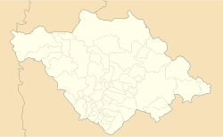
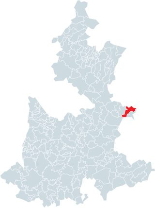
Teolocholco is a town and its surrounding municipality in the Mexican state of Tlaxcala. [1]
Teolocholco | |
|---|---|
| Teolocholco Teolocholco | |
| Coordinates: 19°15′N98°11′W / 19.250°N 98.183°W | |
| Country | |
| State | Tlaxcala |
| Time zone | UTC-6 (Central) |
Teolocholco is a town and its surrounding municipality in the Mexican state of Tlaxcala. [1]
| Climate data for Teolocholco (1951–2010) | |||||||||||||
|---|---|---|---|---|---|---|---|---|---|---|---|---|---|
| Month | Jan | Feb | Mar | Apr | May | Jun | Jul | Aug | Sep | Oct | Nov | Dec | Year |
| Record high °C (°F) | 40.0 (104.0) | 35.0 (95.0) | 32.0 (89.6) | 33.0 (91.4) | 33.0 (91.4) | 35.0 (95.0) | 30.0 (86.0) | 34.5 (94.1) | 30.0 (86.0) | 31.0 (87.8) | 40.0 (104.0) | 40.0 (104.0) | 40.0 (104.0) |
| Mean daily maximum °C (°F) | 22.8 (73.0) | 24.2 (75.6) | 25.6 (78.1) | 27.1 (80.8) | 27.4 (81.3) | 24.8 (76.6) | 23.9 (75.0) | 24.3 (75.7) | 23.6 (74.5) | 23.8 (74.8) | 24.4 (75.9) | 23.7 (74.7) | 24.6 (76.3) |
| Daily mean °C (°F) | 13.1 (55.6) | 14.3 (57.7) | 15.6 (60.1) | 17.1 (62.8) | 18.1 (64.6) | 17.4 (63.3) | 16.7 (62.1) | 16.8 (62.2) | 16.5 (61.7) | 15.7 (60.3) | 14.9 (58.8) | 13.8 (56.8) | 15.8 (60.4) |
| Mean daily minimum °C (°F) | 3.4 (38.1) | 4.5 (40.1) | 5.8 (42.4) | 7.5 (45.5) | 9.2 (48.6) | 10.2 (50.4) | 9.7 (49.5) | 9.4 (48.9) | 9.5 (49.1) | 7.7 (45.9) | 5.6 (42.1) | 3.7 (38.7) | 7.2 (45.0) |
| Record low °C (°F) | −8.5 (16.7) | −3.9 (25.0) | −2.0 (28.4) | 1.0 (33.8) | 3.0 (37.4) | 0.1 (32.2) | 3.0 (37.4) | −9.0 (15.8) | 1.3 (34.3) | −1.0 (30.2) | −3.0 (26.6) | −3.0 (26.6) | −9.0 (15.8) |
| Average precipitation mm (inches) | 11.0 (0.43) | 4.1 (0.16) | 9.4 (0.37) | 30.5 (1.20) | 74.0 (2.91) | 142.0 (5.59) | 171.6 (6.76) | 171.8 (6.76) | 166.8 (6.57) | 70.5 (2.78) | 12.9 (0.51) | 5.4 (0.21) | 870.0 (34.25) |
| Average precipitation days (≥ 0.1 mm) | 1.3 | 0.8 | 1.8 | 5.0 | 10.3 | 15.4 | 16.5 | 16.6 | 15.1 | 7.6 | 1.7 | 0.8 | 92.9 |
| Source: Servicio Meteorologico Nacional [2] [3] | |||||||||||||

Escárcega is a small city in the Mexican state of Campeche, located at 18.62°N 90.74°W in the central part of the state. As of 2010, the city of Escárcega had a population of 29,477.

El Fuerte is a city and El Fuerte Municipality its surrounding municipality in the northwestern Mexican state of Sinaloa. The city population reported in the 2010 census was 12,566 people.
Tepehuanes is a municipality in the Mexican state of Durango. It is located in the North West of Durango at 25°12'"-26°25'"N 105°23'"-106°40'"W, at an elevation of about 1,830 meters (6000 feet).

Apizaco is a city in Apizaco Municipality located near the geographic center of the Mexican state of Tlaxcala, approximately 25 minutes by car from the state's capital city of Tlaxcala. Those seeking to reach the port of Veracruz by railroad from Mexico City must travel through Apizaco. The city began because of its location on this railroad.
Huajicori is both a municipality and the municipal seat of the same in the Mexican state of Nayarit. The population of the municipality was 10,294 in 2000 in a total area of 2,603.5 km2. Its area makes up almost 10% of the state. The population of the town was 2,201 (2005).

Concepción del Oro is one of the 58 municipalities in the Mexican state of Zacatecas. It is located on the northern part of the state and it is bounded by the municipalities of Mazapil and El Salvador; it also lies next to the states of Coahuila and San Luis Potosí. The municipality covers a total surface area of 2,559 square kilometers (988 sq mi).

The municipality of Colotlán is in the northern extremity of the Mexican state of Jalisco. The municipality covers an area of approximately 648 square kilometers. Colotlán is located at 22°12′N103°18′W. It stands at 1,550 metres (5,090 ft) above sea level.

Terrenate is a city, and the surrounding municipality of the same name, in the Mexican state of Tlaxcala. It is situated in the highest part of the state, at 2,680 metres above sea level. "Terrenate" is a Nahuatl name meaning "land the colour of masa".

Tepezalá is a municipality and town in the Mexican state of Aguascalientes. The town of Tepezalá serves as the municipal seat for the surrounding municipality of Tepezalá.
Alcozauca de Guerrero is a municipality in the Mexican state of Guerrero. The municipal seat lies at Alcozauca de Guerrero. The municipality covers an area of 55,160 hectares.

Chiconquiaco is a municipality in the Mexican state of Veracruz. It is located in the Sierra de Chiconquiaco in the middle of the State of Veracruz. It has a surface of 68.27 km2. It is located at 19°45′N96°49′W.

Acatzingo Municipality is a municipality in the Mexican state of Puebla in south-eastern Mexico.

Ahuazotepec Municipality is a municipality in the Mexican state of Puebla in south-eastern Mexico.
Quimixtlán Municipality is a municipality in the Mexican state of Puebla in south-eastern Mexico.
Zongozotla Municipality is a municipality in the Mexican state of Puebla in south-eastern Mexico.
Amaxac de Guerrero is a municipality in the Mexican state of Tlaxcala.
Tocatlán is a town and its surrounding municipality in the Mexican state of Tlaxcala.

Cosio is a municipality and town in the Mexican state of Aguascalientes. It stands at 22°22′N102°18′W. The municipal seat is the town of Cosío. As of 2010, the town of Cosío had a population of 4,898.

Tlaxco is a town and its surrounding municipality in the Mexican state of Tlaxcala.

The geography of the State of Hidalgo refers to the physical geography and human geography of Hidalgo, a state in central Mexico.
Tlaxcala de Xicohténcatl (capital) | ||
| Cities |  | |
| Municipalities | ||
| History | ||
| Sights | ||
| International | |
|---|---|
| National | |
| | This article about a location in the Mexican state of Tlaxcala is a stub. You can help Wikipedia by expanding it. |