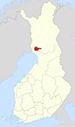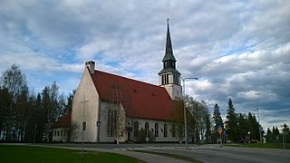
{{lang|sv|Tervola kommun}}"},"settlement_type":{"wt":"Municipality"},"image_skyline":{"wt":"Tervola Church newer.jpg"},"image_caption":{"wt":"Tervola Church"},"image_shield":{"wt":"Tervola.vaakuna.svg"},"shield_size":{"wt":"120x80px"},"image_map":{"wt":"Tervola sijainti Suomi.svg"},"map_caption":{"wt":"Location of Tervola in Finland"},"coordinates":{"wt":"{{coord|66|05|20|N|024|48|40|E|region:FI-10_type:city|display=inline,title}}"},"subdivision_type":{"wt":"Country"},"subdivision_name":{"wt":"{{flag|Finland}}"},"subdivision_type1":{"wt":"[[Regions of Finland|Region]]"},"subdivision_name1":{"wt":"[[Lapland (Finland)|Lapland]]"},"subdivision_type2":{"wt":"[[Sub-regions of Finland|Sub-region]]"},"subdivision_name2":{"wt":"Kemi–Tornio"},"leader_title":{"wt":"Municipal manager"},"leader_name":{"wt":"Mika Simoska"},"area_footnotes":{"wt":"{{Data Finland municipality|area_footnotes|Tervola}}"},"area_total_km2":{"wt":"{{Data Finland municipality|area_total_km2|Tervola}}"},"area_land_km2":{"wt":"{{Data Finland municipality|area_land_km2|Tervola}}"},"area_water_km2":{"wt":"{{Data Finland municipality|area_water_km2|Tervola}}"},"area_rank":{"wt":"{{Data Finland municipality|area_rank|Tervola}}"},"population_as_of":{"wt":"{{Data Finland municipality|population_as_of|Tervola}}"},"population_footnotes":{"wt":"{{Data Finland municipality|population_footnotes|Tervola}}"},"population_total":{"wt":"{{Data Finland municipality|population_total|Tervola}}"},"population_density_km2":{"wt":"{{Data Finland municipality|population_density_km2|Tervola}}"},"population_rank":{"wt":"{{Data Finland municipality|population_rank|Tervola}}"},"demographics_type1":{"wt":"{{Data Finland municipality|demographics_type1|Tervola}}"},"demographics1_footnotes":{"wt":"{{Data Finland municipality|demographics1_footnotes|Tervola}}"},"demographics1_title1":{"wt":"{{Data Finland municipality|demographics1_title1|Tervola}}"},"demographics1_info1":{"wt":"{{Data Finland municipality|demographics1_info1|Tervola}}"},"demographics1_title2":{"wt":"{{Data Finland municipality|demographics1_title2|Tervola}}"},"demographics1_info2":{"wt":"{{Data Finland municipality|demographics1_info2|Tervola}}"},"demographics1_title3":{"wt":"{{Data Finland municipality|demographics1_title3|Tervola}}"},"demographics1_info3":{"wt":"{{Data Finland municipality|demographics1_info3|Tervola}}"},"demographics1_title4":{"wt":"{{Data Finland municipality|demographics1_title4|Tervola}}"},"demographics1_info4":{"wt":"{{Data Finland municipality|demographics1_info4|Tervola}}"},"demographics_type2":{"wt":"{{Data Finland municipality|demographics_type2|Tervola}}"},"demographics2_footnotes":{"wt":"{{Data Finland municipality|demographics2_footnotes|Tervola}}"},"demographics2_title1":{"wt":"{{Data Finland municipality|demographics2_title1|Tervola}}"},"demographics2_info1":{"wt":"{{Data Finland municipality|demographics2_info1|Tervola}}"},"demographics2_title2":{"wt":"{{Data Finland municipality|demographics2_title2|Tervola}}"},"demographics2_info2":{"wt":"{{Data Finland municipality|demographics2_info2|Tervola}}"},"demographics2_title3":{"wt":"{{Data Finland municipality|demographics2_title3|Tervola}}"},"demographics2_info3":{"wt":"{{Data Finland municipality|demographics2_info3|Tervola}}"},"blank_name":{"wt":"{{Data Finland municipality|blank_name|Tervola}}"},"blank_info":{"wt":"{{Data Finland municipality|blank_info|Tervola}}"},"timezone":{"wt":"[[Eastern European Time|EET]]"},"utc_offset":{"wt":"+02:00"},"timezone_DST":{"wt":"[[Eastern European Summer Time|EEST]]"},"utc_offset_DST":{"wt":"+03:00"},"website":{"wt":"{{Url|https://tervola.fi/}}"}},"i":0}}]}" id="mwBA">Municipality in Lapland, Finland
Tervola | |
---|---|
Municipality | |
Tervolan kunta Tervola kommun | |
Coordinates: 66°05′20″N024°48′40″E / 66.08889°N 24.81111°E | |
Country | Finland |
Region | Lapland |
Sub-region | Kemi–Tornio |
Government | |
• Municipal manager | Mika Simoska |
Area (2018-01-01) [1] | |
• Total | 1,592.03 km2 (614.69 sq mi) |
• Land | 1,559.72 km2 (602.21 sq mi) |
• Water | 32.66 km2 (12.61 sq mi) |
• Rank | 41st largest in Finland |
Population (2023-09-30) [2] | |
• Total | 2,854 |
• Rank | 223rd largest in Finland |
• Density | 1.83/km2 (4.7/sq mi) |
Population by native language | |
• Finnish | |
• Swedish | |
• Others | |
Population by age | |
• 0 to 14 | |
• 15 to 64 | |
• 65 or older | |
Time zone | UTC+02:00 (EET) |
• Summer (DST) | UTC+03:00 (EEST) |
Website | tervola |
Tervola is a municipality of Finland.
It is located in the province of Lapland, Finland. The municipality has a population of 2,854 (30 September 2023) [2] and covers an area of 1,592.03 square kilometres (614.69 sq mi) of which 32.66 km2 (12.61 sq mi) is water. [1] The population density is 1.83 inhabitants per square kilometre (4.7/sq mi).
Neighbour municipalities are Keminmaa, Ranua, Rovaniemi, Simo, Tornio and Ylitornio.
The municipality is unilingually Finnish.
Tervola is named after its first Finnish settler, a Savonian named Olli Paavonpoika Tervonen, mentioned on a tax list from the year 1579. The part of the Kemijoki between Paakkola and Rovaniemi was essentially uninhabited before his family's arrival.
The area was originally subordinate to Kemi, becoming a chapel community in 1627 under the name Lapinniemi, while the settlement name Tervola was first mentioned in 1796. Tervola became an independent parish in 1860. [5]
Kemijärvi is a town and municipality of Finland. It is located in Eastern Lapland sub-region.
Keminmaa is a municipality of Finland.
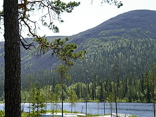
Kolari is a municipality of Finland at the Swedish border, which follows the Torne River, the longest free-flowing river in Europe.
Pelkosenniemi is a municipality of Finland. It is located in the province of Lapland. The municipality has a population of 916 (30 September 2023), which make it the smallest municipality in Lapland in terms of population. It covers an area of 1,881.58 square kilometres (726.48 sq mi) of which 45.4 km2 (17.5 sq mi) is water. The population density is 0.5 inhabitants per square kilometre (1.3/sq mi). Neighbour municipalities are Kemijärvi, Rovaniemi, Salla, Savukoski and Sodankylä.
Posio is a municipality of Finland. It is located in the province of Lapland. The municipality has a population of 2,925 (30 September 2023) and covers an area of 3,544.90 square kilometres (1,368.69 sq mi) of which 506.14 km2 (195.42 sq mi) is water. The population density is 0.96 inhabitants per square kilometre (2.5/sq mi). Neighbour municipalities are Rovaniemi, Kemijärvi, Ranua, Salla, Kuusamo, Taivalkoski and Pudasjärvi.
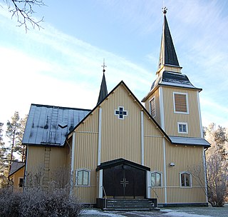
Ranua is a municipality of Finland. It is located in the province of Lapland. The municipality has a population of 3,594 and covers an area of 3,694.79 square kilometres (1,426.57 sq mi) of which 241.09 km2 (93.09 sq mi) is water. The population density is 1.04 inhabitants per square kilometre (2.7/sq mi).
Hyrynsalmi is a municipality in Finland and is part of the Kainuu region.
Hämeenkyrö is a municipality of Finland. It is part of the Pirkanmaa region, and is located 36 kilometres (22 mi) from Tampere. The municipality has a population of 10,300 and covers an area of 505.10 square kilometres (195.02 sq mi) of which 41.34 km2 (15.96 sq mi) is water. The population density is 22.2 inhabitants per square kilometre (57/sq mi).
Keitele is a municipality of Finland.
Kronoby is a municipality of Finland. It is located in the province of Western Finland and is part of the Ostrobothnia region. The municipality has a population of 6,351 and covers an area of 752.65 square kilometres (290.60 sq mi) of which 40.3 km2 (15.6 sq mi) is water. The population density is 8.91 inhabitants per square kilometre (23.1/sq mi). The municipality is bilingual, with the majority speaking Swedish (76.5%) and the minority Finnish (19.2%).
Lumijoki is a municipality of Finland.
Myrskylä is a municipality of Finland. It is located in the Uusimaa region and it is the smallest municipality in the region in relation to its population; the municipality has a population of 1,725 and covers an area of 206.35 square kilometres (79.67 sq mi) of which 5.98 km2 (2.31 sq mi) is water. The population density is 8.61 inhabitants per square kilometre (22.3/sq mi). Neighbouring municipalities are Askola, Porvoo, Pukkila, Orimattila, Lapinjärvi and Loviisa.
Oripää is a municipality of Finland.
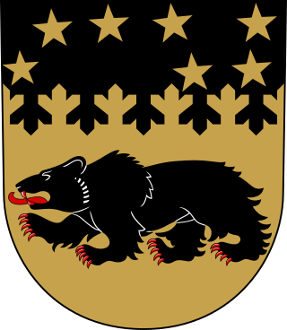
Pudasjärvi is a town and a municipality of Finland. It is located in the province of Oulu and is part of the Northern Ostrobothnia region, 87 kilometres (54 mi) northeast of the city of Oulu and 130 kilometres (81 mi) southwest of the town of Kuusamo. The town has a population of 7,509 and covers an area of 5,867.23 square kilometres (2,265.35 sq mi) of which 228.67 km2 (88.29 sq mi) is water. The population density is 1.33 inhabitants per square kilometre (3.4/sq mi). In terms of area in square kilometres, Pudasjärvi is the second largest township in Finland and one of the largest in the world. It's also one of the most sparsely inhabited.
Pyhäranta is a municipality of Finland. It is located in the province of Western Finland and is part of the Southwest Finland region. The municipality has a population of 1,939 and covers an area of 291.75 square kilometres (112.65 sq mi) of which 148.5 km2 (57.3 sq mi) is water. The population density is 13.51 inhabitants per square kilometre (35.0/sq mi).
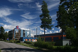
Rusko is a municipality of Finland.
Sievi is a municipality of Finland.
Soini is a municipality of Finland. It is located in the Southern Ostrobothnia region. The municipality has a population of 1,880 and covers an area of 574.22 square kilometres (221.71 sq mi) of which 22.17 km2 (8.56 sq mi) is water. The population density is 3.41 inhabitants per square kilometre (8.8/sq mi).
Taivassalo is a municipality of Finland, about 50 kilometres (31 mi) from the city of Turku. It is located in the Southwest Finland region. The municipality has a population of 1,691 and covers an area of 217.68 square kilometres (84.05 sq mi) of which 77.23 km2 (29.82 sq mi) is water. The population density is 12.05 inhabitants per square kilometre (31.2/sq mi).
Tammela is a municipality of Finland. It is located in the Tavastia Proper region. The municipality has a population of 5,843 and it covers an area of 715.15 square kilometres (276.12 sq mi) of which 74.72 square kilometres (28.85 sq mi) is inland water (2018-01-01). The population density is 9 inhabitants per square kilometre (23/sq mi). The first mention of a village named Tammela was in documents from 1423.
Media related to Tervola at Wikimedia Commons