Teton County is a county in the U.S. state of Wyoming. As of the 2020 United States Census, the population was 23,331. Its county seat is Jackson. Its west boundary line is also the Wyoming state boundary shared with Idaho and the southern tip of Montana. Teton County is part of the Jackson, WY-ID Micropolitan Statistical Area.

Teton County is a county located in the U.S. state of Idaho. As of the 2020 census, the population was 11,630. The county seat is Driggs, and the largest city is Victor. The county was established in 1915 and was named after the Teton Mountains to the east.
Alpine Northwest is a census-designated place (CDP) in Lincoln County, Wyoming, United States. The population was 305 at the 2020 census.
Oakley is a census-designated place (CDP) in Lincoln County, Wyoming, United States. The population was 49 at the 2010 census.

Turnerville is a census-designated place (CDP) in Lincoln County, Wyoming, United States. The population was 192 at the 2010 census.
Hartrandt is a census-designated place (CDP) in Natrona County, Wyoming, United States. It is part of the Casper, Wyoming Metropolitan Statistical Area and the population was 693 at the 2010 census.
Ralston is a census-designated place (CDP) in Park County, Wyoming, United States. The population was 280 at the 2010 census.

Bondurant is a census-designated place (CDP) in Sublette County, Wyoming, United States. The population was 93 at the 2010 census. The town was named after B. F. Bondurant.

Calpet is an unincorporated community in Sublette County, Wyoming, United States. The population was 7 at the 2000 census, when it was a census-designated place (CDP).
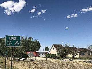
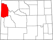
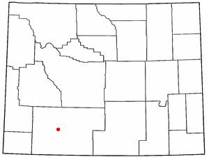
Eden is a census-designated place (CDP) in Sweetwater County, Wyoming, United States. The population was 281 at the 2010 census.
Reliance is a census-designated place (CDP) in Sweetwater County, Wyoming, United States. The population was 714 at the 2010 census.
Washam is a census-designated place (CDP) in Sweetwater County, Wyoming, United States. The population was 51 at the 2010 census.
Alta is a census-designated place (CDP) in Teton County, Wyoming, United States. The population was 429 at the 2020 census. It is part of the Jackson, WY–ID Micropolitan Statistical Area, and it is located between Driggs, Idaho and the Grand Targhee ski resort.

Hoback is a census-designated place (CDP) in Teton County, Wyoming, United States. The population was 1,176 at the 2010 census. It is part of the Jackson, WY–ID Micropolitan Statistical Area. The town is named for John Hoback, a mountain man who guided the Astor party through the area in 1811.
Moose Wilson Road is a census-designated place (CDP) in Teton County, Wyoming, United States. The population was 1,661 at the 2020 census. It is part of the Jackson, WY–ID Micropolitan Statistical Area.
Rafter J Ranch is a census-designated place (CDP) in Teton County, Wyoming, United States. The population was 1,075 at the 2010 census. It is part of the Jackson, WY–ID Micropolitan Statistical Area.
South Park is a census-designated place (CDP) in Teton County, Wyoming, United States. The population was 1,831 at the 2010 census. It is part of the Jackson, WY–ID Micropolitan Statistical Area. The community does not have any connections with South Park, the animated Comedy Central television series.

Wilson is a census-designated place (CDP) in Teton County, Wyoming, United States. The population was 1,567 at the 2020 census, up from 1,482 in 2010. It is part of the Jackson, WY–ID Micropolitan Statistical Area.

Carter is a census-designated place (CDP) in Uinta County, Wyoming, United States. Established by the United States Census Bureau in 1980, the CDP was named after the former village of Carter, in turn named for Judge William A. Carter, which was located within the CDP and of which some abandoned buildings remain standing. The population of the CDP was 10 at the 2010 census. As of 2020, the population was listed as zero on most Population history websites.

Fort Bridger is a census-designated place (CDP) in eastern Uinta County, Wyoming, United States. The population was 354 at the 2020 census. The community takes its name from the eponymous Fort Bridger, established in 1842, which is located within the boundaries of the CDP.