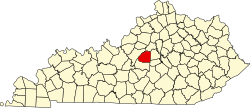
Texas, Kentucky | |
---|---|
Coordinates: 37°39′20″N85°06′37″W / 37.65556°N 85.11028°W | |
Country | United States |
State | Kentucky |
County | Washington |
Elevation | 879 ft (268 m) |
Time zone | UTC-5 (Eastern (EST)) |
• Summer (DST) | UTC-4 (EDT) |
GNIS feature ID | 505101 [1] |
Texas is an unincorporated community in Washington County, in the U.S. state of Kentucky. [1]
A post office called Texas was established in 1853, and remained in operation until 1964. [2] The community was named after the state of Texas. [3]
Frankfort is the capital city of the U.S. state of Kentucky and the seat of Franklin County. It is a home rule-class city. The population was 28,602 at the 2020 United States census. Located along the Kentucky River, Frankfort is the principal city of the Frankfort, Kentucky Micropolitan Statistical Area, which includes all of Franklin and Anderson counties. It is the 4th least populous state capital in the United States, and the 13th most populous city in Kentucky.
Washington County is a county in Texas. As of the 2020 census, the population was 35,805. Its county seat is Brenham, which is located along U.S. Highway 290, 72 miles northwest of Houston. The county was created in 1835 as a municipality of Mexico and organized as a county in 1837. It is named for George Washington, the first president of the United States.
Shelby County is a county located in the far eastern portion of the U.S. state of Texas. As of the 2020 census, its population was 24,022. Its county seat is Center. The county was established in 1835 as a municipality of Mexico and organized as a county in 1837. It is named for Isaac Shelby, a soldier in the American Revolution who became the first governor of Kentucky.
Interstate 69 (I-69) is an Interstate Highway in the United States currently consisting of 10 unconnected segments with an original continuous segment from Indianapolis, Indiana, northeast to the Canadian border in Port Huron, Michigan, at 355.8 miles (572.6 km). The remaining separated segments are variously completed and posted or not posted sections of an extension southwest to the Mexican border in Texas. Of this extension—nicknamed the NAFTA Superhighway because it would help trade with Canada and Mexico spurred by the North American Free Trade Agreement (NAFTA)—seven pieces in Laredo, Texas; Pharr, Texas; Brownsville, Texas; Corpus Christi, Texas; Houston, Texas; northwestern Mississippi; and Memphis, Tennessee, have been built or upgraded and signposted as I-69. Indiana is currently working on a fifth segment that will extend I-69 through the entire state while a sixth segment of I-69 through Kentucky utilizing that state's existing parkway system and a section of I-24 was established by federal legislation in 2008 with several more parkway segments being upgraded since then. This brings the total length to about 880 miles (1,420 km).
Garrard County is a county located east-central Kentucky. As of the 2020 census, the county's population was 16,953. Its county seat is Lancaster. The county was formed in 1796 and was named for James Garrard, Governor of Kentucky from 1796 to 1804. It is a prohibition or dry county, although its county seat, Lancaster, is wet. Lancaster was founded as a collection of log cabins in 1776 near a spring that later provided a constant source of water to early pioneers. It is one of the oldest cities in the Commonwealth. Boonesborough, 25 miles to the east, was founded by Daniel Boone in 1775. Lexington, 28 miles to the north, was founded in 1775. Stanford, originally known as St. Asaph, is 10 miles south of Lancaster. It too was founded in 1775. The oldest permanent settlement in Kentucky, Harrodsburg, was founded in 1774 and is 18 miles to the west. Garrard's present day courthouse is one of the oldest courthouses in Kentucky in continuous use.
Breathitt County is a county in the eastern Appalachian portion of the U.S. state of Kentucky. As of the 2020 census, the population was 13,718. Its county seat is Jackson. The county was formed in 1839 and was named for John Breathitt, who was Governor of Kentucky from 1832 to 1834. Breathitt County was a prohibition or dry county, until a public vote in July 2016 that allowed alcohol sales.
Owensboro is a home rule-class city in and the county seat of Daviess County, Kentucky, United States. It is the fourth-most populous city in the state. Owensboro is located on U.S. Route 60 and Interstate 165 about 107 miles (172 km) southwest of Louisville, and is the principal city of the Owensboro metropolitan area. The 2020 census had its population at 60,183. The metropolitan population was estimated at 116,506. The metropolitan area is the sixth largest in the state as of 2018, and the seventh largest population center in the state when including micropolitan areas.
Danville is a home rule-class city in Boyle County, Kentucky, United States. It is the seat of its county. The population was 17,236 at the 2020 Census. Danville is the principal city of the Danville Micropolitan Statistical Area, which includes all of the Boyle and Lincoln counties. In 2001, Danville received a Great American Main Street Award from the National Trust for Historic Preservation. In 2011, Money magazine placed Danville as the fourth-best place to retire in the United States. Centre College in Danville was selected to host U.S. vice-presidential debates in 2000 and 2012.
Georgetown is a home rule-class city in Scott County, Kentucky, United States. The population was 37,086 at the 2020 census. It is the 6th-largest city by population in the U.S. state of Kentucky. It is the seat of its county. It was originally called Lebanon when founded by Rev. Elijah Craig and was renamed in 1790 in honor of President George Washington. Historically, settlers were drawn to Georgetown for its Royal Spring.
The North American Central Time Zone (CT) is a time zone in parts of Canada, the United States, Mexico, Central America and some Caribbean islands.
Tri-state area is an informal term in the United States which can refer to any of multiple areas that lie across three states. When referring to populated areas, the term implies a shared economy or culture among the area's residents, typically concentrated around a central metropolis.
UTC−06:00 is an identifier for a time offset from UTC of −06:00. In North America, it is observed in the Central Time Zone during standard time, and in the Mountain Time Zone during the other eight months. Several Latin American countries and a few other places use it year-round.
Washington is a neighborhood of the city of Maysville located near the Ohio River in Mason County in the U.S. state of Kentucky. It is one of the earliest settlements in Kentucky and also one of the earliest American settlements west of the Appalachian Mountains. It played a significant role in the lead-up to the Civil War, producing two civil war generals and an escaped slave whose legal case established Canada as a safe haven for escaping slaves. It also provided the site where Harriet Beecher Stowe witnessed a slave auction. It has since been annexed by Maysville, and is sometimes now referred to as Old Washington. The community is in Area 606 served by the 759 exchange.
U.S. Route 127 (US 127) in Kentucky runs 207.7 miles (334.3 km) from the Tennessee state line in rural Clinton County to the Ohio state line in Cincinnati. The southern portion of the route is mostly rural, winding through various small towns along the way. It later runs through the state capital of Frankfort before continuing north, eventually passing through several Cincinnati suburbs in Northern Kentucky, joining US 42 near Warsaw and US 25 in Florence before crossing the Ohio River via the Clay Wade Bailey Bridge.
Anthony Butler was an American soldier, politician and diplomat who served as Chargé d'Affaires to Mexico.
Toonerville is an unincorporated community in Pike County, in the U.S. state of Kentucky. It in located in United States - some 301 mi West of Washington, the country's capital. It is part of a bigger unincorporated community called Mouthcard