
Texas Creek, Colorado is an unincorporated community at the junction of U.S. Highway 50 and State Highway 69 in Fremont County, Colorado, United States. [1]
Texas Creek, Colorado is an unincorporated community at the junction of U.S. Highway 50 and State Highway 69 in Fremont County, Colorado, United States. [1]
38°24′47″N105°34′50″W / 38.41306°N 105.58056°W
Municipalities and communities of Fremont County, Colorado, United States | ||
|---|---|---|
| Cities | 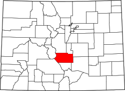 | |
| Towns | ||
| CDPs | ||
| Unincorporated communities | ||
| Ghost towns | ||
| | This Fremont County, Colorado state location article is a stub. You can help Wikipedia by expanding it. |