Texas State Highway 136

Last updated

Texas 136.svg

State Highway 136

Texas State Highway 136
SH 136, highlighted in red
Route information
Maintained by TxDOT
Length108.58 mi [1]  (174.74 km)
Existed1929–present
Major junctions
South endBusiness Loop 40.svgUS 60.svg I-40 BL  / US 60 in Amarillo
North endOklahoma State Highway 136.svg SH-136 at the Oklahoma state line
Location
Country United States
State Texas
Highway system
Texas 135.svg SH 135 Texas 137.svg SH 137

State Highway 136 (SH 136) is a Texas state highway that runs from the Oklahoma state line south of Guymon, Oklahoma to Amarillo. The route was designated on January 23, 1929 from Amarillo to Oklahoma. [2] [3] On March 19, 1930, the route was truncated to Stinnett, with the portion north of Stinnett transferred to SH 117. On February 4, 1941, the section of SH 136 from the Moore–Potter county line to Stinnett was cancelled. On September 22, 1942, the route was extended east to Borger. The highway was extended to the Oklahoma state line on November 21, 1963, replacing most of FM 278 and all of FM 2216.

Junction list

CountyLocationmi [4] kmDestinationsNotes
Potter Amarillo 0.00.0Business Loop 40.svgUS 60.svg I-40 BL  / US 60 Southern terminus
Mayer 3.55.6Texas Loop 335.svg Loop 335 Interchange
4.16.6Texas FM 1912.svg FM 1912 (St. Francis Avenue)
9.815.8East plate.svg
Texas FM 245.svg
FM 245 east
12.219.6East plate.svg
Texas FM 293.svg
FM 293 east Panhandle
16.226.1East plate.svg
Texas FM 1342.svg
FM 1342 east
Moore
No major junctions
Hutchinson 35.857.6North plate.svg
Texas RM 687.svg
RM 687 north Sanford, Stinnett, Lake Meredith Natl Rec Area Sanford Yake
41.266.3North plate.svg
Texas RM 1319.svg
RM 1319 north Sanford
Borger 42.668.6Texas FM 1551.svg FM 1551 (Fairlanes Boulevard)
43.670.2North plate.svg
Texas FM 1559.svg
FM 1559 north
Interchange
45.473.1South plate.svg
Texas 207.svg
SH 207 south / Wilson Street
Interchange; Southern end of SH 207 concurrency
46.074.0East plate.svg
Texas 152.svg
SH 152 east (West Third Street) Skellytown, Pampa
Southern end of SH 152 concurrency
47.476.3South plate.svg
Texas Spur 140.svg
East plate.svg
Texas Spur 245.svg
Spur 140 south (North Main Street) / Spur 245 east (East Carolina Street)
Roundabout
47.876.9West plate.svg
Texas RM 3474.svg
RM 3474 west
49.579.7South plate.svg
Texas FM 1559.svg
FM 1559 south
55.489.2East plate.svg
Texas RM 2277.svg
RM 2277 east
Stinnett 57.191.9West plate.svg
Texas 152.svg
SH 152 west Dumas
Northern end of SH 152 concurrency
57.792.9East plate.svg
Texas RM 1526.svg
RM 1526 east (Broadway Street)
57.893.0West plate.svg
Business plate.svg
Texas 152.svg
Bus. SH 152 west Dumas
64.1103.2North plate.svg
Texas 207.svg
SH 207 north Spearman
Northern end of SH 207 concurrency
Pringle 66.7107.3West plate.svg
Texas FM 1598.svg
FM 1598 west
71.8115.6Texas FM 281.svg FM 281  Sunray
Hansford 74.5119.9West plate.svg
Texas FM 1775.svg
FM 1775 west Morse
79.4127.8Texas FM 520.svg FM 520  Spearman
85.5137.6Texas FM 2018.svg FM 2018  Sunray
Gruver 89.8144.5East plate.svg
Texas Loop 84.svg
Loop 84 east (4th Street)
90.1145.0East plate.svg
Texas 15.svg
East plate.svg
Texas FM 278.svg
SH 15 east / FM 278 east Spearman
Southern end of SH 15 concurrency
90.2145.2West plate.svg
Texas 15.svg
SH 15 west Stratford
Northern end of SH 15 concurrency
96.3155.0Texas FM 2535.svg FM 2535
Texas–Oklahoma state line108.6174.8Oklahoma State Highway 136.svg SH-136  Guymon
1.000 mi = 1.609 km; 1.000 km = 0.621 mi

Related Research Articles

<span class="mw-page-title-main">Texas State Highway 30</span> State highway in Texas

State Highway 30 runs from Business SH 6-R in College Station via Roans Prairie to SH 19 in Huntsville. It is known as Harvey Road between Business SH 6-R and FM 158 in College Station, as 11th Street between I-45 and US 190 in Huntsville, and as Riverside Drive east of US 190 in Huntsville.

<span class="mw-page-title-main">Texas State Highway 40</span> State highway in Texas

State Highway 40 or William D. Fitch Parkway, runs from Farm to Market Road 2154 (FM 2154) to SH 6 in College Station, Texas. The current SH 40 was authorized in 1994. Signage for the highway went up March 2006 and the road was officially opened June 23, 2006.

<span class="mw-page-title-main">Texas State Highway 3</span> State highway in Galveston and Harris counties in Texas, United States

State Highway 3 is a state highway in the U.S. state of Texas that runs from Interstate 45 in Houston near William P. Hobby Airport to State Highway 146, 9.9 miles (15.9 km) northwest of Galveston. For most of its length, SH 3 parallels I-45 and runs alongside the former Galveston, Houston and Henderson Railroad lines.

<span class="mw-page-title-main">Texas State Highway 4</span> Highway in Texas

State Highway 4, known locally as Boca Chica Boulevard, is an east–west state highway in the U.S. state of Texas that runs from the Gateway International Bridge in Brownsville to the Gulf of Mexico at Boca Chica Beach. Outside of Brownsville, it roughly parallels the Rio Grande. It is the southernmost Texas state highway.

<span class="mw-page-title-main">Texas State Highway 9</span> Highway and former highway in Texas

State Highway 9 (SH 9) is a highway near Copperas Cove, Texas. It connects Interstate 14 (I-14), U.S. Route 190 (US 190), and U.S. Highway 190 Business outside of Copperas Cove to Farm to Market Road 116 (FM 116) on the north side of Copperas Cove. The highway opened on February 20, 2014 with a ribbon cutting at 2:00 p.m.

<span class="mw-page-title-main">Texas State Highway 11</span> State highway in Texas

State Highway 11 is a highway that runs from US 59 in Linden to SH 56 in Sherman in northeast Texas.

<span class="mw-page-title-main">Texas State Highway 15</span> Highway in Texas

State Highway 15 is a state highway in the U.S. state of Texas. It runs from the Oklahoma state line 6 miles (9.7 km) east of Follett to US 287 in Stratford.

<span class="mw-page-title-main">Texas State Highway 18</span> State highway in Texas

State Highway 18 is a state highway in the U.S. state of Texas maintained by the Texas Department of Transportation (TxDOT) that runs from Fort Stockton in western Texas to the New Mexico state line between Kermit and Jal, New Mexico. This route was designated in 1958 over the northern half of what was previously SH 82.

<span class="mw-page-title-main">Texas State Highway 19</span> State highway in Texas

State Highway 19 is a state highway in Texas runs from Huntsville to Paris in east Texas.

<span class="mw-page-title-main">Texas State Highway 23</span> State highway in Texas

State Highway 23 is a state highway in the U.S. state of Texas maintained by the Texas Department of Transportation (TxDOT). The highway, located in eastern Lipscomb County in the Texas Panhandle, begins at US 83 northwest of Canadian and extends northward through the town of Booker to the Oklahoma state line. The highway's route designation is numerically continuous with subsequent routes in Oklahoma and Kansas and, together with Oklahoma State Highway 23 and Kansas Highway 23, forms part of a single route from US 83 in Texas to US-83 near Selden, Kansas.

<span class="mw-page-title-main">Texas State Highway 13</span> Former highway in Texas

State Highway 13 was a state highway in the U.S. state of Texas that ran from Amarillo due west to the New Mexico state line near Glenrio, Texas.

<span class="mw-page-title-main">Texas State Highway 33</span> State highway in Texas

State Highway 33 is a route that runs from U.S. Highways 60 and 83 south of Canadian and travels east to the Oklahoma state line, where it becomes State Highway 33.

<span class="mw-page-title-main">Texas State Highway 37</span> State highway in Wood, Franklin, and Red River counties in Texas, United States

State Highway 37 is a state highway that runs from the Oklahoma state line near Albion to Mineola in the northeast corner of the state.

<span class="mw-page-title-main">Texas State Highway 43</span> State highway in Texas

State Highway 43 is a Texas state highway that runs from Henderson to Atlanta.

<span class="mw-page-title-main">Texas State Highway 51</span> State highway in Texas

State Highway 51 is a short state highway located entirely in Hansford County, Texas, just south of Spearman.

<span class="mw-page-title-main">Texas State Highway 57</span> State highway in Texas

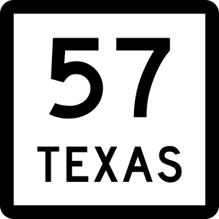
State Highway 57 is a 1.474-mile (2.372 km) Texas state highway located in Tyler.

<span class="mw-page-title-main">Texas State Highway 128</span> State highway in Texas

State Highway 128 is a state highway in Andrews County, Texas.

<span class="mw-page-title-main">Texas State Highway 152</span> State Highway oklahoma/texas

State Highway 152 is a Texas state highway that runs from Dumas east to the Oklahoma state line. The route was originally designated in 1930 between Pampa and Wheeler, but was extended both west and east to its current termini in 1938.

<span class="mw-page-title-main">Texas State Highway 176</span> State highway in Texas

State Highway 176 (SH 176) is a Texas state highway running from the New Mexico state line east to Big Spring. It is most commonly known as the Andrews Highway.

References

  1. Transportation Planning and Programming Division (n.d.). "State Highway No. 136". Highway Designation Files. Texas Department of Transportation . Retrieved 2010-06-15.
  2. "Minutes" (PDF). publicdocs.txdot.gov. Texas Department of Transportation. January 16, 1929. Archived (PDF) from the original on January 25, 2018. Retrieved 30 April 2023.
  3. "Minutes" (PDF). publicdocs.txdot.gov. Texas Department of Transportation. February 18, 1929. Archived (PDF) from the original on December 4, 2018. Retrieved 30 April 2023.
  4. Google (March 6, 2013). "Texas State Highway 136" (Map). Google Maps . Google. Retrieved March 6, 2013.
    Google (March 6, 2013). "Texas State Highway 136" (Map). Google Maps . Google. Retrieved March 6, 2013.
    Google (March 6, 2013). "Texas State Highway 136" (Map). Google Maps . Google. Retrieved March 6, 2013.