Thanet Formation

Last updated
Thanet Formation
Stratigraphic range: Thanetian
The eroding cliffs of Reculver Country Park - geograph.org.uk - 6930.jpg
Grey sands of the Thanet Formation in the cliffs just east of Herne Bay
Type Formation
Unit of Montrose Group
Underlies Lambeth Group
Overlies Chalk Group
Thickness0–30 m (0–98 ft)
Lithology
Primaryfine-grained sand
Otherclay
Location
Coordinates 51°24′N1°06′E / 51.4°N 1.1°E / 51.4; 1.1 Coordinates: 51°24′N1°06′E / 51.4°N 1.1°E / 51.4; 1.1
Approximate paleocoordinates 45°54′N1°00′E / 45.9°N 1.0°E / 45.9; 1.0
Regionsoutheastern England
CountryFlag of the United Kingdom.svg  United Kingdom
Extent London Basin
Type section
Named for Isle of Thanet
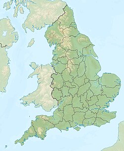
England relief location map.jpg
Orange pog.svg
Thanet Formation (England)

The Thanet Formation is a geological formation found in the London Basin of southeastern England. [1] It is of early to mid-Thanetian (late Paleocene) age and gave its name to that stratigraphic interval. It was previously known as the Thanet Beds, the Thanet Sands and the Thanet Sand Formation. It was named after the Isle of Thanet. The type sections are Herne Bay in Kent for the upper part of the formation and Pegwell Bay for the lower part. [2] [3] It lies unconformably on the Late Cretaceous Chalk Group. It unconformably underlies the Lambeth Group, generally the Upnor Formation but in Essex it is the Reading Formation.
Contents

Distribution

The Thanet Formation is known at outcrop and in the subsurface over central and eastern parts of the London Basin. To the west it is missing, with the Lambeth Group lying directly on the Chalk, and to the north it is replaced by the Ormesby Clay Member. [2] It thins to the west and north of London. It reaches a maximum thickness of over 30 m in North Kent.

Lithology

The predominant lithology is very pale grey or buff fine-grained glauconitic sand. Particularly towards the base of the formation, the sand is interbedded with silts and clays. At the base of the formation a bed of flint pebbles is often developed with clasts up to cobble size in a matrix of glauconitic clayey sand. [2]

At Herne Bay the beds are divided as follows (top to bottom): [4]

Depositional environment

The Thanet Formation was deposited in open marine conditions. The water depth was relatively shallow, above normal wave-base, in an inner or outer shelf setting. [2]

Fossil content

The sequence is known for its rich fossil content, particularly molluscs and fish. [1] The fauna give somewhat contradictory evidence of the climate, with molluscs of both cold and warm water type being found and tropical to sub-tropical fish recognised. Overall, a sub-tropical climate is indicated. [4] The formation also has provided fossils of flora of Pinus macrocephalus , Pinus prestwichi , Palmae and Osmunda dowkeri . [1]

See also

Related Research Articles

Chalk Group

The Chalk Group is the lithostratigraphic unit which contains the Upper Cretaceous limestone succession in southern and eastern England. The same or similar rock sequences occur across the wider northwest European chalk 'province'. It is characterised by thick deposits of chalk, a soft porous white limestone, deposited in a marine environment.

Lambeth Group

The Lambeth Group is a stratigraphic group, a set of geological rock strata in the London and Hampshire Basins of southern England. It comprises a complex of vertically and laterally varying gravels, sands, silts and clays deposited between 56-55 million years before present during the Ypresian age. It is found throughout the London Basin with a thickness between 10m and 30m and the Hampshire Basin with a thickness between 50m and less than 25m. Although this sequence only crops out in these basins, the fact that it underlies 25% of London at a depth of less than 30m means the formation is of engineering interest for tunnelling and foundations.

Geology of London

The geology of London comprises various differing layers of sedimentary rock upon which London, England is built.

Aquia Formation

The Aquia Formation is a geologic sandstone formation that extends from the upper Chesapeake Bay to the James River near Hopewell, Virginia. It consists of clayey, silty, very shelly, glauconitic sand. Fossil records indicate that this stratigraphic unit was created during the Paleocene.

London Basin

The London Basin is an elongated, roughly triangular sedimentary basin approximately 250 kilometres (160 mi) long which underlies London and a large area of south east England, south eastern East Anglia and the adjacent North Sea. The basin formed as a result of compressional tectonics related to the Alpine orogeny during the Palaeogene period and was mainly active between 40 and 60 million years ago.

Fernie Formation

The Fernie Formation is a stratigraphic unit of Jurassic age. It is present in the western part of the Western Canada Sedimentary Basin in western Alberta and northeastern British Columbia. It takes its name from the town of Fernie, British Columbia, and was first defined by W.W. Leach in 1914.

The Belloy Formation is a stratigraphical unit of Permian age in the Western Canadian Sedimentary Basin.

The Mannville Group is a stratigraphical unit of Cretaceous age in the Western Canadian Sedimentary Basin.

The Hannut Formation is a geologic formation in the subsurface of northern Belgium. The formation consists of marine clay and silt, alternating with more sandy layers. On top of this the lithology changes to limestone, siltstone and sandstone and the top of the formation is formed by a layer of glauconite bearing sand. The Hannut Formation was formed during the early to middle Thanetian age.

Vanguard Formation

The Vanguard Formation is a stratigraphical unit of Callovian to Oxfordian age in the Western Canadian Sedimentary Basin.

Geology of East Sussex Overview of the geology of East Sussex

The geology of East Sussex is defined by the Weald–Artois anticline, a 60 kilometres (37 mi) wide and 100 kilometres (62 mi) long fold within which caused the arching up of the chalk into a broad dome within the middle Miocene, which has subsequently been eroded to reveal a lower Cretaceous to Upper Jurassic stratigraphy. East Sussex is best known geologically for the identification of the first dinosaur by Gideon Mantell, near Cuckfield, to the famous hoax of the Piltdown man near Uckfield.

The Bouldnor Formation is a geological formation in the Hampshire Basin of southern England. It is the youngest formation of the Solent Group and was deposited during the uppermost Eocene and lower Oligocene.

Geology of the Isle of Wight

The geology of the Isle of Wight is dominated by sedimentary rocks of Cretaceous and Paleogene age. This sequence was affected by the late stages of the Alpine Orogeny, forming the Isle of Wight monocline, the cause of the steeply-dipping outcrops of the Chalk Group and overlying Paleogene strata seen at The Needles, Alum Bay and Whitecliff Bay.

The geology of Kent in southeast England largely consists of a succession of northward dipping late Mesozoic and Cenozoic sedimentary rocks overlain by a suite of unconsolidated deposits of more recent origin.

Deadwood Formation

The Deadwood Formation is a geologic formation of the Williston Basin and Western Canada Sedimentary Basin. It is present in parts of North and South Dakota and Montana in the United States, and in parts of Alberta, Saskatchewan, and southwestern corner of Manitoba in Canada. It is of Late Cambrian to Early Ordovician age and was named for exposures in Whitewood Creek near Deadwood, South Dakota. It is a significant aquifer in some areas, and its conglomerates yielded significant quantities of gold in the Black Hills of South Dakota.

Favel Formation

The Favel Formation is a stratigraphic unit of Late Cretaceous age. It is present in southern Manitoba and southeastern Saskatchewan, and consists primarily of calcareous shale. It was named for the Favel River near Minitonas, Manitoba, by R.T.D. Wickenden in 1945.

Tuffeau de St Omer

The "Tuffeau" de Saint-Omer is a geologic formation in northern France. The sandstones of the formation, named after Saint-Omer, preserve bird and primate fossils dating back to the middle Thanetian age of the Paleocene epoch of the Paleogene period, dating to about 58 Ma.

Golden Valley Formation

The Golden Valley Formation is a stratigraphic unit of Late Paleocene to Early Eocene age in the Williston Basin of North Dakota. It is present in western North Dakota and was named for the city of Golden Valley by W.E. Benson and W.M. Laird in 1947. It preserves significant assemblages of fossil plants and vertebrates, as well as mollusk and insect fossils.

Upnor Formation Geological formation in Kent, England

The Upnor Formation is a geological formation found in the London Basin of southeastern England. It is of Thanetian age. It lies unconformably on the Thanet Formation for most of its outcrop, but in the west it lies directly on Chalk Group. It is generally overlain either by the Reading Formation or the Woolwich Formation, but locally in north and east Kent it is overlain unconformably by the Harwich Formation. It forms the lowermost part of the Lambeth Group. The type section is at Lower Upnor Pit, north Kent. The formation has provided fossils of the eutherian mammal Arctocyonides arenae.

Gai-As Formation

The Gai-As Formation is an Early to Middle Permian geologic formation correlated with the Ecca Group and designated "Ecca" Group, because it does not belong to the Karoo, in the southwestern Kunene Region and northern Erongo Region of northwestern Namibia. The Gai-As Formation represents the second-oldest sedimentary unit of the Huab Basin, overlying the Huab Formation. The formation was deposited in a fluvial to lacustrine setting.

References

  1. 1 2 3 Thanet Formation at Fossilworks.org
  2. 1 2 3 4 Aldiss D.T. (2014). "The stratigraphical framework for the Palaeogene successions of the London Basin, UK". Open Report OR/14/008. British Geological Survey. pp. 9–14. Retrieved 30 July 2016.
  3. "Thanet Formation". BGS Lexicon of Named Rock Units. British Geological Survey . Retrieved 30 July 2016.
  4. 1 2 Holmes. "British Cenozoic fossil fishes sites Site: HERNE BAY (GCR ID: 2911)" (PDF). Volume 16: Fossil Fishes of Great Britain. Extracted from the Geological Conservation Review. pp. Chapter 14: pages 2 and 4. Retrieved 9 April 2012.