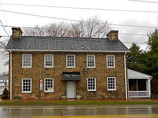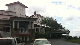
Fayette County is a county in the Commonwealth of Pennsylvania. It is located in southwestern Pennsylvania, adjacent to Maryland and West Virginia. As of the 2020 census, the population was 128,804. Its county seat is Uniontown. The county was created on September 26, 1783, from part of Westmoreland County and named after the Marquis de Lafayette. The county is part of the Southwest Pennsylvania region of the state.

Uniontown is a city in Perry County, Alabama, in west-central Alabama. As of the 2020 census, the population of the city is 2,107, up 18.7% over 2010. Of the 573 cities in Alabama, Uniontown is the 207th most populous.

Pillow is a borough in Dauphin County, Pennsylvania, United States. The population was 291 at the 2020 census. It is part of the Harrisburg–Carlisle Metropolitan Statistical Area.

East Uniontown is a census-designated place (CDP) in Fayette County, Pennsylvania, United States. The population was 2,419 at the 2010 census, down from 2,760 at the 2000 census.

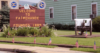
Fairchance is a borough in Fayette County, Pennsylvania, United States. The population was 1,889 at the 2020 census, a decline from the figure of 1,975 tabulated in 2010. It is served by the Albert Gallatin Area School District.

Henry Clay Township is a township in Fayette County, Pennsylvania, United States. The population was 1,764 at the 2020 census. The township was created June 9, 1824, from the eastern portion of Wharton Township. It is named for 19th-century American statesman Henry Clay. The northwestern corner of its territory was used to create Stewart Township on November 17, 1855. It is served by the Uniontown Area School District.

Hopwood is a census-designated place (CDP) in Fayette County, Pennsylvania, United States. The population was 2,090 at the 2010 census, up from 2,006 at the 2000 census. It is located in North Union and South Union townships. The village was named after John Hopwood.

Leith-Hatfield is a census-designated place (CDP) in Fayette County, Pennsylvania, United States. The population was 2,546 at the 2010 census, down from 2,820 at the 2000 census. The twin villages of Leith and Hatfield are located in South Union Township.

New Salem-Buffington was a census-designated place (CDP) in Fayette County, Pennsylvania, United States, and part of the Pittsburgh Metro Area. The population was 808 at the 2000 census. For the 2010 census the area was split into two CDPs, New Salem and Buffington. Both communities are located in Menallen Township.

North Union Township is a township in Fayette County, Pennsylvania, United States. The population was 11,829 at the 2020 census, a decline from the figure of 12,728 tabulated in 2010. The Laurel Highlands School District serves the township.

Redstone Township is a township in Fayette County, Pennsylvania, United States. The population was 5,077 at the 2020 census, a decline from the figure of 5,566 tabulated in 2010. The Brownsville Area School District serves the region.

South Union Township is a township in Fayette County, Pennsylvania, United States. The population was 10,897 at the 2020 census, an increase over the figure of 10,681 tabulated in 2010.

Uniontown is the largest city in and the county seat of Fayette County, Pennsylvania, United States, 46 miles (74 km) southeast of Pittsburgh. The population was 9,984 at the 2020 census. It is part of the Pittsburgh metropolitan area.

Green Township is a township in Indiana County, Pennsylvania, United States. Green Township was formed from Wheatfield Township circa 1816 and was named for the great evergreen forests covering the area. The population was 3,457 at the 2020 census. The township includes the communities of Bencetown, Berringer, Commodore, Cookport, Cush Cushion, Dixonville, Fleming Summit, Grisemore, Leard, Lovejoy, Martintown, Pine Flats, Prosperity Hill, Purchase Line, Shanktown, Starford, Spruce, Utah, Uniontown, and Wandin.

Division No. 9, Canada, is one of the eighteen census divisions within the province of Saskatchewan, as defined by Statistics Canada. It is located in the eastern part of the province, bordering Manitoba. The most populous community in this division is Yorkton.

Salem Township is one of twenty-one townships in Knox County, Illinois, USA. As of the 2010 census, its population was 1,003 and it contained 449 housing units.

Mount Aetna is a census-designated place in Tulpehocken Township, Berks County, Pennsylvania, United States. It is located along Pennsylvania Route 501 near the border of Lebanon County. The community is named after the active volcano, Mount Etna, in Sicily. As of the 2010 census, the population was 354 residents.

Eggertsville is a hamlet and census-designated place (CDP) within the town of Amherst in Erie County, New York, United States. The population of the CDP was 15,019 at the 2010 census.

Grier City is a census-designated place located in Rush Township, Schuylkill County in the state of Pennsylvania, United States. Grier City was part of the Grier City-Park Crest CDP for the 2000 census, before splitting into two separate CDPs for the 2010 census, the other being Park Crest. The community is located off Interstate 81. As of the 2010 census, the population was 241 residents. As of the 2020 census, the population was 296 residents.

Hegins is a census-designated place located in Hegins Township, Schuylkill County in the state of Pennsylvania, United States. The community is located near the community of Valley View at the intersection of Pennsylvania Routes 25 and 125 and is approximately 50 miles northeast of Harrisburg. As of the 2018 the population was 850.


