Snydertown, Northumberland County, Pennsylvania

Last updated
Snydertown,
Northumberland County,
Pennsylvania
Snydertown, Pennsylvania.jpg
Snydertown, Pennsylvania
Northumberland County Pennsylvania Incorporated and Unincorporated areas Snydertown Highlighted.svg
Location of Snydertown in Northumberland County, Pennsylvania.
USA Pennsylvania location map.svg
Red pog.svg
Snydertown
Location on Snydertown in Pennsylvania
Usa edcp location map.svg
Red pog.svg
Snydertown
Snydertown (the United States)
Coordinates: 40°52′24″N76°40′14″W / 40.87333°N 76.67056°W / 40.87333; -76.67056
Country United States
State Pennsylvania
County Northumberland
Incorporated1871
Government
  TypeBorough Council
Area
[1]
  Total3.49 sq mi (9.04 km2)
  Land3.43 sq mi (8.89 km2)
  Water0.06 sq mi (0.15 km2)
Elevation
[2] (benchmark at borough center)
534 ft (163 m)
Highest elevation
[2] (hill at northeast boundary)
1,042 ft (318 m)
Lowest elevation
[2] (Susquehanna River)
470 ft (140 m)
Population
 (2020) [3]
  Total325
  Density94.67/sq mi (36.55/km2)
Time zone UTC-5 (Eastern (EST))
  Summer (DST) UTC-4 (EDT)
Zip code
17877
Area code 570
FIPS code 42-71688
GNIS feature ID1215518

Snydertown is a borough in Northumberland County, Pennsylvania, United States. As of the 2010 census, the borough population was 339.

Contents

History

The first owner of property in Snydertown was Godfrey Rockefeller. His land passed into the hands of Joseph Snyder, for whom Snydertown is named. Snydertown was incorporated from Shamokin Township in 1871. [4]

Geography

QR 4012 (Snydertown Road) in Snydertown QR 4012 (Snydertown Road).JPG
QR 4012 (Snydertown Road) in Snydertown

Snydertown is located at 40°52′24″N76°40′14″W / 40.87333°N 76.67056°W / 40.87333; -76.67056 (40.873399, -76.670632). [5] According to the United States Census Bureau, the borough has a total area of 3.5 square miles (9.0 km2), all land.

Shamokin Creek passes through Snydertown. Most of Snydertown's terrain is hilly, but is flat near Shamokin Creek. Most of the land in the borough is forest, but there is some farmland. [6]

Demographics

Historical population
CensusPop.Note
1880 260
1890 242−6.9%
1900 27614.0%
1910 2884.3%
1920 32111.5%
1930 273−15.0%
1940 34225.3%
1950 314−8.2%
1960 278−11.5%
1970 267−4.0%
1980 35834.1%
1990 41616.2%
2000 357−14.2%
2010 339−5.0%
2020 325−4.1%
Sources: [7] [8] [9] [3]

As of the census [8] of 2000, there were 357 people, 136 households, and 99 families residing in the borough. The population density was 102.4 inhabitants per square mile (39.5/km2). There were 143 housing units at an average density of 41.0 per square mile (15.8/km2). The racial makeup of the borough was 99.16% White, 0.56% Asian, and 0.28% from two or more races.

There were 136 households, out of which 31.6% had children under the age of 18 living with them, 61.0% were married couples living together, 7.4% had a female householder with no husband present, and 26.5% were non-families. 22.1% of all households were made up of individuals, and 7.4% had someone living alone who was 65 years of age or older. The average household size was 2.60 and the average family size was 3.04.

In the borough the population was spread out, with 23.8% under the age of 18, 6.7% from 18 to 24, 31.1% from 25 to 44, 26.6% from 45 to 64, and 11.8% who were 65 years of age or older. The median age was 39 years. For every 100 females there were 113.8 males. For every 100 females age 18 and over, there were 100.0 males.

The median income for a household in the borough was $40,250, and the median income for a family was $41,563. Males had a median income of $30,000 versus $20,625 for females. The per capita income for the borough was $15,107. About 5.9% of families and 7.6% of the population were below the poverty line, including 10.4% of those under age 18 and none of those age 65 or over.

Related Research Articles

<span class="mw-page-title-main">Dayton, Pennsylvania</span> Borough in Pennsylvania, United States

Dayton is a borough in Armstrong County, Pennsylvania, United States. The population was 549 at the 2020 census.

<span class="mw-page-title-main">Rural Valley, Pennsylvania</span> Borough in Pennsylvania, United States

Rural Valley is a borough in Armstrong County, Pennsylvania, United States. The population was 826 at the 2020 census.

<span class="mw-page-title-main">Conyngham Township, Columbia County, Pennsylvania</span> Township in Pennsylvania, United States

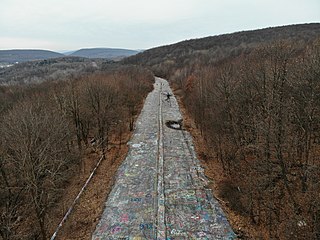
Conyngham Township is a township in Columbia County, Pennsylvania, United States. It is part of Northeastern Pennsylvania. The population was 689 at the 2020 census. Conyngham Township surrounds the famous borough of Centralia, and part of the mine fire is located here. The abandoned town of Byrnesville is located here.

<span class="mw-page-title-main">Pillow, Pennsylvania</span> Borough in Pennsylvania, United States

Pillow is a borough in Dauphin County, Pennsylvania, United States. The population was 291 at the 2020 census. It is part of the Harrisburg–Carlisle Metropolitan Statistical Area.

<span class="mw-page-title-main">Herndon, Pennsylvania</span> Borough in Pennsylvania, United States

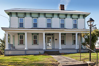
Herndon, formerly Trevorton Junction, is a borough along the Susquehanna River in Northumberland County, Pennsylvania, United States. Herndon was first founded by Robert A. Parrish in 1840. The town was later named for Naval commander William Lewis Herndon, who died in 1857 while trying to rescue passengers from his sinking ship. The population was 324 at the 2010 census.

<span class="mw-page-title-main">Kulpmont, Pennsylvania</span> Borough in Pennsylvania, United States

Kulpmont is a borough in Northumberland County, Pennsylvania, United States. The population was 2,758 at the 2020 census.

<span class="mw-page-title-main">Marion Heights, Pennsylvania</span> Borough in Pennsylvania, United States

Marion Heights is a borough in Northumberland County, Pennsylvania, United States. The population was 611 at the 2010 census.

<span class="mw-page-title-main">McEwensville, Pennsylvania</span> Borough in Pennsylvania, United States

McEwensville is a borough in Northumberland County, Pennsylvania, United States. The population was 298 during the 2020 census.

<span class="mw-page-title-main">Milton, Pennsylvania</span> Borough in Pennsylvania, United States

Milton is a borough in Northumberland County, Pennsylvania, United States, on the West Branch Susquehanna River, 50 miles (80 km) north of Harrisburg, located in Central Pennsylvania's Susquehanna River Valley. It is approximately 10 miles upriver from the mouth of the West Branch Susquehanna River and about 30 miles downriver of Williamsport.

<span class="mw-page-title-main">Mount Carmel, Pennsylvania</span> Borough in Pennsylvania, United States

Mount Carmel is a borough in Northumberland County, located in the Coal Heritage Region of Central Pennsylvania's Susquehanna River Valley, United States. The population was 5,725 at the 2020 census. It is located 88 miles (141 km) northwest of Philadelphia and 71 miles (114 km) northeast of Harrisburg, in the Coal Region. It is completely encircled by Mount Carmel Township.

<span class="mw-page-title-main">Northumberland, Pennsylvania</span> Borough in Pennsylvania, United States

Northumberland is a borough in Northumberland County, Pennsylvania, United States. The population was 3,804 at the 2010 census.

<span class="mw-page-title-main">Riverside, Pennsylvania</span> Borough in Pennsylvania, United States

Riverside is a borough in Northumberland County, Pennsylvania, United States. The population was 1,932 at the 2010 census. The current mayor is John LaMotte.

<span class="mw-page-title-main">Shamokin Township, Pennsylvania</span> Township in Pennsylvania, United States

Shamokin Township is a township in Northumberland County, Pennsylvania, United States. The population at the 2010 Census was 2,407, an increase over the figure of 2,159 tabulated in 2000.

<span class="mw-page-title-main">Turbotville, Pennsylvania</span> Borough in Pennsylvania, United States

Turbotville Borough is a borough in Northumberland County, Pennsylvania, United States. The population was 705 at the 2010 census.

<span class="mw-page-title-main">Upper Augusta Township, Pennsylvania</span> Township in Pennsylvania, United States

Upper Augusta Township is a township in Northumberland County, Pennsylvania, United States. It was formed in 1846 by the division of Augusta Township into Upper and Lower sections. The population at the 2010 Census was 2,586, an increase over the figure of 2,556 tabulated in 2000.

<span class="mw-page-title-main">Watsontown, Pennsylvania</span> Borough in Pennsylvania, United States

Watsontown is a borough in Northumberland County, Pennsylvania, United States. The population was 2,351 at the 2010 census. It was named for John Watson, an early settler.

<span class="mw-page-title-main">Marysville, Pennsylvania</span> Borough in Pennsylvania, United States

Marysville is a borough in Perry County, Pennsylvania, United States. The population was 2,652 at the 2020 census. It is part of the Harrisburg–Carlisle Metropolitan Statistical Area.

<span class="mw-page-title-main">New Buffalo, Pennsylvania</span> Borough in Pennsylvania, United States

New Buffalo is a borough in Perry County, Pennsylvania, United States. The population was 124 at the time of the 2020 census.

<span class="mw-page-title-main">Branchdale, Pennsylvania</span> CDP in Pennsylvania, United States

Branchdale is a census-designated place (CDP) in Schuylkill County, Pennsylvania, United States. The population was 436 at the 2000 census.

<span class="mw-page-title-main">New Berlin, Pennsylvania</span> Borough in Pennsylvania, United States

New Berlin is a borough in Union County, Pennsylvania, United States. The population was 791 at the 2020 census.

References

  1. "ArcGIS REST Services Directory". United States Census Bureau. Retrieved October 15, 2022.
  2. 1 2 3 "Snydertown Topo Map, Northumberland County PA (Riverside Area)". TopoZone. Locality, LLC. Retrieved 27 November 2019.
  3. 1 2 "Census Population API". United States Census Bureau. Retrieved Oct 12, 2022.
  4. "Snydertown Borough, Northumberland County, Pennsylvania (PA)".
  5. "US Gazetteer files: 2010, 2000, and 1990". United States Census Bureau. 2011-02-12. Retrieved 2011-04-23.
  6. "Google Maps".
  7. "Census of Population and Housing". U.S. Census Bureau. Retrieved 11 December 2013.
  8. 1 2 "U.S. Census website". United States Census Bureau . Retrieved 2008-01-31.
  9. "Incorporated Places and Minor Civil Divisions Datasets: Subcounty Resident Population Estimates: April 1, 2010 to July 1, 2012". Population Estimates. U.S. Census Bureau. Archived from the original on 11 June 2013. Retrieved 11 December 2013.