See also
- Capitol Hill (disambiguation)
- Hill (disambiguation)
- Viscount Hill, Richard 'The Great Hill', diplomat
- The Hills (disambiguation)
- The Mount (disambiguation)
- The Mountain (disambiguation)
The Hill most frequently refers to Capitol Hill, Washington, D.C., and entities named after it, including:
The Hill may also refer to:
Bellevue means "beautiful view" in French.
Wildcats are small cats native to Europe, the western part of Asia, and Africa.
Capitol Hill is a neighborhood of Washington, D.C., adjacent to the United States Capitol.

Capitol Hill is a neighborhood in Washington, D.C., located in both Northeast D.C. and Southeast D.C.. Dominated by the United States Capitol, which sits on the highest point of Capitol Hill, it is one of the oldest historic districts in Washington. Home to around 35,000 people in just under 2 square miles (5 km2), Capitol Hill is also one of the most densely populated neighborhoods. The name "Capitol Hill" is frequently used as a metonym for the U.S. Congress.

Thomas Ustick Walter was the dean of American architecture between the 1820 death of Benjamin Latrobe and the emergence of H. H. Richardson in the 1870s. He was the fourth Architect of the Capitol and responsible for adding the north (Senate) and south (House) wings and the central dome that is predominantly the current appearance of the U.S. Capitol building. Walter was one of the founders and second president of the American Institute of Architects. In 1839, he was elected as a member to the American Philosophical Society.

Northeast is the northeastern quadrant of Washington, D.C., the capital of the United States. It encompasses the area located north of East Capitol Street and east of North Capitol Street.

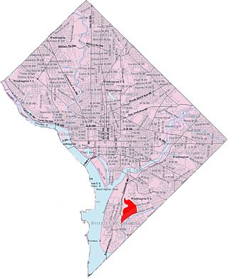
Congress Heights is a residential neighborhood in Southeast Washington, D.C., in the United States. The irregularly shaped neighborhood is bounded by the St. Elizabeths Hospital campus, Lebaum Street SE, 4th Street SE, and Newcomb Street SE on the northeast; Shepard Parkway and South Capitol Street on the west; Atlantic Street SE and 1st Street SE on the south; Oxon Run Parkway on the southeast; and Wheeler Street SE and Alabama Avenue SE on the east. Commercial development is heavy along Martin Luther King, Jr. Avenue and Malcolm X Avenue.
Hilltop or Hill Top is the top of a hill and may refer to:

The Residence Act of 1790, officially titled An Act for establishing the temporary and permanent seat of the Government of the United States, is a United States federal statute adopted during the second session of the 1st United States Congress and signed into law by President George Washington on July 16, 1790. The Act provides for a national capital and permanent seat of government to be established at a site along the Potomac River and empowered President Washington to appoint commissioners to oversee the project. It also set a deadline of December 1800 for the capital to be ready, and designated Philadelphia as the nation's temporary capital while the new seat of government was being built. At the time, the federal government operated out of New York City.

The Lee Highway was a national auto trail in the United States, connecting New York City and San Francisco, California, via the South and Southwest.

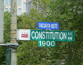
Constitution Avenue is a major east–west street in the northwest and northeast quadrants of the city of Washington, D.C., in the United States. It was originally known as B Street, and its western section was greatly lengthened and widened between 1925 and 1933. It received its current name on February 26, 1931, though it was almost named Jefferson Avenue in honor of Thomas Jefferson.

The history of Washington, D.C., is tied to its role as the capital of the United States. The site of the District of Columbia along the Potomac River was first selected by President George Washington. The city came under attack during the War of 1812 in an episode known as the Burning of Washington. Upon the government's return to the capital, it had to manage the reconstruction of numerous public buildings, including the White House and the United States Capitol. The McMillan Plan of 1901 helped restore and beautify the downtown core area, including establishing the National Mall, along with numerous monuments and museums.

Folsom Field is an outdoor college football stadium in the western United States, located on the campus of the University of Colorado in Boulder. It is the home field of the Colorado Buffaloes of the Pac-12 Conference.

Cajun Field is a football stadium located on the South Campus of the University of Louisiana at Lafayette in the city of Lafayette, Louisiana. Nicknamed The Swamp, it is the home field of Louisiana Ragin' Cajuns athletics. Cajun Field is primarily used for its American football team. Cajun Field has an official capacity of 41,426 with 2,577 chairback seats.
A student quarter or a student ghetto is a residential area, usually in proximity to a college or university, that houses mostly students. Due to the youth and relative low income of the students, most of the housing is rented, with some cooperatives. Landlords have little incentive to properly maintain the housing stock, since they know that they can always find tenants. Non-students tend to leave the area because of the noise and raucous behavior of the students. Property crimes, sexual assaults, and noise and drug violations are more common in student quarters.

Barney Circle is a small residential neighborhood located between the west bank of the Anacostia River and the eastern edge of Capitol Hill in southeast Washington, D.C., in the United States. The neighborhood is characterized by its sense of community, activism, walkability, and historic feel. The neighborhood's name derives from the eponymous former traffic circle Pennsylvania Avenue SE just before it crosses the John Philip Sousa Bridge over the Anacostia. The traffic circle is named for Commodore Joshua Barney, Commander of the Chesapeake Bay Flotilla in the War of 1812.

Greenway is a residential neighborhood in Southeast Washington, D.C., in the United States. The neighborhood is bounded by East Capitol Street to the north, Pennsylvania Avenue SE to the south, Interstate 295 to the west, and Minnesota Avenue to the east.

The following outline is provided as an overview of and topical guide to District of Columbia: