
Derbyshire is a ceremonial county in the East Midlands of England. It borders Greater Manchester, West Yorkshire, and South Yorkshire to the north, Nottinghamshire to the east, Leicestershire to the south-east, Staffordshire to the south and west, and Cheshire to the west. Derby is the largest settlement, and Matlock is the county town.

Icknield Street or Ryknild Street is a Roman road in England, with a route roughly south-west to north-east. It runs from the Fosse Way at Bourton on the Water in Gloucestershire to Templeborough in South Yorkshire. It passes through Alcester, Studley, Redditch, Metchley Fort, Birmingham, Sutton Coldfield, Lichfield, Burton upon Trent and Derby.

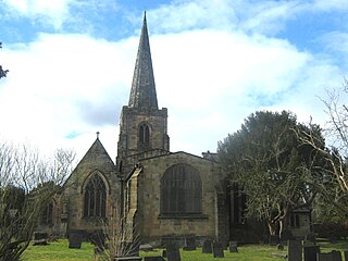
Wirksworth is a market and former quarry town in the Derbyshire Dales district of Derbyshire, England. Its population of 4,904 in the 2021 Census was estimated at 5,220 in 2023. Wirksworth contains the source of the River Ecclesbourne. The town was granted a market charter by Edward I in 1306 and still holds a market on Tuesdays in the Memorial Gardens. The parish church of St Mary's is thought to date from 653. The town developed as a centre for lead mining and stone quarrying. Many lead mines were owned by the Gell family of nearby Hopton Hall.
Duffield is a village in the Amber Valley district of Derbyshire, 5 miles (8.0 km) north of Derby. It is centred on the western bank of the River Derwent at the mouth of the River Ecclesbourne. It is within the Derwent Valley Mills World Heritage Area and the southern foothills of the Pennines.

The history of Derbyshire can be traced back to human settlement since the last Ice Age, over 10,000 years ago. The county of Derbyshire in England dates back to the 11th century.
An agger (Latin) is an ancient Roman linear mound or embankment. The word is sometimes applied to fortifications, such as the Agger Servianus, a part of the Servian Wall of Rome, which protected the city on its most vulnerable side, the Campus Esquilinus. It consisted of a double rampart bearing formidable fortifications. In modern usage however, particularly in British archaeology, it is most commonly used to describe the ridge or embankment on which Roman roads were built. The course of a Roman road can often be traced today by the distinctive line of the agger across the landscape and even when destroyed by agriculture, the vestigial mound that can persist has allowed archaeologists in recent years to trace the course of many Roman roads using lidar.

Aquae Arnemetiae was a small town in the Roman province of Britannia. The settlement was based around its natural warm springs. The Roman occupation ran from around 75 AD to 410 AD. Today it is the town of Buxton, Derbyshire in England.

Ardotalia, also known as Melandra or Melandra Castle, is a Roman fort in Gamesley, near Glossop in Derbyshire, England.

Carsington is a village in the middle of the Derbyshire Dales, England; it adjoins the hamlet of Hopton, and is close to the historic town of Wirksworth and village of Brassington.
Derventio was a small town in the Roman province of Britannia. Today the area is known as Little Chester, on the outskirts of Derby, located in the English county of Derbyshire.

Batham Gate is the medieval name for a Roman road in Derbyshire, England, which ran south-west from Templebrough on the River Don in South Yorkshire to Brough-on-Noe and the spa town of Buxton in Derbyshire. Gate means "road" in northern English dialects; the name therefore means "road to the bath town".
Strutt's Park Roman Fort was a Roman fort in Strutt's Park, a suburb of Derby in Derbyshire, England. It was built around the year 50 and replaced, probably between the years 75 and 80, by a new fort at Little Chester on the opposite bank of the River Derwent.

The Derby Racecourse Roman settlement was the third settlement in Derby or Derventio which was a small town in the Roman province of Britannia. It lies 600m east of Derventio fort in Little Chester, on the outskirts of Derby, in the English county of Derbyshire. The Roman road from Derventio to Sawley on the River Trent passes the settlement. It is a scheduled National Monument.
The Long Lane is the medieval and modern name of the Roman road that ran almost due westwards from Derventio, the Roman fort and vicus in the suburbs of modern Derby, through Derbyshire to Rocester and Draycott in the Moors. From that point onwards the same road – no longer called "The Long Lane" – continued through Staffordshire to Chesterton near Newcastle-under-Lyme. Its destination was Middlewich, from which the important city of Chester was in easy reach.

Navio Roman fort overlooks a tight bend of the River Noe at Brough-on-Noe near Hope, Derbyshire, in England. Navio fort and vicus is a Scheduled Monument.

Lutudarum was a town in the Roman province of Britannia, in the area that is now mid-Derbyshire. The settlement was believed to have been at either Wirksworth or nearby Carsington. However, Barnatt and Smith in their most recent assessment, determined that Carsington was not proven as Lutudarum, although Matlock and Cromford might be other candidates. Matlock was dismissed by its own historian Nailor in his excellent history of the Matlocks and Dennis had considered that Cromford might represent a river wharf on the Derwent but would not be Lutudarum. This leaves only Wirksworth as the likely location. The town was recorded as Lutudaron between Derventio and Veratino (Rocester) in the Ravenna Cosmography's list of all known places in the world in about 700 AD.

Doctor's Gate is a Roman road in the Derbyshire Peak District of England, which ran between Melandra fort at Glossop and Navio fort at Brough-on-Noe. Doctor's Gate was recorded in 1627 as "Docto Talbotes Gate", named after Dr John Talbot who is attributed with improving the summit section in the late 15th century and 'gate' is derived from the Scandinavian word for road.

Ivonbrook Grange is a civil parish within the Derbyshire Dales district, in the county of Derbyshire, England. Largely rural, Ivonbrook Grange's population is reported with the population of neighbouring parishes for a total of 180 residents in 2011. It is 130 miles (210 km) north west of London, 15 miles (24 km) north west of the county city of Derby, and 3+1⁄2 miles (5.6 km) south west of the nearest market town of Matlock. Ivonbrook Grange is wholly within the Peak District national park on its southern edge, and shares a border with the parishes of Aldwark, Bonsall, Brassington, Ible as well as Winster. There is one listed structure in Ivonbrook Grange.

