
Dharmapuri is a city in the north western part of Tamil Nadu, India. It serves as the administrative headquarters of Dharmapuri district which is the first district created in Tamil Nadu after the independence of India by splitting it from then Salem district on 2 October 1965. The city is located 50 km from Krishnagiri, 69 km from Salem, 60 km from Tirupattur, 90 km from Hosur, 117 km from Thiruvannamalai, 126 km from Bangalore and Erode, 181 km from Tiruppur, 200 km from Coimbatore and Tiruchirappalli, 300 km from Madurai and the state capital Chennai. It is located between latitudes N 11 47’ and 12 33’ and longitudes E 77 02’ and 78 40’. It is one of the major leading cultivators and producers of mangoes in the state along with Krishnagiri, and is often referred as Mango Capital of India.
Rasipuram is a Municipality in the Indian state of Tamil Nadu and suburb of city of Salem located in Namakkal District. It is the headquarters for the Rasipuram taluk. As of 2015, the town had a population of 88,584 and an area of 24 km2 (9.3 sq mi). It has 27 wards and steps have been taken to increase the wards to 33. Rasipuram is known for ghee and tapioca sago.
Jolarpettai is a Municipality in Tirupattur district, Tamil Nadu, India. It is a commuter rail hub in Southern Railway, which is one of the largest Railway Junction in Tamil nadu. It is 7 km from district headquarter Tirupattur and 18 km from Vaniyambadi.
Kalambur is a selection grade town panchayat in Polur taluk, Tiruvanamalai district in the Indian state of Tamil Nadu, famous for its rice production. As of the 2011 census, the town had a population of 31,751. K.T.R.Palani is a Chairman of Kalambur selection grade Town panchyat.
Tindivanam is a municipality in Viluppuram district in the Indian state of Tamil Nadu. It is the second largest town in Villupuram District after the headquarters town Villupuram. Important roads from north to south Tamil Nadu pass through Tindivanam and similarly from west to east.
Valavanur is a panchayat town in Viluppuram district in the Indian state of Tamil Nadu. It is situated near to the Tamil Nadu–Puducherry border on NH 45A.
Vettavalam is a first grade panchayat town in Tiruvanamalai district in the Indian state of Tamil Nadu.
Aarani, officially spelled as Arni, and also known as Periya Aarani, is a major commercial, industrial and cultural hub and also a divisional headquarter in the Thiruvanamalai district of Tamil Nadu, India. The town is the second largest urban center next to the district headquarters, Thiruvannamalai, and is administered by a selection grade municipality. Aarani is home to silk weaving, spinning mills and agricultural industries. Famous Aarani silk and a paddy variety named Aarani Ponni, known for its rich aroma, originates from Aarani. The town is often nicknamed as The Silk City. Aarani also has a rich cultural heritage as it is a major center of Tamil Jainism.
Thalaivasal is a town and Taluk in the Salem district of Tamil Nadu, India. It is located 18 km away from the Sub-district headquarter Attur and 70 km away from the Salem District Headquarter. It is one of the Taluks of the Salem District
Attur Taluk is one of the taluks, or administrative division of Salem District in the state of Tamil Nadu, India. The division's headquarters is Attur town.

Viluppuram, Villupuram, or Vizhuppuram is a municipality and the administrative headquarters of Viluppuram district.
Melnariyappanur is a village panchayat located near Chinnasalem taluk of Kallakurichi district, Tamil Nadu. It is famous for the shrine dedicated to the King of Miracles, Saint Antony of Padua. His feast is celebrated every year on 13 June. People in the area cultivate turmeric, rice, corn, cotton, green chilis, pulses, tapioca sugar, tamarind, and yellow lentils.

South Arcot District was a district in the Madras Presidency of British India. It covered the area of the present-day districts of Cuddalore, Kallakurichi and Viluppuram in the Indian state of Tamil Nadu. The district was divided into eight taluks and covered a total area of 13,510 square kilometres (5,217 sq mi). The administrative headquarters was the town of Cuddalore.
Ulundurpettai or Ulundurpet is a municipality in Ulundurpet taluka of Kallakurichi district of Tamil Nadu, India. It is at the intersection of NH 68 and NH 45 located 205 km from Chennai and 129 km from Tiruchirappalli. Ulundurpettai itself is a Constituency for Tamil Nadu State Assembly, and is the Taluk headquarters for Ulundurpet taluka in the eastern region of Kallakurichi district, and is in Ulundurpet revenue block.
Meppuliyur is a village in Ulundurpet Taluk, Kallakurichi District, Tamil Nadu, India. The rural population depends on agriculture. The village, town, and vankanar slum colony is divided into three parts. People speak Tamil and Telugu.

National Highway 79 is a National Highway in India entirely within the state of Tamil Nadu. It runs between Ulundurpettai and Salem in the Indian state of Tamil Nadu for a total of 134 km (83 mi). It connects with NH 44 and NH 544 at Salem. NH 79 connects NH 68 and SH 69 at Ulundurpettai and SH 6 at kallakurichi. It was upgraded to a dual carriageway road in two phases on a Build-operate-transfer basis by Reliance Infrastructure and Maytas.
Kallakurichi is one of the 38 districts in the state of Tamil Nadu in India. The district headquarter is Kallakurichi. Kallakurichi District was announced on 8 January 2019 and it came into existence on 26 November 2019.
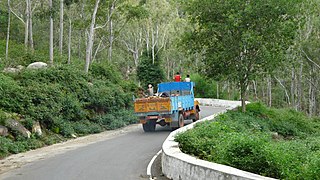
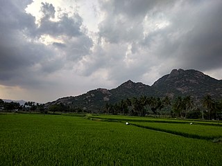
Kalvarayan Hills taluk or Kalvarayanmalai taluk is one of the six taluks of Kallakurichi district in the Indian state of Tamil Nadu.
Kandachipuram taluk is one of the 9 taluks of Viluppuram district, in the Indian state of Tamil Nadu.
Thiruvennainallur taluk is one of the 9 taluks of Viluppuram district in the Indian state of Tamil Nadu.


